Durango & Silverton Railroad, SW Colorado
Take SW Colorado's iconic narrow-gage railroad along the spectacular Animas River!
What You'll See
The train climbs nearly 3000 feet from Durango (elev. 6512 ft., 1985 m) to Silverton (elev. 9318 ft., 2840 m) in a distance of 45 miles. This route provides an amazing spectrum of bedrock geology including scenic Mesozoic sandstones, some of America's oldest metamorphic rocks, and finally the 30 million year old volcanic caldera that hosted precious metal mines in the Silverton region.
Oh, and the famous scenery of the San Juan mountains!
Travel to Durango
Durango is located in SW Colorado. It does have a small airport served by three airlines (see https://www.flydurango.com/), but most people will want to drive there so they can tour the region.
Durango has plenty of hotels and good restaurants.
The Railroad
Their website for info & reservations: https://www.durangotrain.com/
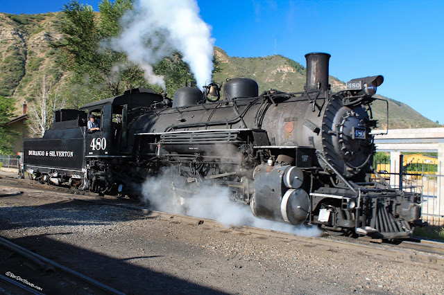
The railroad has been here since 1882 serving the once-bustling mining districts in and around Silverton. It has been promoted as a scenic railroad ever since, and has been called America's most scenic railroad by many publications -- and I agree!
In the 1950's, several movies showed the railroad including Ticket to Tomahawk, Across the Wide Missouri, Denver & Rio Grande, Viva Zapata, and Around the World in 80 Days. Later, Butch Cassidy and the Sundance Kid featured the railroad. But don't worry -- outlaws don't chase the train any more!
And I think you'll want to know this paragraph from their website: "Today the Durango & Silverton Narrow Gauge Railroad continues to provide year-round train service, operating a historical train with rolling stock indigenous to the line. The locomotives used to pull today’s train remain 100% coal-fired, steam-operated. The locomotives are 1923-25 vintage and are maintained in original condition. The coaches each feature bathroom facilities and are heated during the winter months for passenger comfort. Open gondola cars provide a panoramic view of the mountains. Concessions are available on every train. The Durango & Silverton is owned and operated by American Heritage Railways."
You'll board at the quaint station in the south part of Durango. Parking is ample in the gravel lot to the west by McDonald's.
Geology of the Rail Line
The Animas River Valley is bounded by scenic Mesozoic sandstone and siltstone, all dipping southward (to the left in the above photo, to the right in the photo below). The white sandstone is the Jurassic Entrada Sandstone, which is also one of the prominent sandstone layers around Moab, Utah, where it is reddish. The red layers below the Entrada are the Triassic Dolores Formation (more recently named the Chinle Group) and Permian Cutler Formation. The Entrada was deposited in an extensive, sandy desert, while the older Dolores / Chinle includes a variety of deposits including river channels, flood plains, lake bottoms, and some volcanic ash.
The bright red sandstone and siltstone are the Permian Cutler Formation. Picture this: The Cutler was deposited in rivers, lakes, sandy deserts, and shorelines when North America was close to the equator, and before the dinosaurs showed up. It was a totally different world!
You'll get up close and personal with the bedrock! These are the "basement" of North America -- Archean (>2.5 billion years old) gneisses and granites called the Irving Formation. While the overall rock type is gneiss, in detail it contains a wide variety of metamorphosed rock -- amphibolite metamorphosed from volcanic rocks, biotite- and epidote-bearing schist and gneiss, metamorphosed plutonic rocks like granite and diorite, quartzite and feldspathic quartzite, metasiltstone, banded-iron formation, and muscovite-quartz-biotite schist. Whew! The gneisses are all the rocks with light & dark colored layering. The granites usually have very large crystals of feldspar and quartz, and are often dikes (like veins).
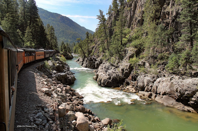
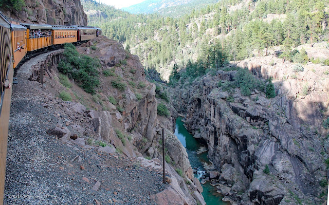
Near an hour out of Durango, the railroad reaches the beautiful gorge. It's lined with the ancient gneisses.
I think this is where the word "gorgeous" was invented!
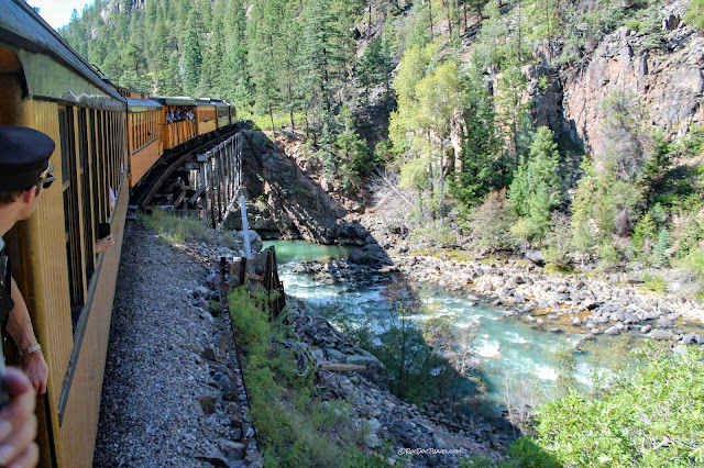
The railway is cut into the cliffs above the Animas River, and provides a stomach-dropping view over the side.
Don't worry too much -- they haven't lost a train here yet!
The Animas River has a wonderful turquois color from the fine silt & clays washed down from glaciated valleys. Watch how it changes color along the route.
For me, it was hard not to photograph every yard of the trip! I think I did, anyway.
The Animas River can get ferocious when it floods, as evidenced by stripped bedrock and debris piled at the high water marks. Notable floods occurred in 1911 (the biggest one), 1927, 1949, 1970, 2005, and 2019. The 2019 flood damaged a section of the rail line at Cascade Canyon.
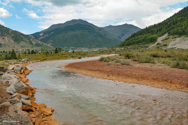
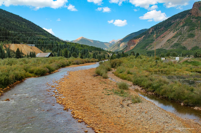
About half-way through the trip, you'll start to notice an orangey color to the river rocks. This is iron-rich clays & minerals released in a tailings pond accident in the mining district in volcanic rocks near Silverton. While working on cleaning up mine waste water in 2015, crews accidentally overflowed the pond where contaminants were settled out of the water. The waste flooded down the Animas river, coating rocks with this orangey stain. Terrible damage was done to fish & plants. There haven't been fish in the Animas River for several decades. The Gold King Mine, source of the disaster, is located here: 37.894637, -107.638307 Mines and tailings continue to be cleaned up around the West with great success, and fortunately accidents like this are rare. I used to work for a company that cleans up mine water, and was peripherally involved in that work, so I know something about it.
Some of the red staining is natural from the volcanic bedrock upstream north of Silverton along Cement Creek, but most is from the 2015 accident. The big landslide complexes near Cement Creek contribute a lot of the red clay.
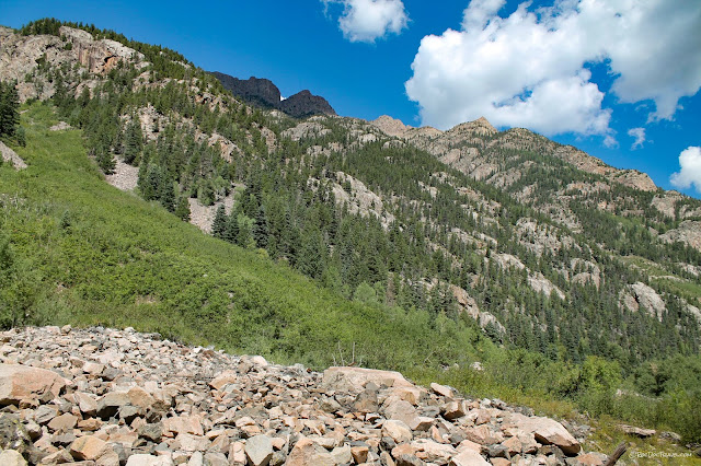
You'll get occasional views up & down the canyon of the high surrounding peaks, which are up to 14,000 feet high. This is Vermillion-7 Peak.
The train stops a few times to refill the water tank on the long climb to Silverton. Here, an engineer has lowered a fat pipe using a cable, filling the tank with a great rush.
As you get near Silverton, you'll notice the higher rocks on the west side of the canyon are sedimentary layers like limestone and sandstone. These are Paleozoic rocks deposited when this was the western edge of North America.
The iron staining become more pronounced as you approach Silverton.
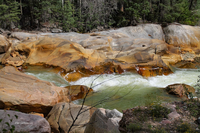
The bedrock here has been scoured by mostly springtime floods throughout the centuries and millennia. You can spot the annual high water mark by the lack of vegetation. Infrequent higher floods usually deposit debris (like logs) into the trees & bushes.
This area has over 300 productive mines! The peak periods were 1870 to about 1920, with brief activity after that when precious metal prices were high. This one is a mile south of Silverton.
A large avalanche chute south of Silverton. In winter, snow avalanches tear tress out of the forest, often chopping them off at the snow line. In summer, flash floods carry mud and rocks down, eroding a deep gully and forming a rocky fan at its mouth.
Looking back south into the canyon from near Silverton.
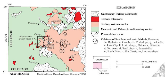
USGS map of calderas & bedrock in the Silverton region.
Looking into Silverton, the river rocks are really red from the 2015 accident. The mountains in this picture are the Silverton caldera.
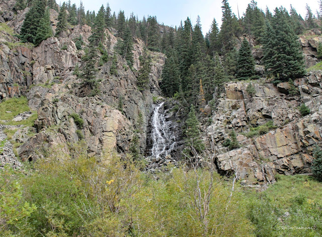
Watch for this waterfall on the east side of the train south of Silverton.
The colorful rocks north of Silverton are remnants of a volcanic caldera, one of several that include the Uncompahgre, Lake City, and San Juan calderas. They were active from 35 to 22 million years ago. Remember, a caldera is a collapsed volcano that results from an extraordinarily large eruption. Calderas often later fill in with lava flows and explosively erupted tuffs. The calderas around Silverton and Ouray were extensively corroded and altered by hydrothermal water circulation, which produced the colorful reds, oranges, and yellows and were the source of precious metal deposits. It's this alteration, along with mining activity, that put the iron-rich clays & minerals into the Animas River.
Looking west from Silverton.
Looking west from Silverton are volcanic peaks outside of the Silverton caldera.
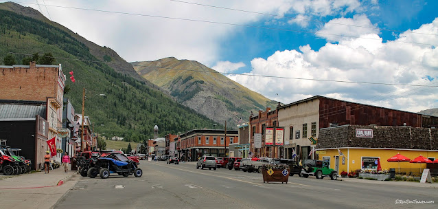
Silverton is a quaint, quiet (except for the ATVs), enjoyable place to visit. You'll find shops and restaurants aplenty to keep you busy while waiting for the train's afternoon departure.
I especially like visiting old mining towns because they were prosperous enough to build and preserve some of the peak architecture and commerce of the era, which is missing in most small towns of the same era.
This is a trip to put on your bucket list!
-----
Extras:
B.S.-- Embers from the coal-fired steam engines have occasionally sparked forest fires. The railroad has done extensive mitigation along the line (removing dead trees, cutting trees close to the line) to prevent this from happening again. You'll see the results of their efforts along the route.M.S.-- Over $300 million in precious metals were transported on this railroad, much more than Butch Cassidy ever stole!
Ph.D. -- Geologic maps covering the route are available here:
Durango East quadrangle: https://ngmdb.usgs.gov/Prodesc/proddesc_41293.htm
Silverton Quadrangle: https://ngmdb.usgs.gov/Prodesc/proddesc_32197.htm

