Gallatin River Canyon, Montana
Gallatin River Canyon near Big Sky, Montana

Explore one of the West's most beautiful river canyons!
Travel to Gallatin Canyon
Interactive Google Map of the Big Sky area. Zoom and pan to follow Highway 191 along the Gallatin River.
This is one of the easiest, loveliest trips at RocDocTravel.com!
Airport: Bozeman
Lodging: Big Sky and several guest ranches and campgrounds in Gallatin Canyon.
Vehicles: Any. Gallatin Canyon is not steep.
Special considerations: Not a winter trip unless you're well prepared! Watch Spring and Fall weather conditions for snow.
Geology of Gallatin Canyon
This trip starts on the south end in Yellowstone.
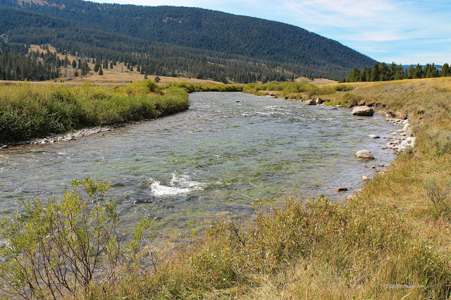
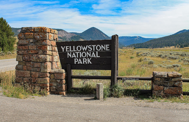
U.S. Highway 191 comes north from West Yellowstone through the edge of the National Park (there's no entry fee). It follows a tributary of the Gallatin River (seen in this picture) down from the Continental Divide. The headwaters of the Gallatin are several miles east of here in the Gallatin Mountains near beautiful Bannock Peak.
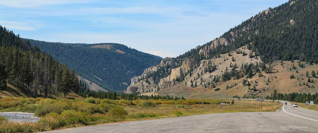
It's all downhill from here! The highway meets the Gallatin River at the wide southern mouth of its long, beautiful canyon. This stretch of Highway 191 is just inside the Wyoming border.
The river is remarkably clear, and has cut through bedrock ranging in age from Cretaceous (about 150 - 70 million years) all the way to Archean (over 2.5 billion years). Most of the gray cliffs you'll see along the canyon are the Madison Group (named for the Madison range just to the west) limestones that are about 325 million years old and rich in fossils. This and the remainder of the Gallatin River are in Montana.
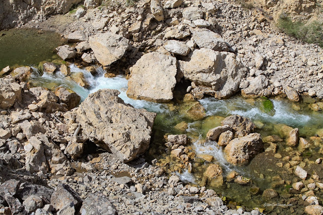
There are several landslides along the sides of the upper Gallatin Canyon. This is one of the biggest, made of shale (bedrock made of clay). From the looks of it, it's age is at least several centuries, maybe more. Landslides were quite common in this region when the glaciers melted and the climate warmed.
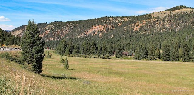
This wide spot in the valley makes me think of homesteading in the old West. The slopes in the distance are Cretaceous rocks, mostly shale and siltstone.
The view northward shows the influence of softer Cretaceous layers that form the gentle slopes. Harder, older layers form the steep wooded slopes and cliffs.
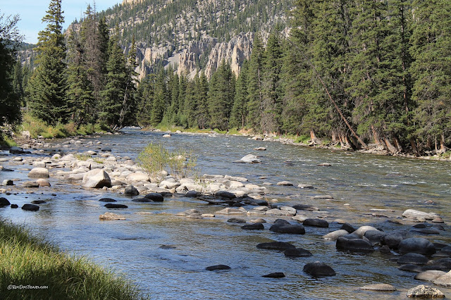
Take your time, stop and walk down to the river. It's so remarkably clear, it's mesmerizing!
From this point on you're out of Yellowstone, back to National Forest and private land. This view is to the south, toward Yellowstone.
Once out of Yellowstone, the canyon starts to narrow and steepen a bit. The cliffs are Madison Group limestone.
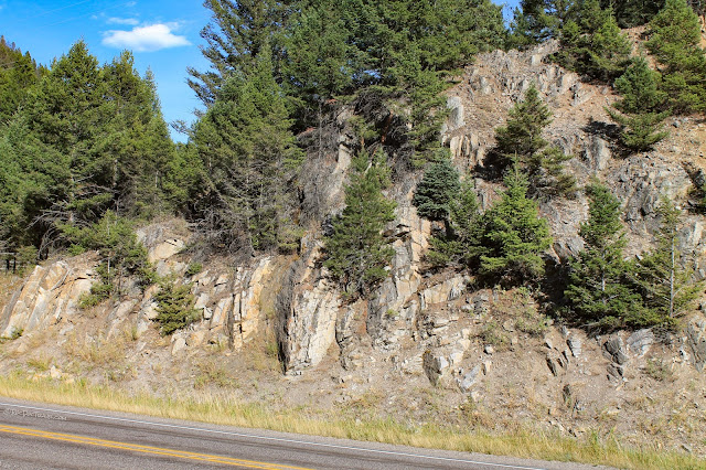
There's a reverse fault on the left side of this outcrop that has tilted the rocks vertically. Great uplift and faulting occurred to form the Rocky Mountains between about 70 and 40 million years ago.
Watch for this large spring on the west side of the canyon. Springs like this occur when groundwater encounters a barrier, often shale, that it cannot flow through. The water then follows the shale downhill until it emerges on a slope like this.
Where the Mississippian age layers are near river level, the canyon is narrow and steep and scenic.
Okay, if I had to be a pine tree, I'd want to be that one!
This is the mouth of the biggest side canyon & tributary to the Gallatin, Taylor Fork. The next few pictures are in Taylor Fork.
This is Taylor Fork's gorge through the Madison Group limestone layers. It formed because of a big landslide complex on the left that has pushed the river up against the cliffs.
Taylor Fork cuts a deep, steep gorge through the Madison Group limestones to get out to Gallatin Canyon.
Looking down in the gorge, you can already see how the water in Taylor Fork is different from the water in the Gallatin River -- Taylor Fork is mossy green.
A few miles farther west, the moss infestation is pretty dramatic. It's pretty, but I'm sure it's not good for the ecosystem.
Back in Gallatin Canyon, you'll start to see the high peaks near Big Sky.
The highway provides a lot of turn-outs, so plan on a lazy, lingering trip through the canyon.
The tallest cliffs are the Mississippian-age Madison Group -- and not just here, but from southern Canada down to northern Utah, most of the tall gray cliffs you see are the 340 million year old continental shelf limestones.
The reddish layers just south of Big Sky are the Jurassic & Triassic (dinosaur age!) formations including the Morrison and Woodside.
You'll know when you're getting close to Big Sky when you see the canyon widen out and high peaks appear to the north.
One of the most interesting sights geologically is the ridge that borders Big Sky on the north. The triangular "flat iron" rock slabs you see are steeply tilted bedrock in a big syncline that was formed along with a thrust fault that lifted the farther bedrock up against the nearer. This fault and fold are part of the "Laramide" orogeny (mountain-building event) that occurred between 70 and 40 million years ago. The Laramide orogeny built the Rocky Mountains. That makes these "flat irons" cousins of the famous ones at Boulder, Colorado.
The low, flat-topped hills in eastern Big Sky are capped with a layer of rhyolite ash from Yellowstone. In fact, the Huckleberry Tuff is the product of Yellowstone's biggest eruption 2.1 million years ago.
A closer look at the steep strata east of highway 191 at Big Sky. The thrust fault is just over the skyline.
Looking west from the highway at the intersection with highway 64 (the road into Big Sky) shows the steeply tilted bedrock of the syncline.
North of Big Sky's northern ridge, you're in some very old, quite fascinating bedrock! These gneisses, schists, and granites are some of North America's oldest rocks that form the ancient core of the continent. They were metamorphosed in continental collisions between 1.7 and 3.3 billion years ago (Archean age).
Very little silt and mud enters the Gallatin River in this part of the canyon, making the water exceptionally clear and appealing.
Watch for the road cuts that expose the metamorphic rocks! They're great places to pick up samples and see the interesting fabrics in the rock.
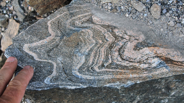
This layered gneiss is granitic in chemistry, and shows evidence of stretching with pinch-and-swell structures.
Look for small folds in the gneiss layers. They mimic the larger folds in the canyon.
Layers often slip during folding, producing "slickensides" like this one -- polished & grooved surfaces formed by sliding. They also form in faults.
Here's a few-meters-scale fold in the gneiss. The vertical lines are drill/blast holes.
The gneiss layering is steeply tilted in most of the canyon. Location:
45.407404, -111.224702
Here's where metamorphic rocks boggle my mind: All this change in minerals, stretching, segregating into layers, and folding takes place in the solid state, without any melting. Minerals rearrange their molecules under pressure like tinker toys in a vice, flattening against the greatest pressure. Because minerals like micas are quite pliable under this pressure, they segregate into layers (the dark layers here), leaving the stronger minerals like quartz and feldspars in light colored layers.
The beauty is in the details -- get out and look at the road cuts! Look for folds, stretched minerals, and pinched-off layers like these.
Feldspars (the pink minerals here) are pretty resilient under pressure, so they retain more of their original size than other minerals. They've been stretched in these pinched structures while other minerals are completely flattened.
Storm Castle Peak is made of Cambrian rocks sitting on top of the Archean rocks, and all the way up to Triassic rocks at the top.
Here's a closer look at the cliffs below Storm Castle Peak. The thickest cliffs are once again the Mississippian limestones. The lowest layers nearest the river are Cambrian in age.
I've come across CCC camps and projects all around the West. They did some great smallish projects that would never have otherwise been done, including erosion control, flood control, and water catchments.
Take a few minutes to drive up Storm Castle Road to enjoy the scenery. This is Spire Rock. The canyon also has a couple of good campgrounds and undeveloped camping spots.
Related Trips:


