Borah Peak, Idaho West
Borah Peak, Idaho - West Side
Discover how continental shelf mud ended up atop Idaho's highest peak and site of a M7 earthquake in 1983!
- Breath-taking scenery
- 20 mile-long fresh fault scarp
- Hiking trail to peak
- Great ATV and hiking trails
- Great back-country camping
- No crowds, ever
Travel to Borah Peak
Interactive Google Map of Borah Peak area
Lodging Near Borah Peak
Borah is pretty remote from towns, so it's a good place to camp with tents, truck campers, or trailers. But here are the nearest towns:
Sun Valley / Ketchum (west) -- The famous resort area has a lot of accommodations, and in the summer they're reduced in price. It's a graded gravel road to get to Borah from there, okay for cars when dry.
Challis (north) -- Challis has a couple of motels along the highway. If you're camping, I highly recommend Challis Hot Springs along the Salmon River, where I've stayed many times on field trips. The grassy, shady camp sites and swimming pools are a bargain, and spending time strolling along the rapid Salmon River is a soul-filling treat. Here's their website.
McKay (south) -- A couple of small motels. Farther south, Arco has a couple of motels and a KOA.
The mountain front at Borah is conspicuously steep Just look at the alluvial fans, whose apeces (apexes) are a thousand feet higher than the valley! That means the mountain is uplifting faster than erosion & deposition can deepen the canyons and lower their mouths. This view is from the Chilly road.
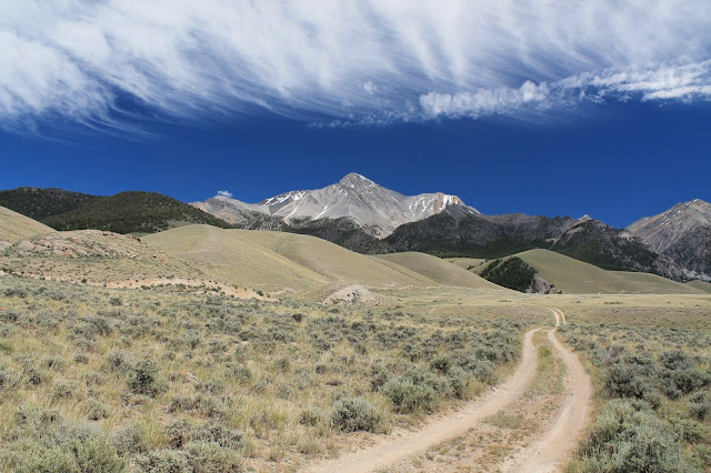
Borah Peak is made of limestones that formed on the ancient continental shelf. On the right (west) side are steeply tilted layers of the more colorful Jefferson Formation, which includes black dolostone and yellow calcareous siltstone. The hiking trail goes up that western ridge. The tilting occurred during continental collisions between about 150 and 50 million years ago. Uplift of the mountain range only started about 15 million years ago. This view also shows the fault scarp from the 1983 earthquake.
Borah Peak Trail
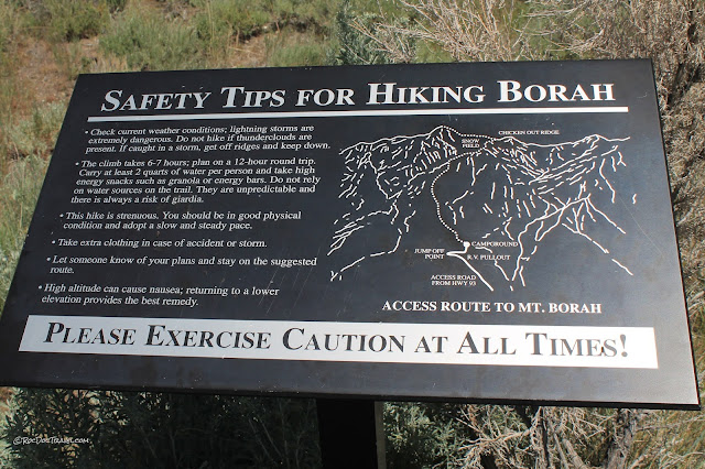
Driving up to the trailhead from the highway, you'll have good views of the 1983 fault scarp (the light-colored ribbon along the lower mountain front). More on that later.
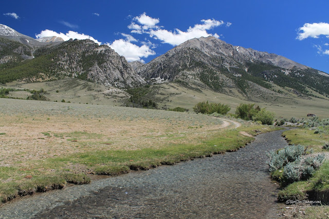
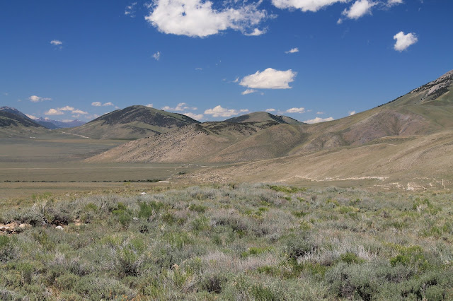
This is looking back to the west over the valley toward the peaks around Sun Valley. The valley area is appropriately called "Chilly." The epicenter of the 1983 earthquake was out there.
The Borah Peak trailhead gets a steady flow of visitors all summer long. That means it's busy for Idaho, not busy like California trails!
1983 Fault Scarp
Borah Peak was the site of a M6.9 (old scale M7.1) earthquake on October 28, 1983 at 8 in the morning. It was the biggest quake in the U.S. in 25 years. Its maximum shaking intensity (Mercalli scale) was IX, which is violent and has only been reached a few times in the U.S. It was felt from Calgary, Alberta on the north to Salt Lake City on the south, and from western Wyoming to eastern Oregon. The fault scarp is 21 miles (34 km) long, with a maximum displacement of about 9 feet (2.7 m). The mountain range rose nearly a meter, while the valley dropped nearly 2 meters (measured away from the scarp). You can find authoritative information about the quake at the USGS.
Because of its remote location, only 2 people were killed in the earthquake, but tragically those two were children walking to school in Challis. Tara Leadon, 7 years old, and Travis Frank, 6, were killed when a 75 year old stone facade on a store collapsed on them.
From the road to the trailhead, you can follow a 2-track trail to the north along the fault scarp. You'll need good tires and good ground clearance. 4WD is only necessary when it's muddy or you go north to south (there's a steep hill, downhill to the north).
Faults usually form branches, especially tilted (dipping) faults like the Lost River Fault here. They're analogous to fractures in glass, which branch off, merge, and are sometimes parallel without merging. Just how the geometry forms is a function of bedrock strength, depth of gravel, structures or fabrics in the bedrock, and direction of fault slip.

The scarp is fascinating to geologists! Its varied geometry tells us a lot about the geometry of the fault at depth. A simple but powerful principle says that the geometry we see at the surface in map view is the same geometry at depth when turned on its side in cross-section view. Let's apply that principle to the following pictures of the scarp.
There are four scarps in this photo -- the nearest is in the brown grass in the foreground. The first (nearest) is short, and nearly merges with the second to the right. The second is the main, longest scarp. The third is short and does not merge with any others. The fourth (highest) takes over where the third died out.
That's colorful Dickey Peak to the north, which is just short of 11,000 feet. The orange-ish color is a silty, sandy limestone. The months-long freeze/thaw daily cycle up there breaks the bedrock into pieces, which fall down those extensive talus slopes.
Looking north along the scarp. Doublesprings Pass road goes through the canyon on the right. Challis is through the mountain pass at far left.
The main scarp is in the foreground, with two smaller ones above it. The unnamed peak is made of continental shelf limestone, and tops out at about 10,700 feet.
The scarp crosses this unnamed creek with three branches. The lower two likely merge at depth, while the upper may not (based on their surface geometry).
Looking north to the fault scarp at Rock Creek (at center), with tall Dickey Peak in the background.
I'm always interested in looking at where a fault crosses a canyon or stream because it reveals its tilt. Here you can see the fault scarp dropping down to the left (west) into Rock Creek's canyon. That tells us the fault dips west.
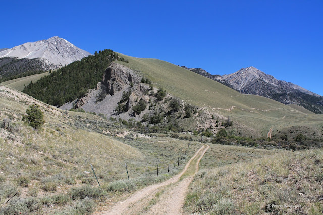
Borah Peak is the high gray peak at left, and the canyon is Rock Creek. The scarp is the light-colored ribbon low on the mountain front.
Fault scarps often have branches and braids like this, where the relatively soft material in the slopes breaks easily. Looking north toward Thousand Springs Pass road.
From a distance (from Highway 93) you can see the fault scarp meandering along the lower mountain front.
Visitor Site on Doublesprings Pass Road
A sign on highway 93 will point you toward this site. The Doublesprings Pass Road is a smooth, graded gravel road. It was displaced in the earthquake, but of course it has been smoothed out since. The site is a dirt parking lot with an outhouse, a fence around the scarp, and informative signs.
A graben is a block dropped down between normal faults, like the one seen here at the visitor site. The graben is a miniature of all the valleys in the Basin and Range province.
Doublesprings Pass
Only a few roads cross the imposing Lost River Range, and this is the best of them. It leads to the sparsely populated Pahsimmeroi Valley and some amazing scenery & geology.
An interesting trip using this road is to take it northeast to the Pahsimmeroi Valley road, then north to Ellis on the Salmon River. Look for the metamorphic rocks along the road at Ellis! From there, you can go west to Challis or east to Salmon, and it's wonderful scenery all the way.
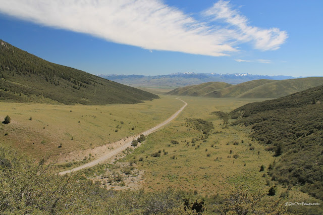
Looking SW back down the road, Borah is out of the picture to the left several miles. The mountains in the distance are the Pioneers adjacent to Hailey, Ketchum, and Sun Valley.
The summit is also a drainage divide between the Snake (to the south, on the west side of the Lost River Range) and Salmon rivers (Pahsimmeroi River goes to the Salmon).
To the northeast are the northern Lemhi Mountains on the far side of Pahsimmeroi Valley. They are covered with volcanic rocks erupted from the Challis calderas about 44 million years ago.
Related Posts
Borah Peak area, east side
topic "Idaho"
