M6.5 Stanley, Idaho Earthquake

M6.5 Stanley, Idaho Earthquake

March 31, 2020


Stanley Idaho earthquake 2020 landslide subsidence rockfall avalanche snow slide liquefaction copyright RocDocTravel.com

See where, why, and what happened in this unusual Idaho earthquake

Geology of the Quake


Stanley Idaho earthquake 2020 landslide subsidence rockfall avalanche snow slide liquefaction copyright RocDocTravel.com
6.5 is a pretty big earthquake!  Seismologists officially call it "moderate," but that's because they compare it to the whole world.  In Idaho, this is a big one!  Only the M6.9 Borah Peak quake in 1983 was bigger in the past century.

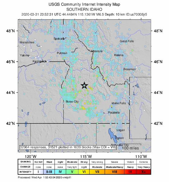
It was felt from northern Utah and Nevada, throughout Idaho to western Montana and southern Canada.

The location's the thing.  It happened just at the boundary between the extending tectonic province called the Basin and Range and the less-stressed province of the Pacific Northwest.  The crust in the Basin and Range is being pulled (extended) westward, while the Pacific Northwest here is experiencing very little stress.  The direction the fault slipped doesn't really match either block -- a north-south trending left-slip fault (opposite of the San Andreas, which is right-slip).  In simpler terms, left-slip means when looking across the fault, the other side moved to your left.

Stanley Idaho earthquake 2020 landslide subsidence rockfall avalanche snow slide liquefaction copyright RocDocTravel.com
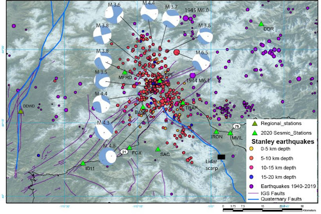
It's also very interesting because of the number of aftershocks.  This map shows only a month or two, but they're still going strong as I write this 3 months later.  An aftershock is generally along the same fault as the main quake, or at least in the same volume of crust that slipped.  So far, there have been nearly a thousand aftershocks.  [Idaho Geological Survey image]


Stanley Idaho earthquake 2020 landslide subsidence rockfall avalanche snow slide liquefaction copyright RocDocTravel.com
The epicenter was NW of Stanley, out in the mountains of central Idaho.  According to this geologic map from the USGS, the local area has several candidate faults at the surface which could have caused the quake.  The bedrock there is mostly granite (green on this map).  This map also shows where Stanley and Stanley lake are relative to the epicenter.

Stanley Idaho earthquake 2020 landslide subsidence rockfall avalanche snow slide liquefaction copyright RocDocTravel.com
I went to the area 3 days after the quake to look around.  Stanley is about 18 miles from the epicenter.  The only evidence of shaking I could see in Stanley was minor things like snow sliding off metal roofs.  The temperature this day was about 15 F.  

Stanley Idaho earthquake 2020 landslide subsidence rockfall avalanche snow slide liquefaction copyright RocDocTravel.com
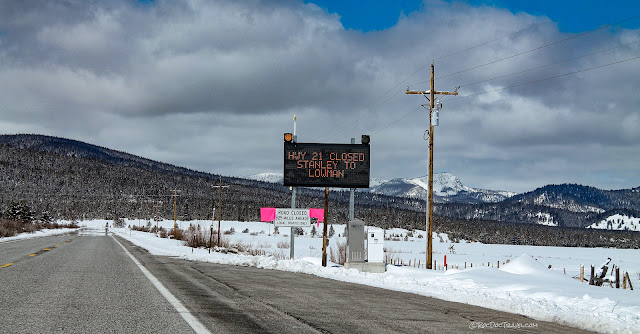
Snow and rock slides closed highway 21 southwest of the epicenter for a few days.

Stanley Idaho earthquake 2020 landslide subsidence rockfall avalanche snow slide liquefaction copyright RocDocTravel.com
Here's a snow slide near the epicenter.

Stanley Idaho earthquake 2020 landslide subsidence rockfall avalanche snow slide liquefaction copyright RocDocTravel.com
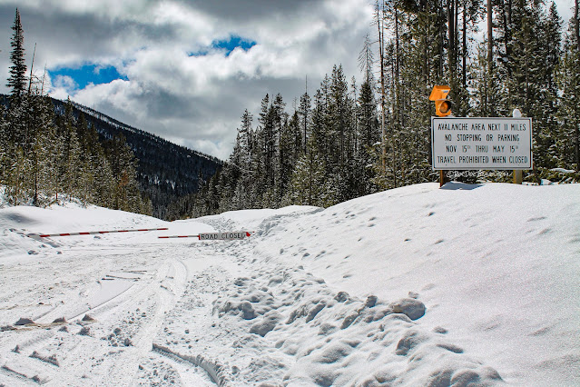
I went to the road closure, which is a permanent gate in case of avalanches.  I couldn't get close enough to the snow slides to see them.

Stanley Idaho earthquake 2020 landslide subsidence rockfall avalanche snow slide liquefaction copyright RocDocTravel.com
Here's another slide near the epicenter.

Stanley Idaho earthquake 2020 landslide subsidence rockfall avalanche snow slide liquefaction copyright RocDocTravel.com
The road up the Beaver Creek canyon at the epicenter was blocked by snow, but this hillside had some rocks fallen onto the snow.

Stanley Idaho earthquake 2020 landslide subsidence rockfall avalanche snow slide liquefaction copyright RocDocTravel.com
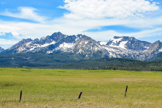
After the snow cover melted away, I went back to Stanley.  This is the amazing view of the Sawtooth Mountains from Galena Summit.  Stanley is at the far right in this valley, and the epicenter just past the Sawtooths in this view.

Stanley Idaho earthquake 2020 landslide subsidence rockfall avalanche snow slide liquefaction copyright RocDocTravel.com
These eye-popping glaciated granite mountains are why Stanley is popular.  Many aftershocks occurred under these peaks.

Stanley Lake

Stanley Idaho earthquake 2020 landslide subsidence rockfall avalanche snow slide liquefaction copyright RocDocTravel.com
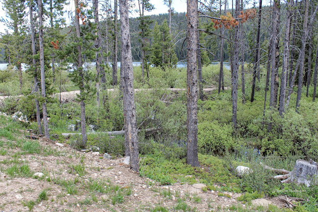
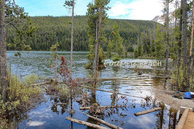
The largest and most visible damage from the quake was subsidence of the west shore of Stanley Lake, shown here.  These trees are now sitting in a foot of water.

Stanley Idaho earthquake 2020 landslide subsidence rockfall avalanche snow slide liquefaction copyright RocDocTravel.com
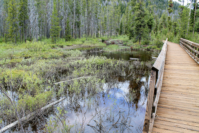
The shoreline trail had to be built up to stay out of the water.

Stanley Idaho earthquake 2020 landslide subsidence rockfall avalanche snow slide liquefaction copyright RocDocTravel.com
The inlet delta from the creek (inventively named Stanley Lake Creek) liquefied during the quake and sank into the lake.  There used to be a quite large sandy beach here.  Now the forest is sunk into the lake!

Stanley Idaho earthquake 2020 landslide subsidence rockfall avalanche snow slide liquefaction copyright RocDocTravel.com
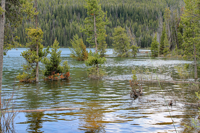
A closer view of the sunken shoreline.  Notice the tilted and fallen trees.  During liquefaction, the soil flows, removing support from tree roots.

Stanley Idaho earthquake 2020 landslide subsidence rockfall avalanche snow slide liquefaction copyright RocDocTravel.com
This section of the west shoreline sunk a few feet.

Stanley Idaho earthquake 2020 landslide subsidence rockfall avalanche snow slide liquefaction copyright RocDocTravel.com
Liquefied soil has no strength, and so cannot support trees.  Fallen or tilted trees are a sign of liquefaction.

Stanley Idaho earthquake 2020 landslide subsidence rockfall avalanche snow slide liquefaction copyright RocDocTravel.com
Beautiful McGown Peak presides over the scene.

Stanley Idaho earthquake 2020 landslide subsidence rockfall avalanche snow slide liquefaction copyright RocDocTravel.com
See how lumpy and disrupted the soil is?  That's the result of liquefaction.

Stanley Idaho earthquake 2020 landslide subsidence rockfall avalanche snow slide liquefaction copyright RocDocTravel.com
From along the lake, you can see the sunken and tilted trees on the western show in front of McGown Peak.

Stanley Idaho earthquake 2020 landslide subsidence rockfall avalanche snow slide liquefaction copyright RocDocTravel.com
Here's a little closer view of the sunken shoreline.

In summary, the M6.5 quake near Stanley, Idaho was one of the biggest in the region in the past century.  Because of its location, however, it did no structural damage, but only damage to vulnerable soils and slopes.  Its location at the boundary between tectonic provinces means it will be studied by geologists for years to come, in the quest to better understand the earth in this fascinating region.

Most Popular Posts

The San Andreas Fault: I-15 to I-5

Mouth of the Columbia River