Lemhi Canyon 1 - Eightmile Canyon
Eightmile Canyon, Lemhi Mountains, Idaho
A perfect off-road getaway!Travel to Lemhi Mountains
This 100 mile-long mountain range is located in east-central Idaho between Howe on the south and Salmon on the north. State Highway 28 runs along its east side, and is the access point for this trip.Interactive Google Map centered on Eightmile Canyon in the Lemhi Range, Idaho
Eightmile Canyon is located in the southern Lemhi range. The nearest "inhabited place" searchable in Google Maps is called Blue Dome, and is just a couple of miles to the northeast along Highway 28.
Vehicles: This trip uses mountain trails accessible only by horses, 4-wheelers, side-by-sides, dirt bikes, and of course on foot. Mountain bikes will have to walk/carry for significant stretches of loose cobbles.
Lodging: Lower Eighmile Canyon has numerous primitive camp sites. The Birch Creek Recreation Area in the valley below has outhouses, water, tables, and fire pits. Limited lodging is available in Mud Lake, with more distant choices in Idaho Falls, Rexburg, and Salmon.
Seasons: This trip is only passable in July through September, and even then depends on the weather.
Geology of the Lemhi Mountains, Idaho
The southern Lemhi Range is composed of a thick stack of limestones that formed on a long-lived continental shelf before the bedrock of Oregon, Washington, and northern California were added to the continent. This "carbonate bank" is tens of thousands of feet thick. The west front of the range has older rocks from Devonian to Proterozoic in age (about 360 to 1100 million years old) that are mostly sandstone, siltstone, and their metamorphosed equivalents (also offshore and near-shore deposits).What's really intriguing to geologists about the Lemhi Range is its double mountain-building events. From about 150 to about 70 million years ago, pieces of continents and volcanic island chains slammed into the west coast while the Pacific Plate's twin subducted under North America, carrying whatever was embedded on it into the subduction zone. The result was compression of the continental shelf, shoving it landward and creating the spectacular folds we see in the Lemhi Range. Thick slabs of the shelf limestones were shoved eastward and stacked on top of each other along thrust faults, moving as far as 50 km. This Cretaceous event is called the Sevier orogeny, named after the Sevier river in central Utah where it was first recognized.
The second mountain-building event is the ongoing Basin and Range Orogeny that creates earthquakes and mountain ranges across the West, from Yellowstone at the NE corner down to Death Valley on the SW corner, and from Salt Lake City on the east to the Sierra Nevada on the west (see the map). The West is being slowly stretched toward the west, resulting in earthquakes, faulting, and uplift of mountain ranges. It began about 17 million years ago, and continues (slowly!) today.
This map shows the outline of the seismically active part of the Basin and Range Province. The Lemhi Mountains are in the upper right. Many publications ignore the mountains of central Idaho in this province, but they are under the same stresses and as seismically active as the rest, so I (and many others) include them. One of my friends in Montana would also include much of western Montana as well. In fact, one of the West's biggest earthquakes was at Borah Peak in the Lost River Range, only about 30 miles from this trip, in 1983 (M6.9).
The Lemhi range is one of triplet, nearly identical ranges -- the Lost River Range to the west, the Lemhi's, and the Beaverhead Range to the east. The range-front faults responsible for uplift of these ranges are on the west sides, and have uplifted the bedrock by thousands of feet and lifted up the Cretaceous folds and thrust faults. If it were not for this latest uplift, the remains of the Sevier orogeny would be buried and out of sight.
Eightmile Canyon
The Eightmile Canyon trail begins in the Birch Creek recreation area. This is the most direct road, but it does involve a 2-foot-deep stream crossing. A dry crossing, better for trailers, starts farther south along Highway 28 where the creek crosses the highway. Location here: 44.081869, -112.877068 Southern road located here: 44.072255, -112.840793
All the trails here are well marked, but it does help to have a Forest Service trail map, available here: https://trails.idaho.gov/ Birch creek is at 6000 feet elevation. The trail climbs to 9800 feet!
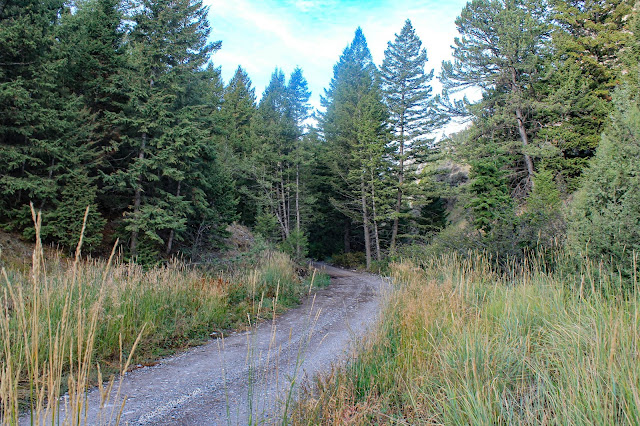
The road into Eightmile is very good, suitable for any vehicle. It's only farther up past many good campsites that it becomes an ATV trail.
The Lemhi Mountains and their neighbors the Beaverhead and Lost River mountains are uniquely Idahoan. They all share thick limestone bedrock that drains rain and snowmelt into the underground, meaning there are precious few creeks (I'll show you some on this trip). That also means the canyon bottoms are quite narrow and rugged, except in shale intervals. The Lemhi and surrounding mountains are instantly recognizable to those who have spent time here, even appearing in a 2020 Polaris ATV commercial!
Deer, elk, moose, coyotes, and a stray mountain lion inhabit the Lemhi mountains. Black bears are only common in the northern half of the range. You'll never see a mountain lion, but they'll see you!
Like in much of Idaho, the trails are restricted to 50-inch vehicles. Here, it's for good reason (as opposed to a bureaucrat's arbitrary decision!) -- only a very narrow ATV can make it between trees and rocks! This is the trail heading southward, up the south fork of Eightmile canyon. Trail 173 / 022 (it changes number here, at the 50 inch sign). Location here: 44.054953, -112.995562
Every foot of the trail is scenic, and the scenery changes constantly as you ride the trail. Good camping and group spots are common along the lower trail.
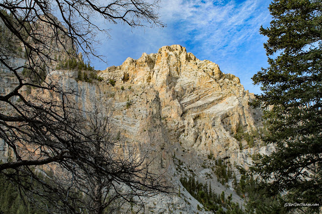
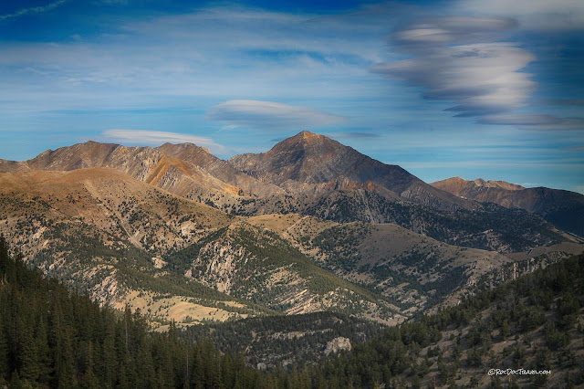
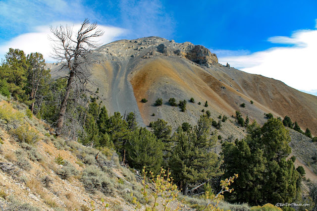
After a while, you'll get an open view of the surrounding peaks. The trail heads up across the back side of this unnamed 10,400 foot peak. Notice that the entire thing is limestone, and there's no sign of a creek in the canyon.
The trail provides good views of the folding in the Lemhi range. I've drawn some lines to help distinguish the shape of this fold. Notice the difference in fold shape between the thin versus thick layers.
This 50-inch trail switches back a few times to climb toward the summit.
More good folding! This is textbook thrust belt folding, and what's remarkable to me is how few geologists know about it. When I was in graduate school, we studied the thrust belt in exhaustive detail, and this part of Idaho was almost totally ignored in the published research! There's still very little about it, except some studies of fossils and sedimentology. Existing geologic maps aren't very detailed, but at least were done exceptionally well by outstanding geologists. I've talked about the Lemhis with other geologists, and we all agree we'd love to do a lot of work here, especially with students, but we all say the same thing -- "They're too darned rugged! You'd spend all your time hiking!" What a pleasant obstacle to have!
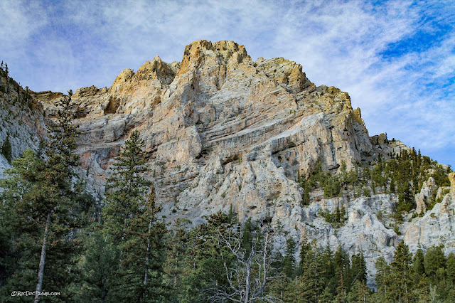
There's the big yellowish peak again.
Here's another look at the fold, from higher up.
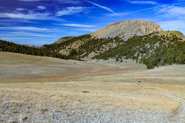
Rocky trail heading up toward the summit.
The trail along the summit. You'll get fantastic views to the north, south, and east. Elevation at the top is 9800 feet. Location here: 44.027549, -112.982531
This is the western part of the summit.
Looking from the eastern summit toward the western summit.
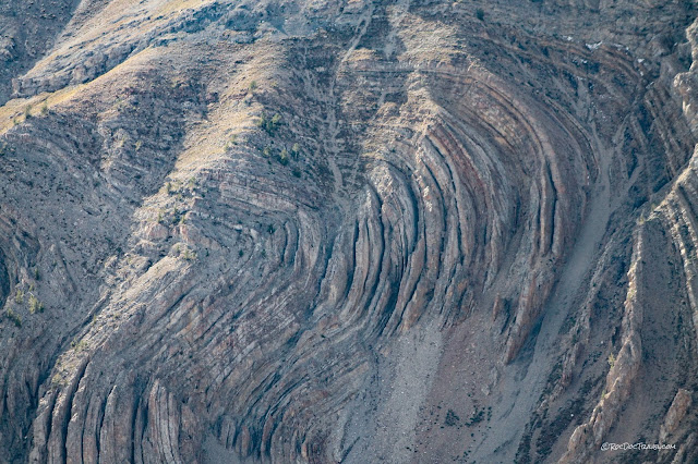
To the south are these fantastic, huge folds. You can see the real shape of the fold only when you look edge-on ("along strike") like this. From down in the valley (off to the left), you can't even see that there's a fold here. Fold located here: 44.014964, -112.975802
What a geologist looks at here is the varying shape of the fold from left to right. It's tighter on the left, and becomes more open and rounded to the right, likely constrained by the folding all around it. That's pretty typical when the folding takes place at relatively shallow depths, in the upper 5 km of the crust.
This outcrop makes me want to rock climb!
Looking north from the summit, down south fork of Eightmile Canyon, to Idaho's 3rd highest peak, Diamond Peak at 12,200 feet.
A little closer look at Diamond Peak...
This fold is off to the northwest. I've drawn in some lines to help you see the shape of the fold -- it's like an accordion! The entire range is folded like this, as is the Lost River Range to the west.
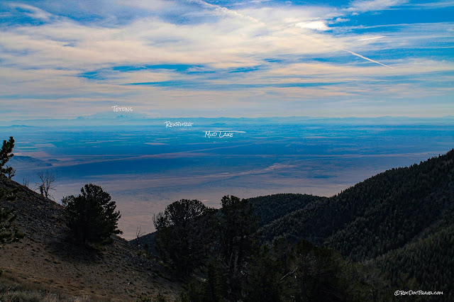
That good, clear Idaho air lets you see as far as the Earth's curvature will allow! The Tetons are 100 miles away! Looking east across the northern Snake River Plain, which is the path of the Yellowstone volcanic "hot spot." If you had been able to stand here about 6 million years ago, you would have been looking at a volcanic complex standing much higher.
A slightly different view.
The Tetons mark the east end of the Basin and Range geologic province, which is characterized by north-south faults that have created mountain ranges with intervening valleys. Geologists call the fault-uplifted mountain blocks "horsts," and the valleys "grabens" after old German terms.
Looking northeast, you can see massive Scott Peak, which is the Montana-Idaho state line and continental divide. These are the Beaverhead Mountains, an eastward continuation of the continental shelf limestones and Cretaceous thrust faults & folds found in the Lemhis. Highway 28 is there in the valley, parallel to Birch Creek.
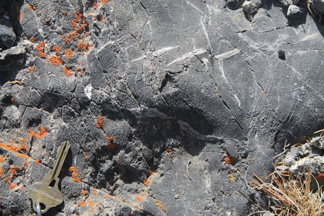
Do take a little time to look closely at the limestones! You're almost certain to see fossils like these fragments of crinoids and other shelly animals. I've also found huge "horn corals," which look like a horn-of-plenty.
The shingled calcite veins are called shear fractures because they form when the limestone is being bent. Fractures open in the direction of tension, and are immediately filled with calcite (the main mineral in limestone).
Mormon Gulch & North Creek
It's a good, smooth trail down the gulch. There are some old mine workings on a trail branch if you're interested -- not much to see, but you could find some copper ore minerals.
The trail leaves Mormon Gulch to the south, heading up and over to North Creek. Location: 44.018827, -113.016415
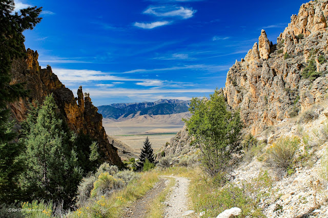
Heading over the ridge, you'll finally get a westward view of the Lost River Range across Little Lost River Valley. They are made of the same rock layers (formations) as the Lemhis.
The farms near Howe appear in the distance to the southwest. The bump on the far horizon is Big Southern Butte, a rhyolite volcanic dome formed after the Yellowstone hot spot had passed northeastward, leaving pockets of magma behind.
This colorful, unnamed peak is just over 10,560 feet. The yellowish color is common in these limestone ranges, caused by minor iron content in the bedrock and a bit of alteration by hot waters (which is what attracted prospectors here).
This trail will constantly remind you that you're deep in rugged mountains! This is a heckuva talus slope!
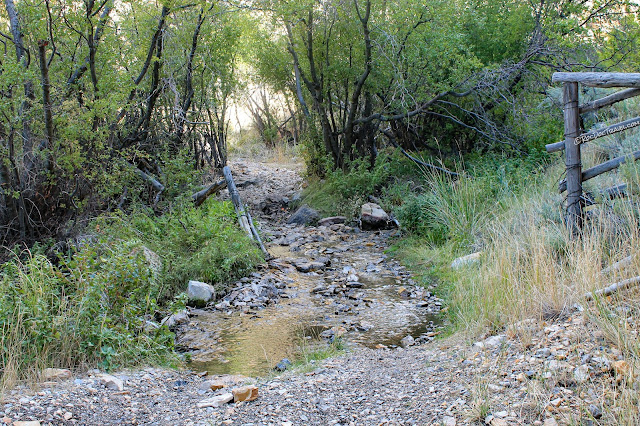
The trail does pass by a precious spring in northern North Creek canyon. If you waited quietly here near dusk or dawn, you'd undoubtedly see some wildlife. Location: 44.001078, -113.010381
It's a good, easy road down North Creek.
Looking back up North Creek to the crest of the range.
The bedrock on the west mountain front has older rocks that are quite colorful. The canyon descends through the Devonian and Ordovician rocks (360 to 480 million years old) that are mostly lightly metamorphosed sandstone and some dolomite. The west edge of the range has Proterozoic metasediments that are between 500 and about 1100 million years old.
Yes, there really is a North Creek! That's one sign that this part of the range is not limestone.
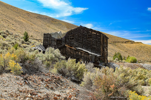
Some old ore facilities at the mouth of North Creek.
Here's what the North Creek trail entrance looks like on the west side of the range. It's trail 40157 here (I guess they don't like consistent numbering!). Location: 43.976988, -113.032987
The mouth of North Creek on the west side of the Lemhi Mountains.
Little Lost Creek Valley is home to some hearty farmers and a very big sky. Borah Peak, Idaho's highest, is hidden in the far left distance behind nearer ridges.
M.S. -- More Science
Bedrock geologic map: https://ngmdb.usgs.gov/Prodesc/proddesc_10267.htm
Related Posts:
Other Lemhi Canyons posts
