Canyonlands National Park, Utah - part 1
Canyonlands National Park, Utah - part 1
Featuring Dead Horse Point and Mineral Bottom Road
Travel to Canyonlands
Canyonlands is located in SE Utah near the town of Moab. It's south of I-70 and accessed from US 191. It may be remote, but it has some of the most spectacular and unique scenery you'll ever see!
Lodging: Motels in Moab, or camping in Canyonlands or Arches parks. Moab has the whole spectrum of accommodations, from Air B&B to inexpensive motels to high-end resorts. Canyonlands has a few campgrounds, and there are some along the Colorado River upstream from Moab that I've really enjoyed. I like camping here because it really immerses you in the landscape.
Vehicles: Any for Canyonlands and Dead Horse Point. If you want to travel Mineral Bottom Road, you'll need a capable 4x4 and offroad experience -- casual driving will only get you stuck or worse!
Food: Food is notably deficient in the park (which may change if current rumblings pan out) and it's a long drive from Moab, so pack your own food and water.
Website: https://www.nps.gov/cany/index.htm For info on services, see
https://www.nps.gov/cany/planyourvisit/goodsandservices.htm
Seasons: The park is open all year, but The Needles visitor center (located in the south end of the park, far from Moab) is closed in winter. July and August temperatures are around 100F (38C), so extra caution is needed for vehicles and for hiking. I recommend visiting in the "shoulder seasons," March-May and September-October. AVOID Easter week when the area is absolutely crowded by the Easter Jeep Safari.
Geology of Canyonlands
(National Park Service)
Canyonlands includes rocks from the Permian Elephant Canyon Formation on the bottom, upwards to the Navajo Sandstone on the plateaus. Nearby Arches National Park is in younger rocks, mostly the Jurassic Navajo to Entrada Sandstones. (The colors in this stratigraphic column are not the rock colors, but the geologic map colors.)Canyonlands is located on the Colorado Plateau, a geologic and physiographic province characterized by a thick pile of (usually) horizontal sedimentary rocks, high elevation, and deeply cut canyons. The Triassic and Jurassic rocks include scenic red sandstone and siltstone that most people envision when they think of this area. The Colorado Plateau has also been the backdrop for a lot of classic Westerns and other movies, including several of John Ford's westerns, Back To The Future III, Planet of the Apes (1968), and Forest Gump ("I'm tired. I think I'll go home now.")
How did the canyons form? About 5 million years ago, this region was low and flat. The meandering pattern of the Green and Colorado rivers shows that they were much like the Mississippi is today -- flat. But then the region began to slowly uplift, about 1 mm per year. When land rises, rivers down-cut to maintain a stable profile. For example, where streams cross fault scarps, they cut into the uplifted side to get back to their original profile. So, as the area uplifted, the rivers responded as they always do by eroding their channels. And so the land rose above the rivers!
The Green River comes from the north, where it originates in western Wyoming. As it enters Canyonlands, its canyon deepens. The Colorado River enters from the east, where it originates in the western Colorado Rockies. They join in the park south of Dead Horse Point and near The Needles visitor center.
Dead Horse Point
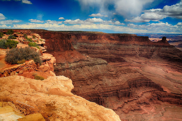
Dead Horse Point is a Utah State Park. It adjoins Canyonlands in the north-central area, and being located between the Green and Colorado rivers, includes the best overlook of the canyons.Both parks are accessed by the same road from US 191 north of Moab (38.672432, -109.686607). Follow the signs to the Dead Horse Point turn-off.
The drive to Canyonlands and Dead Horse Point immediately immerses you in this fantastic layered scenery. The rocks along this road are the Navajo (lowest), Kayenta, and Wingate sandstones. You can recognize the Navajo by its fossil sand dunes and their cross-bedding, usually lighter colors. The Kayenta above it includes some white and dark brown sandstones, and the Wingate is thick orange-brown sandstone that caps many of the hills here.
By the switchbacks, you're on the Navajo Sandstone. Look around at the fossil dunes -- their cross-bedding shows the way the wind was blowing that day 160 million years ago (the steep slope is down-wind). The light-colored layers include the Carmel Formation that's widespread in Arches.
A look down into the canyon south of the switchbacks shows the Wingate Sandstone cliffs below the light-colored Navajo.
This view shows the many thin sand dunes that make up the Navajo. They're much thinner here than in Zion National Park, where individual dunes can be hundreds of feet thick. The thick red sandstone in the cliffs north of the road are the Entrada Sandstone, which forms the Arches in Arches Park.
At Dead Horse Point, you'll see some of the Navajo Sandstone thin dunes.
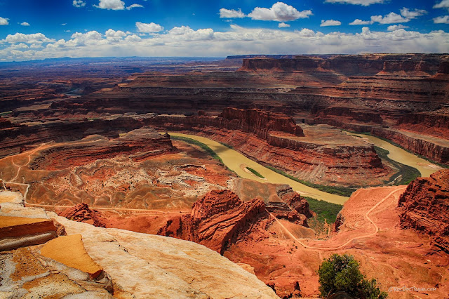
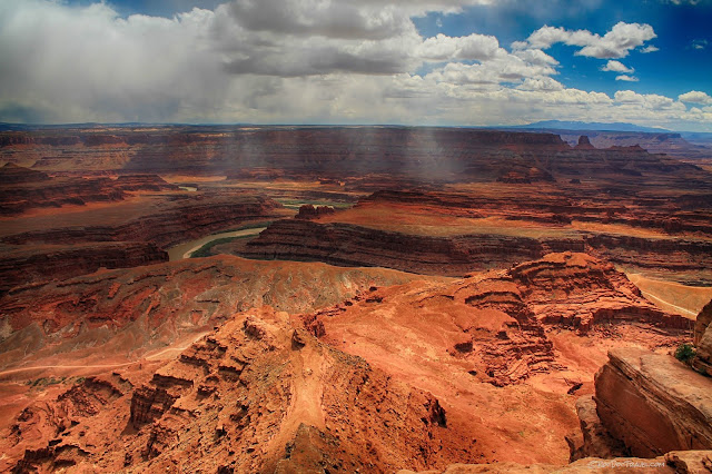
The view at Dead Horse Point includes all of the rock layers from the Jurassic Navajo Sandstone you're standing on, all the way down to the Permian Elephant Canyon formation by the river. The mountains in the south distance are the Abajo Mountains by Monticello, Utah.
The road down below is called Potash Road on maps, road 142. I hope it'll be an upcoming field trip!
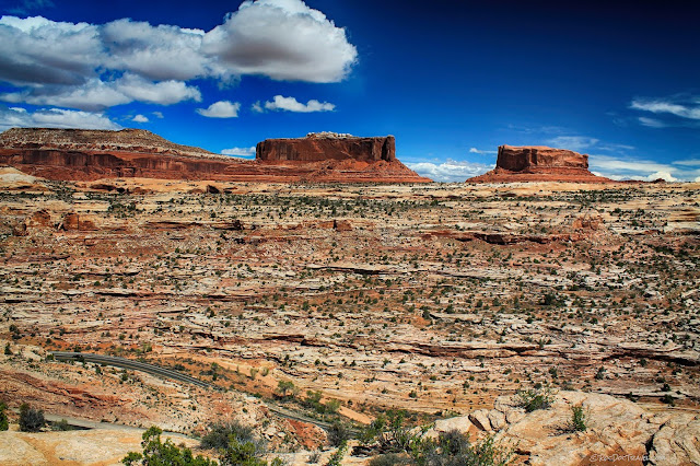
The mesas, buttes, and towers in southern Utah are erosional remnants between streams. As streams develop a dentritic (branching) pattern, some areas are left uneroded between the branches. What's left is buttes and towers like this one.
Looking south.
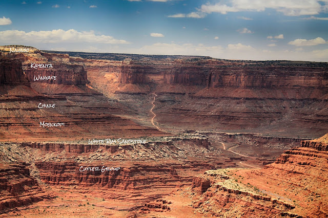
West of Dead Horse Point, you'll see the Shafer Canyon Road that comes down from the road to Grand View Point (field trip upcoming). You can also see the strata from Jurassic Navajo on top down to the Permian Cutler Group on bottom.
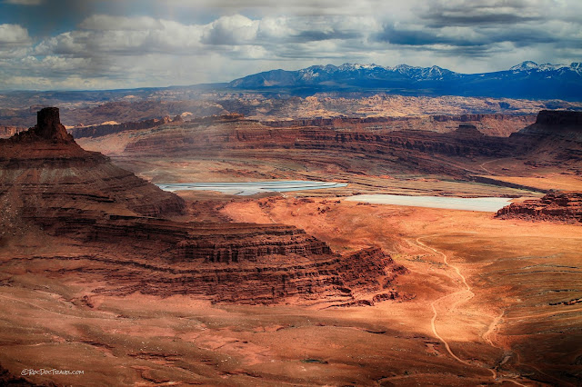
Looking eastward toward Moab are the potash ponds and the La Sal Mountains, which top out over 11,000 feet. The broad plateau in the foreground is on top of the Curtis Formation (more on that below).
The bright blue potash ponds have a very interesting story! Potash is a group of potassium-rich minerals (salts) including potassium chloride, potassium carbonate, and potassium hydroxide. It's important for making fertilizers, and is also used in aluminum recycling, electroplating, and in medicines. It's mined here underground at the Kane Creek mine by pumping river water into the mine to dissolve the potash. The salty slurry is then pumped to the evaporation ponds to crystallize the potash minerals. To me, the beautiful colors of the ponds create a uniquely beautiful scene!
Looking east, a good look at the strata in these steep cliffs.
The lowest cliffs by the river are the Permian rocks down to the Elephant Canyon Formation. By comparison, the south rim of the Grand Canyon is the Permian Kaibab Limestone, and rocks by the river are Precambrian. That means the Colorado River cuts even deeper in the strata as it flows southward toward the Grand Canyon. (See the field trips for explanations about uplift & erosion).
Mineral Bottom Road
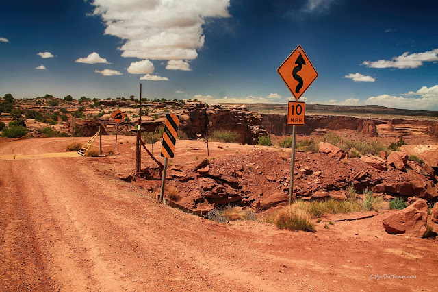
This road takes you down to the Green River in the western part of Canyonlands. It connects to the 100 mile-long White Rim Trail.Except for the first couple of miles down to the Mineral Bottom river access (38.524599, -109.992961), this road is for well-equipped 4-wheel-drive vehicles only. The roads include deep sand, ruts, rocks, ledges, wash crossings, narrow sections, and other obstacles. Take the signs below seriously!
Signs at the turn-off to Mineral Bottom Road, located here: 38.583209, -109.801190
Please note that all UTV's (side-by-sides, 4-wheelers, sandrails) are prohibited, even if they are street legal. I'm disappoined by this because I'd like to do the entire 100-mile ride in my side-by-side. But I understand the reasons for the rule -- to prevent the inevitable abuse and off-road riding that leaves ugly, permanent scars. A few dummies ruin the experience for the rest of us!
I don't think this sign has enough wiggles! It's a stomach-dropping thrill to approach the top of the cliffs, hoping you'll see a road down there somewhere!
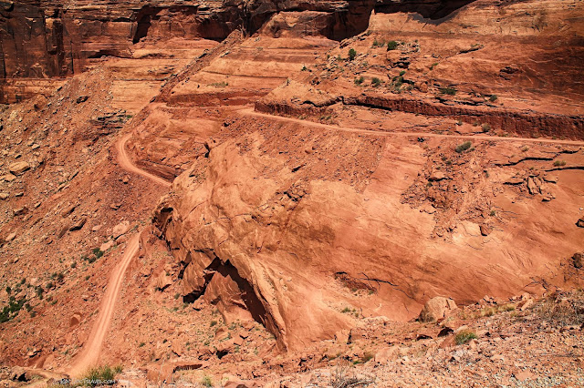
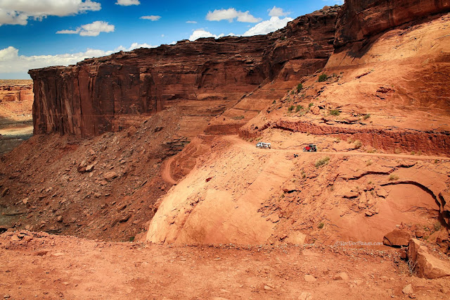
The road is carved into the thick Wingate Sandstone. It's actually not difficult, not too narrow, and not very steep, and yet when you drive it you feel like you've really accomplished something! It's probably more nerve-wracking to be a passenger than the driver, who is in control (you hope!). 38.509080, -109.996703
Yes, if you slide off the road, you're in for a very bad day. But all you have to do is steer, and you'll be fine. The road is only one vehicle wide in several places, so watch for other traffic.
Jeep Safaris from Moab are really popular, and very worth the cost!
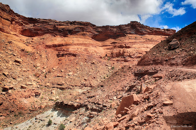
Once the road has carved its way down below the Wingate Sandstone, it widens where the colorful Chinle and red Moenkopi formations are easier to bulldoze.
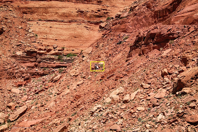
Looks like someone didn't steer carefully!
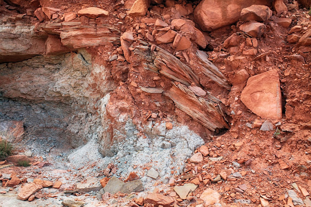
The Chinle is one of my favorite formations because of its varied and unusual colors, and because it contains petrified wood in many places. Its colorful shales contain volcanic ash that weathers into colors including pale to bright green, purple, red, and orange.
Take time to look back up at the road you just conquered.
Here's some colorful volcanic ash-rich shale in the Chinle Formation. The volcanoes in the Triassic were located all along the California coast where the Sierra Nevada are now.
View from the bottom of the road back toward the top. (See "My Breakdown Story" below, which happened here)
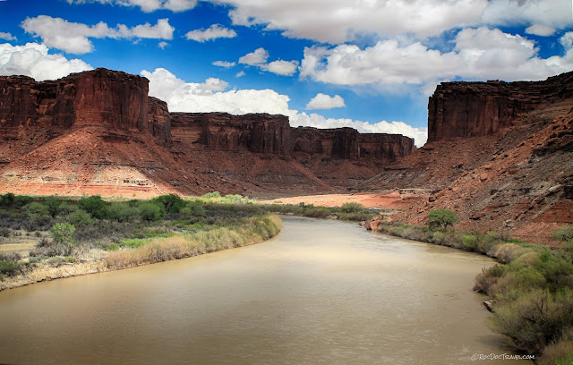
The Green River! If you turn right at the bottom of the canyon, you'll go to the Mineral Bottom boat launch.
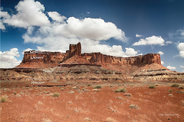
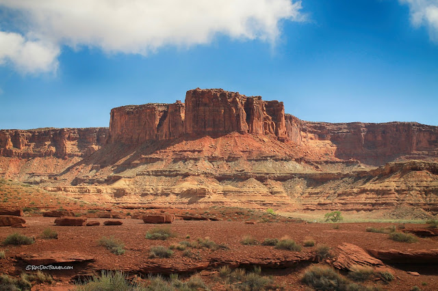
Down the river a couple of miles is a wide area with two side canyons (Taylor Canyon and the Upheaval Dome trail). Looking east, this mesa has good exposures of the Triassic and Jurassic strata. The cap is the Jurassic Kayenta, and the thick cliffs are the Jurassic Wingate Sandstone. The colorful slopes and thin cliffs below that are the Triassic Chinle Formation, and the very red foreground is the Triassic Moenkopi Formation. Recognizable relations apply over this entire part of Canyonlands -- the thick red cliffs are the Wingate, the colorful slopes are the Chinle, and the broad red areas are Moenkopi. [Note that the strata above the Kayenta have been eroded off this area, including the Navajo and Entrada sandstones that are so prominent in Arches.]
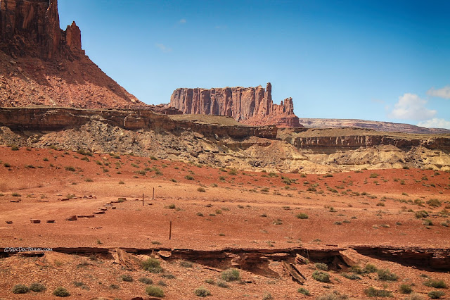
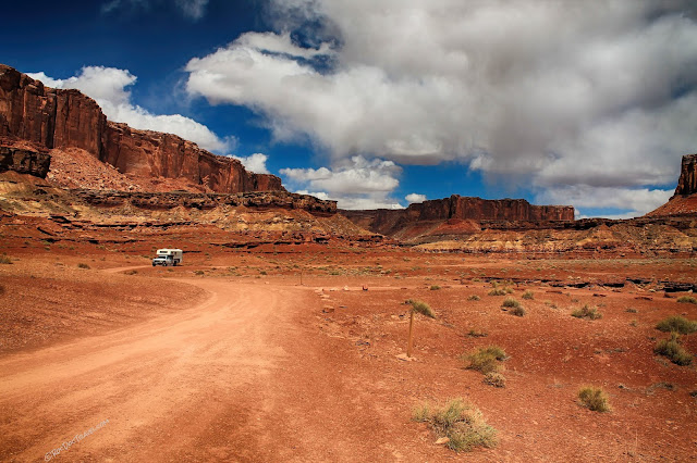
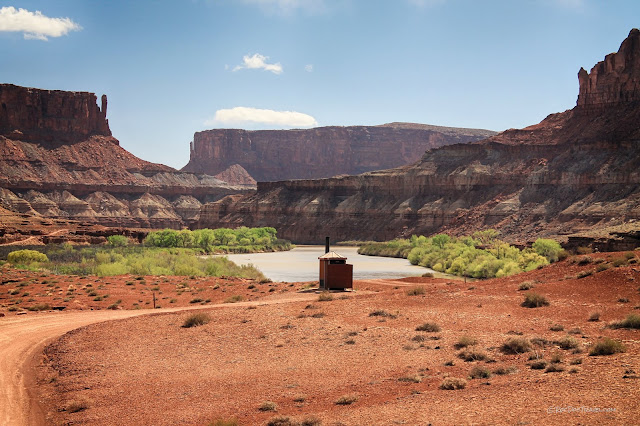
This is Labyrinth "Campground" (38.474903, -110.000295), which consists of an outhouse and some posts on the red Moenkopi.
Labyrinth Campground wasn't very busy on this beautiful but chilly day. We did not see a single other person or vehicle.
Because it flows through a lot of shale formations, the Green River is quite murky with clay. The canyon is widest where the bedrock near river level is softest, like here with Chinle and Moenkopi shales and siltstones forming the wide canyon. The red cliffs in the foreground are Moenkopi. This is looking north, upstream.
Looking south, downstream.
Just south of the Labyrinth Campground is the trail to Upheaval Dome, off to the left of this picture. But the road crosses a long stretch of loose sand at Taylor Canyon Wash, at the base of the mesa in this picture. Only cross loose sand if you know what you're doing! [Low tire pressure, around 8 psi, is recommended in addition to 4WD]
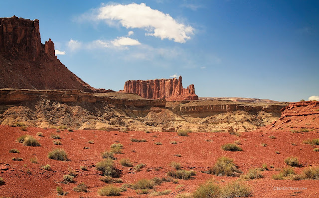
the views in every direction are spectacular down in the canyon! This is looking NW at an unnamed mesa with well-developed vertical fractures.
My latest installment in the series, "Loo With A View."
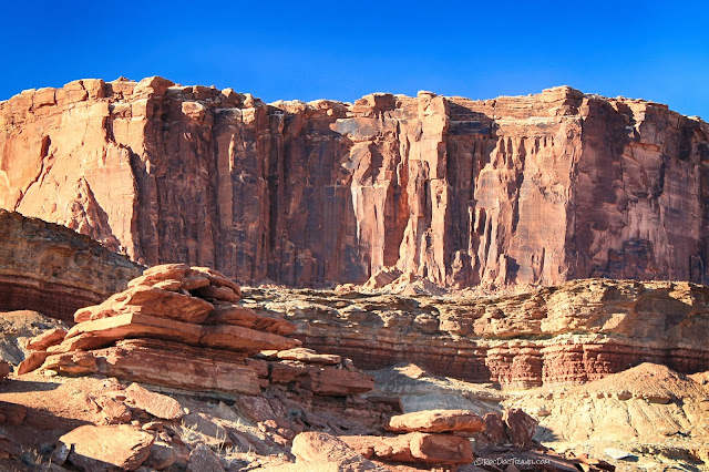
Looking south, this prominence shows the vertical joints (fractures) that affect sandstones throughout the area. In Arches National Park, it's these fractures in the Jurassic Entrada Sandstone that form the arches in long, narrow ridges. Here, they haven't been eroded out as much in the Wingate Sandstone.
The foreground cliffs & slopes are the fascinating Chinle Formation. Walk around in these, and keep your eyes open for ripples (see below) and colorful sedimentary rocks. The big Wingate Sandstone forms the cliffs, with thinner-layered Kayenta on top.
Plan to spend a whole day down in the canyon. Watch how the colors and shadows change from morning to mid-day to evening. The canyon changes appearance over the hours!
This is a ripple in the upper Moenkopi. It formed on a tidal flat in slowly flowing water, and still has some mud cracks on it. You're seeing a snapshot of one day on Earth about 240 million years ago!
Arches National Park
Dinosaur National Park
Grand Canyon
My Breakdown Story
If you travel the back-country enough, you'll have a story to tell of breaking down or getting stuck. My biggest ever came on this trip.I was traveling in a 1993 Chevrolet K3500 (1-ton) pickup with the 6.5 liter turbo-diesel engine and a 5-speed manual transmission. In the bed was a 3000 pound camper. The switchbacks went smoothly. The big truck barely made some of the tightest turns, but did make them. At the bottom of the entry road where it first gets to the river, I put on the parking brake, put the transmission in neutral, and got out to take pictures including the one of the road sign above. When I got back in to leave, the clutch pedal went to the floor with very little effort, and the truck would not go into gear. I had no clutch. At the bottom of Canyonlands. With a switchback road and 30+ miles between me and help. At 4:30 pm.
I could roll-start and pop the truck into gear, so I could move, but if I got stopped where I could not roll forward, I would be stuck and have to get a very expensive tow to Moab. I'm pretty good at double-clutching (shifting without a clutch), so was confident that I could keep the truck moving as long as I didn't fully stop.
My son was with me, and we decided that heading to Moab was not the best option because repair shops would all be closed by the time we got there, and at this time of day we were bound to run into Jeeps coming down the switchbacks, and we would have to stop for them. So we decided to go to our reserved campsite a couple of miles down the river and spend the night, and try the road in the morning.
What I didn't know was how narrow the road is along the river! On one side are rough sandstone cliffs, and on the other side only 8 1/2 feet away was a 30 foot drop directly into the river. I had an 8 foot wide camper, and I couldn't stop.
The camper scraped the cliffs, but I was not about to slip down the soft slope into the river. Sweating, praying, and clenching, we made it through to the Labyrinth campground, which is just an outhouse on flat dirt. I parked facing slightly downhill, and we spent the night.
We left just before dawn, hoping to get back up the road without encountering any opposing traffic. Along the narrow stretch, the camper again scraped the cliffs, but this time a window broke. We kept going, praying we would not have to stop. And then we encountered this:
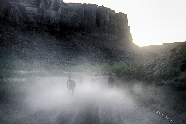
Wild horses and a big mule! I couldn't believe our luck! We had to follow them agonizingly slowly for nearly a mile until the canyon widened enough for them to get off the road.
With the truck in 2nd gear (first gear is super low), we inched our way up the switchbacks. I've never been so nervous behind the wheel! I could not stop until we got to the top! Somehow, we made it. Once on the bigger roads, I was able to shift into higher gears, and with some luck and very little skill made it all the way to Moab. We pulled into a repair shop, and hoping for the best, I killed the engine. Two days later we had a new clutch and a story to tell.
So I say to Canyonlands in my best Schwartzenegger voice, "I'll be back!"


