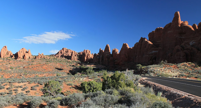
Arches National Park - Part 2
Arches National Park - Part 2
The back (north) half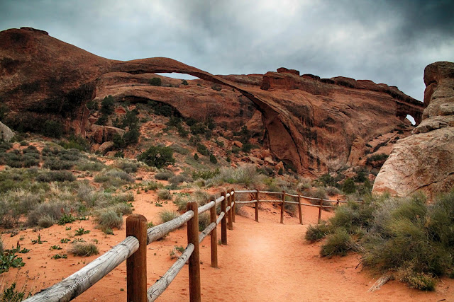
Explore the world-famous arches and discover their geologic stories!
Traveling to Arches National Park (see Part 1)
Delicate Arch and Landscape Arch are the most crowded places in the park, as crowded as any place you've been in Yosemite, Zion, or Yellowstone. Mid-day during the summer, parking becomes impossible.In summer, you'd be wise to arrive before 9 a.m. and drive directly to one or the other to beat the crowds. Then wait until about 4 pm to go to the other. Visit the middle of the park in the middle of the day. I was there in late April, and even then was able to avoid crowds by seeing the most popular features in early morning and late afternoon/evening.
Accessibility: Quite a few trails and locations in Arches are accessible to everyone, including the Landscape Arch and Sand Dune Arch trails described here (chairs with some help or power to get over sand) and the amazing panorama view points. Because of the nature of the sandstone ridges, however, places like Delicate Arch, Double O Arch, Fiery Furnace, and most of Devil's Garden are not accessible to wheel chairs.
How Arches Form
Chances are, it isn't what your 7th grade science teacher told you! Get the real, complete story in Part 1.Arches are collapse features, and wind has nothing to do with them! The long, parallel fractures in the sandstones at Arches are called joints. Erosion along the joints has cut the sandstone into long, narrow ridges. Where a ridge gets undercut by erosion, it collapses in arcuate slabs that fall and are eroded away. If that process cuts all the way through the ridge, an arch forms.
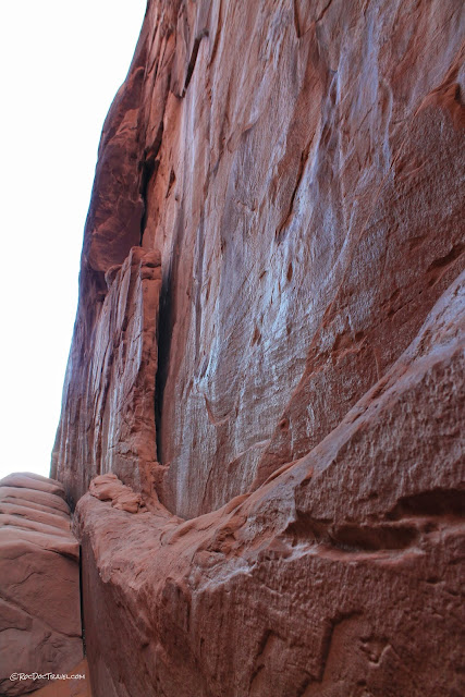
Here's a joint that has just parted a slab from its fossil dunes. Continued fracturing, falling, and erosion will widen the spaces between the ridges.
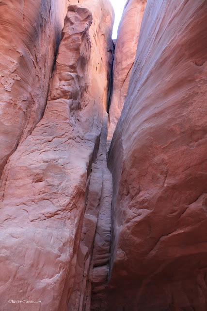
You can see the joints responsible for this national park. These ones haven't been eroded much yet.

Sand dune cross-bedding shows which direction the wind blew -- down the steepest slopes (the slip face). See how many cross-beds you can find that show the wind direction 160 million years ago!

About white versus red sandstone: Recent research suggests that the original color of the sandstones was red from its iron oxide (rust) content. Where organic-rich groundwater has flowed through the sandstones (while they were underground), it removed the rust and turned them white. The same goes for the red and white sandstones in Zion National Park, where the research was done.
Delicate Arch
This symbol of Utah (it's on the license plates) is at the end of its own road, half-way through the park on the right (east) side of this map.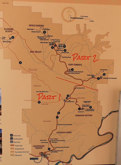
(Utah DMV)
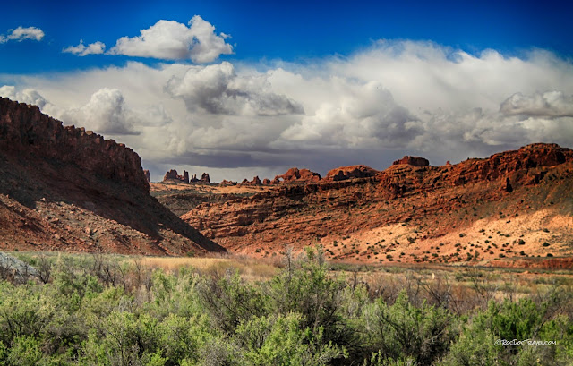
On your way to or from Delicate Arch, stop at Panorama Point to get spectacular views in all directions, including this one to the east of the Delicate Arch area.

Because over a million people walk it every year, the path is well-beaten, smooth, and easy to follow. It continues up the sandstone ramp in the upper right of this photo.
The first thing you'll see on the trail is Wolfe Ranch & the Turnbow cabin. It's hard to imagine scratching out a living here from 1898 to the early 1900's.
Salt Valley Wash is a brackish, uninviting desert stream.
View to the southeast from near the parking lot shows the arches up at The Windows.
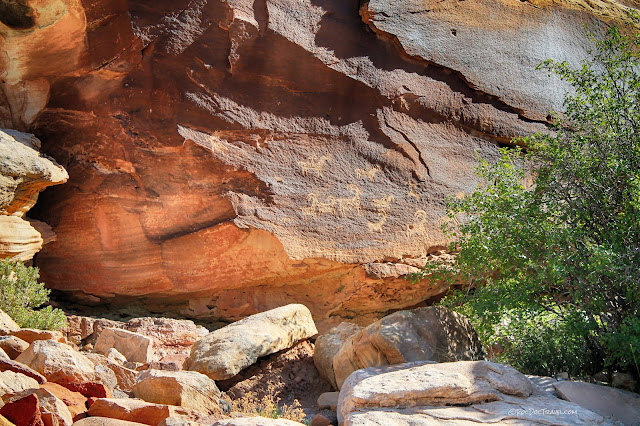
Don't miss the rock art just across the creek bridge from Wolfe Ranch. Art like this was chipped into a coating of iron and manganese oxides called desert varnish. The varnish forms as dust is accreted onto the surface by dew. Experiments show that desert varnish takes many centuries to millennia to form.
This interesting boulder is along the trail. It has layers and veins of quartz in a siltstone block. Hot water must have flowed through fractures in the siltstone, crystallizing quartz when it cooled and saturated.
A close-up view shows the quartz.
This is such a cool trail! The jaw-dropping views are non-stop, the colors vibrant, and the landscape other-worldly!
The trail takes you up this broad sandstone ramp on the cross-bedded Navajo paleo-sand dunes. It has a great view over Salt Valley with its gypsum-rich, light-colored shales and siltstones (more about Salt Valley below).
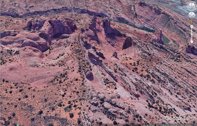
This remarkable Google Earth view shows the trail where it rises onto the Delicate Arch ridge. Thanks to the Google employees who added this great amount of detail!
You'll find this convenient set of hand-carved stairs. The sandstone can be slick when wet, especially where millions of shoes have polished it smooth.
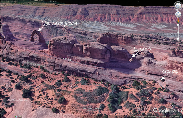
Here's another remarkably details Google Earth view of the trail to Delicate Arch. The ridge rises gradually to the east because of local minor folding. The first picture of the arch below was taken from the window labeled here.
These arches are north of the trail where you rise higher to get to Delicate Arch.
Delicate Arch as seen from the window along the trail. The deeply eroded pit is quite impressive in person! It formed by slow erosion of the sandstone by flowing and ponded water, and freeze-thaw loosening of the sand grains. The arch is an eroded remnant of a narrow fin bounded by joints in the Entrada Sandstone. The joints didn't affect the lower Entrada and Navajo sandstones as much.
The last hundred yards of the trail are on this ledge. It's not scary, but I would hold my kids' hands tightly! The arch is off to the left of this photo.
You'll round that last corner, pop over the ridge crest, and there it is! What's remarkable to me about this arch is its isolation from the rest of the remaining "fin" of sandstone. Unlike all other arches in the park, this one stands alone, not as part of a larger fin. Looking at this view, you'll wonder where the horizontal lines in the license plate come from.
Because sand dunes grow on the down-wind slip face, which is tilted, the layer boundaries within the fossil dunes (Entrada and Navajo Sandstones) exaggerate he tilt of any terrain they're on.
The arch itself has sand dune layers in it.
In case you wonder what's behind the arch, this Google Earth view shows you -- it's huge cliffs! No wonder the trail comes up the ridge instead of directly up from the valley!
I'm blown away by the detail the staff at Google have put into the terrain and images at Arches! When Google Earth first came out, the terrain was severely rounded off to conserve computer memory. The first detailed terrain I saw was in Yosemite, where staff put in the details of Half Dome. Soon thereafter, I saw detail appear at the Matterhorn in the Alps.
You'll have to take turns with selfie-seekers to get up to the arch. I had to stifle laughter at some of the goofy antics people capture in their pictures!
Notice the person below the arch for scale. A view of this end explains the name "Delicate."
This curious traveler is standing for scale by the west leg of the arch.
Here's the view from the lower view area (east down the road from the main parking lot).
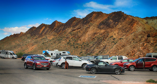
The lower view area parking lot is along a fold caused by movement of salt and gypsum underground. The sandstone stained with desert varnish is the Cretaceous Dakota Sandstone, which is quite a bit younger than the Entrada.
Landscape Arch
Located at the far (north) end of the main park road is the Devil's Garden parking lot. Several trails take off from here, including the well-marked, well-traveled trail to Landscape Arch. There are also good restrooms (outhouses) at the parking lot.The trail to landscape arch takes off to the northwest, at the far end of the parking lot. It follows eroded joints between the sandstone fins, and is less than a mile long. Remember, the sandstone was originally continuous across this whole area -- erosion along the parallel joints widened out the spaces between.
The hardest part about this trail is watching your step! Not that the trail is rough (it's not), but there's fascinating scenery to see at every step!
This amazing ridge shows two joints in early stages of erosion. And the sharp-eyed will also see the lower (fossil) sand dune whose top was eroded off by the upper dune.
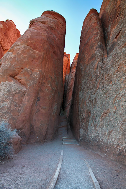
Where the trail squeezes between sandstone ridges, you get a feeling of intimacy with the sandstone. Reach out and touch the 160 million year old sand dune bedding!
And where the trail brings you to broader views, see how many goblins, ghouls, animals, and beings you can see in the sandstone towers. I swear, I 've seen Elvis here!
You'll finally arrive at the first Landscape Arch view. Watch how your impression of the width, height, and shape of the arch changes as you get closer.
It's the fifth longest arch in the world at 290 feet (88 m) wide.
You can see the big pile of rocks that have fallen off the arch, some of which fell quite recently. A lot of sand has accumulated on the pile as well, drifted there by the wind. It's only at this closest view that you can see that the arch was eroded out of a narrow ridge.

The trail continues past Landscape Arch into the farther reaches of Devil's Garden. The trail keeps you a fair distance away from the arch. Park rangers have the unenviable task of dealing with the full spectrum of human behavior, which unfortunately includes carelessness, ignorance, and mischief. The arch has been damaged and vandalized in the past, and has experienced some seriously dangerous rockfalls. And so every one is kept back.
Devil's Garden & Double O Arch
If you continue on the trail past Landscape Arch, you'll experience even more spectacular sights!This cute little butte has amazing sand dune cross-bedding.
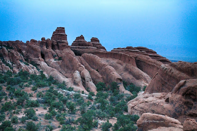
Looking NW at more of Devil's Garden, you'll see closely-spaced, narrow sandstone ridges covering a huge area. What a place to get lost!
The trail to Double-O Arch takes you on top of a ridge! The distance to Double-O Arch is 1.93 miles from the parking lot.
The ridge trail is a unique thrill, and has some of the park's best views.
Double-O Arch was in the 1989 film "Indiana Jones and the Temple of Doom." It's at the end of the opening credits, where actor River Phoenix finds an artifact in a (non-existent) cave under the arch. The arch is bigger than it looks in photos -- 79 feet across and 150 feet high (picture a 15-story building fitting under it!).
The ridge by Double-O also provides amazing views of Devil's Garden.
Sand Dune Arch & The Center of the Park
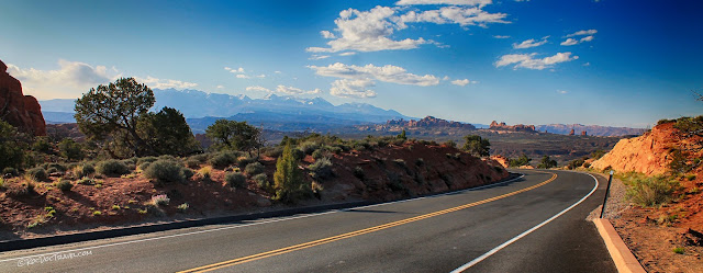
On the park road between the Delicate Arch turn-off and the Devil's Garden parking lot are some great arches, views, and trails.Views along the park road make me wish for more turn-outs!
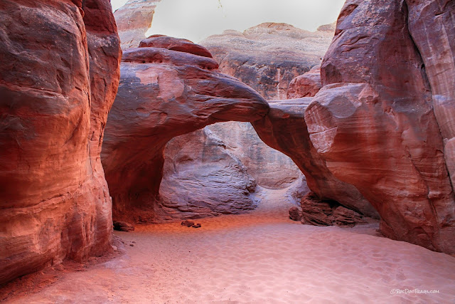
I recommend this short walk to Sand Dune Arch, especially if you have kids with you. It tickles the imagination!
Sand -- what did you expect?
You'll round a corner and suddenly there it is! This is a cozy, quiet alcove surrounded by high ridges that shut out all other sounds.
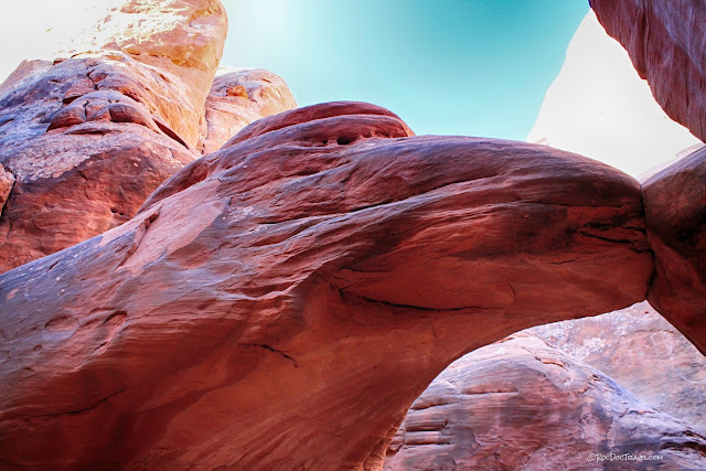
Does anybody else see the Teenage Mutant Ninja Turtle here? He's on the arch.
Take a few minutes to wander and explore!
Looking north from the Sand Dune Arch trail, you'll see these shapely ridges.
Pretty Skyline Arch is a short hike off the park road. Sitting back in a somewhat secluded valley, it's a peaceful diversion from the more crowded spots.
Salt Valley Wash
Don't forget to marvel at the park's central valley! It's essentially an elongated salt dome. Because salt and gypsum are much less dense and less strong than the other sedimentary rocks, they can squeeze out and flow when they're buried deep. They've done just that in Salt Valley Wash, tilting the sandstones.The park road approaching Salt Valley Wash, heading south.
I got up onto a hill to see the valley, and across to the park's southern half.
Fiery Furnace has the reddest sandstones and the narrowest ridges in the park. Hiking in there can be quite confusing, so rangers lead guided hikes.
The La Sal Mountains from near Fiery Furnace.
Related Trips:
Grand CanyonDinosaur National Monument
Canyonlands National Park
Zion National Park


