Grand Canyon Rafting - part 3
Grand Canyon Rafting - part 3
Blacktail Canyon to Havasu CreekIn this Part 3 rafting trip through the Grand Canyon, we'll explore the lower Paleozoic rocks and some of the most fascinating side-canyons with their creeks and waterfalls! See Part 1 for information on raft tour companies and logistics.
For full descriptions of all the rock layers, read my page here.
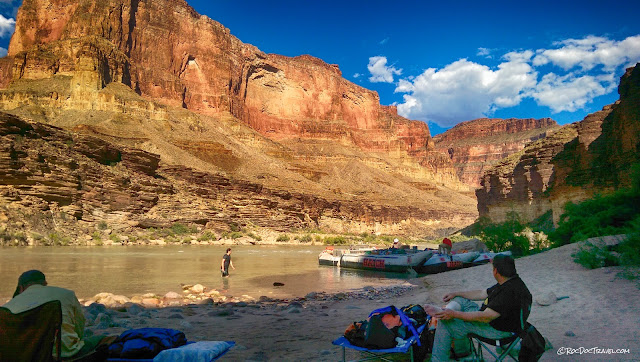
This is the second stretch of river in the Tapeats Sandstone, the first being farther back near the Little Colorado River. Its stack of foot-thick layers is visually compelling, and provides ledges to walk on (which are pretty rare in the canyon). The red cliffs in the distance are the thick Redwall Limestone,
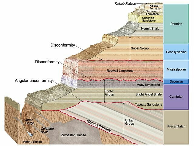
The stratigraphic column helps you keep track of where you are in the thick stack of rocks in the Grand Canyon. From Blacktail Canyon to Havasupai, the subject of this Part 3 trip, you're in the Great Unconformity (called "Angular unconformity" here) to the Muav Limestone. (USGS diagram) For a full description of the strata, read my page here.
The first slopes above the layered Tapeats Sandstone are the Bright Angel Shale. It has a few little cliff-forming silt-sandstone layers, and is truly fascinating to examine up close. It formed just offshore in shallow ocean waters that received sediment from onshore. The first thick cliffs above the slopes are the intriguing Muav Limestone, which formed in shallower waters and even near-beach environments after the Bright Angel. Inside, the rock is mostly gray to brown, but outside is mostly stained red from the rocks above. In this location you can really see its true colors.
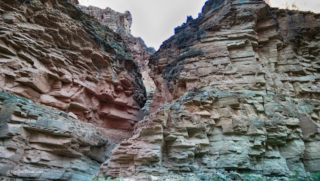
Don't miss the side canyons! They are often the source of rocks that form rapids, so many boaters have their eyes on the river when passing these gems. Look how narrow and deep this little canyon has cut into the Tapeats Sandstone! And it shows the Great Unconformity at its mouth.
This warms the geologic cockles of a geologist's heart -- the Great Unconformity! In this spot, the ancient Vishnu metamorphosed rocks stuck up above sea level, forming an island. The lowest layers of the Tapeats were deposited around it. Just think -- you're seeing a 525 million year old island!
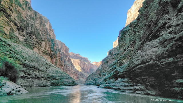
One of the great things about the layering of the Tapeats Sandstone is its visual impact. For a long stretch of the river where the Tapeats is gently dipping downstream, you feel like you're flowing down a funnel. What's going on geologically is, this is the west flank of the highest uplift that forms the canyon. The highest part of the Kaibab uplift is where the main South Rim and North Rim park facilities are. To the east and west, the plateau is lower. That's part of the magic of the Grand Canyon -- the river flows into the highlands, and then back out of them!
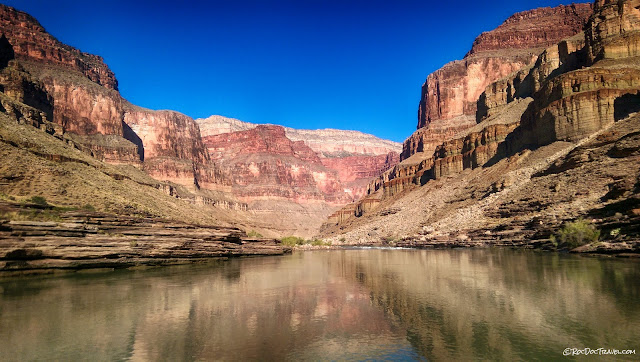
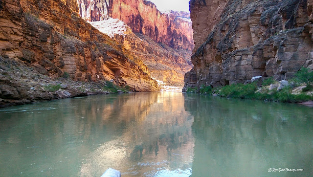
The river here is still in the Vishnu rocks. The thickest red cliffs are the Redwall Limestone, with the brownish Muav Limestone below, and the brown Tapeats below that with its thin layers.
Before the river finally exits the Precambrian rocks, it gives you some wonderful treats. The Vishnu metamorphic and Zoroaster granitic rocks here are steeply tilted, forming polished flat slabs above the river.
Wherever you can, take the time to get hands-on with the granite. Look for the pinkish outcrops. This section has been polished by the river, creating some fascinating patters on the dark mica minerals. Granite with this texture of extra large minerals is called "pegmatite," and it's a universal geologist favorite. The pink minerals are potassium-rich feldspar, and the clear-gray are quartz. Silvery mica is called muscovite (yes, named after its use in Moscow!) and the black is biotite.
This white quartz vein was injected into a fracture in the granite pegmatite, and helped form more large minerals.
Here, the pegmatite is a dike -- a slab of granite that filled a fracture in the older rocks. The black rock is very old amphibolite, a metamorphic rock that forms deep in the crust.
One last section of Precambrian Zoroaster rocks there on the left, with beautiful pink pegmatite dikes.
One of the many waterfalls. There are half a dozen along this stretch of river, most just a few minutes' hike from the Colorado. On a hot day, they're SO refreshing! Amount of water will depend, of course, on time of year and how wet the year has been (which can vary A LOT!).
One of the larger south-side canyons. The river is near the top of the Tapeats. The slopes in the foreground are the Bright Angel Shale, and the dark cliffs are the Muav Limestone. The tall reddish cliffs are the Redwall Limestone.
We found a long sandy beach, and of course had to get out and examine the layering in the sand. The cross-bedded layers tell us water direction and relative speed.
Deer Creek waterfall is straight-up amazing! The creek is incised -- deeply entrenched -- into the Tapeats (the layered rock up high) and falls over the Vishnu Shist 180 feet (55 meters). The force of the water is too hard to stand under! The pool is cool and refreshing, so give it a try! There's also a good trail that winds up to the top.
The creek had an easier time sawing down through the Tapeats than it did the harder Vishnu Schist below. Eventually, the falls will get shorter as the creek cuts deeper.
The strata undulate a bit, so the river is variably in the Vishnu, Tapeats, and even the Muav. This nice beach is on the Vishnu.
Postcard, anyone?
A nice view of the (from the bottom up) Tapeats thin-layered cliffs, dark brown Muav, and tall Redwall cliffs.
Approaching yet another set of rapids. On the big rafts Hatch Expeditions uses, they're no big deal -- just a lot of fun!
The northern section of the canyon is mostly quite narrow like this. Side canyons are quite narrow and steep where streams have cut down through the strata.
One of the many side canyons that offer hope of escape from the deep gorge.
This side canyon in the Tapeats Sandstone shows just how narrow and steep the canyons can be.
Once in a while, you get a glimpse of the high cliffs in the distance, but these views are rare in the narrow northern part of the canyon.
Where the river turns westward, the strata slant downward so that the river seems to climb up the strata. Here, the river is in the Tapeats, but in the distance the Muav Limestone drops down to river level. It's a bit of an odd feeling -- you're going downstream, but the river gets higher stratigraphically.
The Muav section of the river is a bit troubling. It's full of slip surfaces like this one that indicate landslide movement. I would not be surprised in the least to hear of a giant landslide into the canyon.
In a few spots, small monoclines bend the strata. This one lifts the Tapeats back up to river level.
The river has created caves and overhangs in many places in the Tapeats Sandstone. They just beg to be explored!
One of the narrowest sections of the river.
Narrow river and distant cliffs.
Millennia of river flow have scoured these polished scoops into the sandstone.
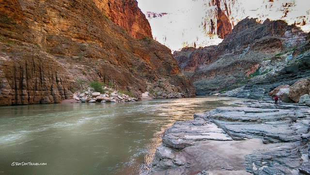
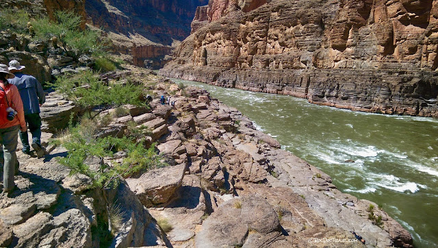
Wherever you can get out and walk around, do it! There aren't that many places you can, but the layered Tapeats provides several places.
After a while in this section of the canyon, you get the feeling that there's no way out. A formidable view like this doesn't help.
The whitish cliff and the debris below it are a recent avalanche. Over time, the rock surface becomes stained by minerals from the rocks above and accumulations of dust and lichen. Keep your eyes open for fresh avalanches like this one.
Another of the narrowest spots in the canyon.
The mouth of Havasu Canyon. The rock here is the Tapeats Sandstone. Location: 36.307741, -112.763180
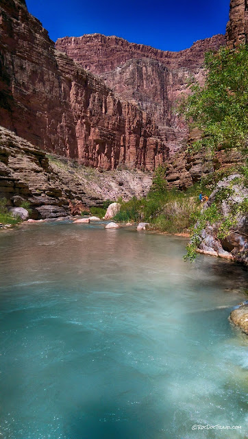
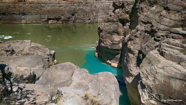
Havasu Creek's turquoise water stands out in welcome contrast to the Colorado's muddy brown-green. You'll invariably find other boaters here.
The big rafts take turns unloading at the conveniently stair-stepped Tapeats cliffs.
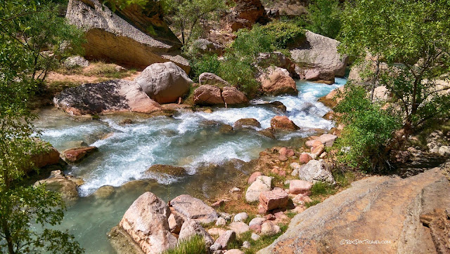
The trail up Havasu Creek will take you from ledge to ledge in the Tapeats above the creek. These pictures were taken at a pretty low water level -- your experience may vary.
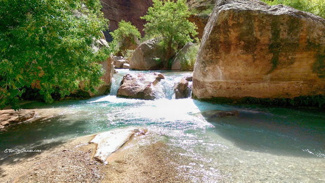
The creek has a plethora of idyllic swimming holes.
Proof that the RocDoc was really there!
Many of the big boulders in the creek fell from higher rock layers like the Redwall Limestone.
You can spot the geologists in the canyon -- they're the ones wearing long sleeves, wide-brimmed hats, sunglasses, and sometimes even long pants. When you spend so many days a year outside, year after year, you learn to cover up. Thankfully, modern clothes breathe and are quite comfortable, even if not fashionable!
No words needed!
Navigating the Tapeats ledges.
Near the mouth of the canyon, the trail has to go high above the creek because of its deep, cliff-lined incision.
Looking back up the canyon near the mouth.
The muddy Colorado quickly overwhelms and obliterates the beautiful Havasu turquoise water.
When you get back to the boats, you'll wonder why you couldn't just spend the rest of the week in Havasu Creek!
Next: Part 4, Landslides and Volcanoes

