Grand Canyon Rafting - part 2
Grand Canyon Rafting - part 2
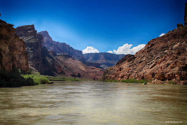
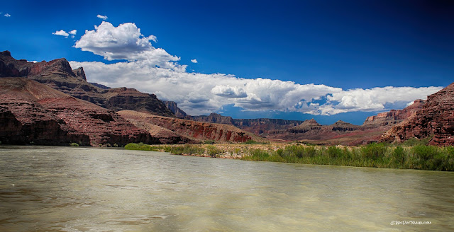
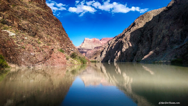
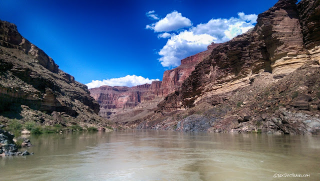
The Basement(above) Leaving Marble Canyon and the Little Colorado River, you'll notice big changes in the canyon. The central canyon widens out and the distant rims get higher. The bedrock along the river gets more varied and colorful. And there are good reasons for these changes!
For more, read full descriptions of the rock layers here.
Into The Uplift
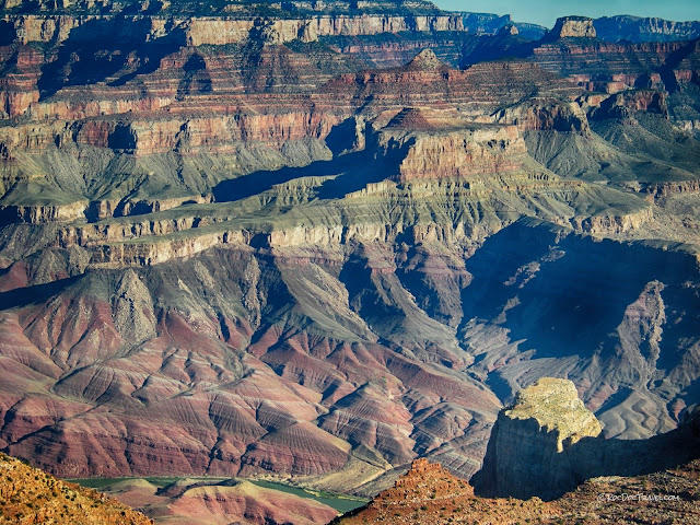
At about Lava Canyon, where black basaltic rocks first appear near the river, the Colorado does something remarkable that rivers just are not supposed to do -- it flows into higher terrain! Two ramp-like folds (called monoclines for their one tilted panel) lift the bedrock nearly a mile higher. Like most tectonic processes, this folding and uplift took place very slowly, on the order of a couple of millimeters per year. The river had no trouble sawing through a measly couple of millimeters in a year to maintain its equilibrium profile. In other words, the landscape rose around the river, while the river stayed pretty close to its original elevation! Isn't it remarkable that the Colorado River flows into and across an uplift! At over 8000 feet, the North Rim is the highest place for many miles around, and the 7200 foot South Rim is higher than the land south of it.
In this photo I took from the South Rim, you can see how the land rises from east to west on the monoclines. On the river, this rise coincides with meeting the Precambrian rocks, and that is no coincidence -- the rocks have been uplifted, brought thousands of feet up to the surface.
The Precambrian Rocks
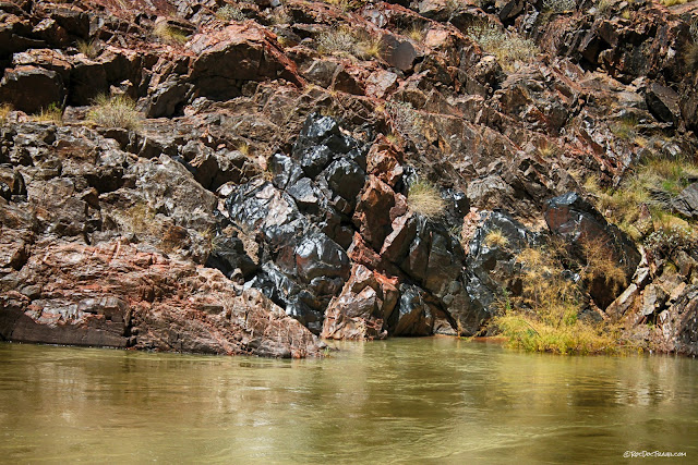
The black layer in this picture is the Cardenas Basalt, about a billion years old. Below it is the reddish Dox Sandstone.
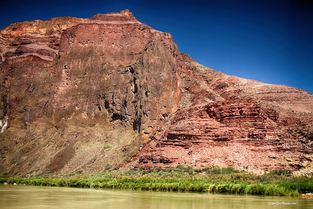
You'll see a lot of the red Dox Sandstone along the river. The Grand Canyon Group Precambrian rocks give the canyon its most vivid colors, and yet because they are mostly barren of vegetation, this part of the canyon looks and feels formidably desert-like.
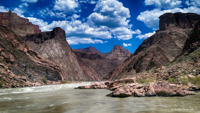
The river is quite calm through the Grand Canyon Group rocks because they contain easily eroded layers.
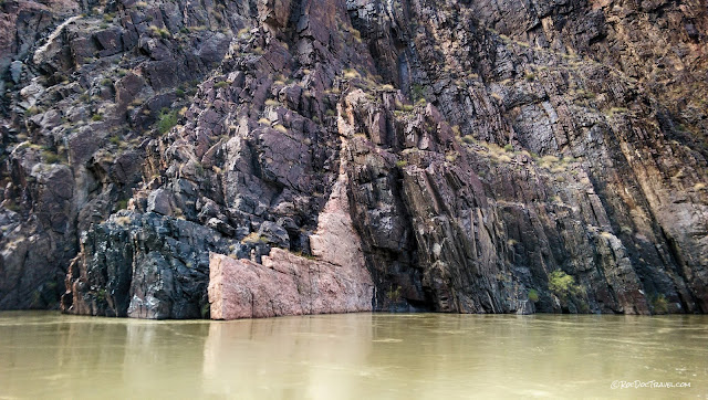
This is the Butte fault, which placed the Cardenas Basalts (left) against the Dox Sandstone (right). The fault moved in two periods, first about a billion years ago and second about 70 million years ago when the monoclines formed. It's the easiest fault to see along the river.
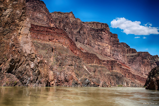
This view shows the strata from the Dox Sandstone at the river all the way up to the Redwall Limestone in the high butte. The tan-brown continuous cliff is the Cambrian Tapeats Sandstone that sits on an eroded surface atop the Grand Canyon Group rocks. Do you see the slight angular relationship between the Flathead and the dark & light layers below? The lower rocks are tilted gently to the right, while the Tapeats is nearly horizontal. That is the unconformity, an eroded surface. Several hundred million years of Earth's history are missing on this boundary at this location!
This is what the lower unconformity looks like from the South Rim. The colorful Grand Canyon Supergroup rocks are tilted, and the younger layers are nearly horizontal.
The deep gorge where the river enters the Vishnu Schist and Zoroaster Granite, the oldest rocks in the canyon, is an imposing sight! John Wesley Powell recorded his fear and trepidation at entering such a narrow, steep canyon with their heavy, rigid boats. The slope above the inner gorge is the "greatest unconformity" between the Vishnu Schist and the Grand Canyon Group rocks above. Up to 1.6 billion years of Earth's history is missing along this eroded surface!
This is a close-up view of a minor fault in the Dox Sandstone. The rock looks wrinkled because the sand moved around and folded while it was still soft and wet.
Soft-sediment deformation in the Dox Sandstone.
The Hakatai Shale has incredible red-orange colors that really stand out. Notice that it and the other Grand Canyon Supergroup rocks are all tilted, while high above the younger strata in the familiar cliffs are nearly horizontal. We'll see the unconformity between them much better farther down the river.
The lower unconformity is the boundary between the gently tilted reddish Bass Limestone (1.2 billion years old) and the gray Vishnu Schist (1.7 billion years old).
The Crystalline Gorge
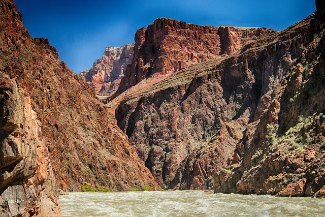
The river is much rougher once you enter the metamorphic & granitic "basement" rocks because they are more resistant to erosion. The slope at high center is the lower unconformity.
The rocks have been polished by the river for a good 30 feet above present river level. That shows how high the river got naturally, before any dams were built. This is the last picture taken by my old camera. Get a waterproof case!
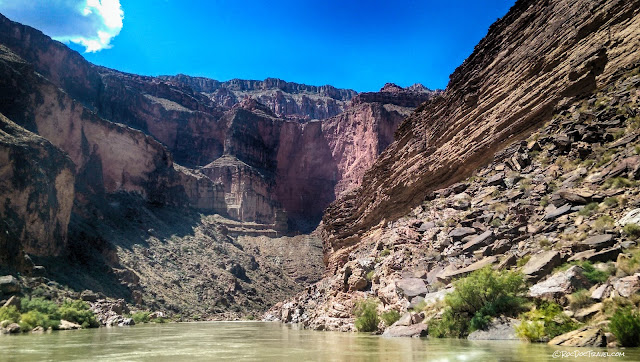
The basement section of the canyon is quite narrow and steep! It almost feels like you're being pulled down a funnel.
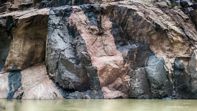
Here's a good view of the basement rocks. The pinkish rocks are "Zoroaster" granite, and the black rocks are amphibolite, a dense rock with high iron and magnesium content. This is what the deep continental crust looks like -- igneous rocks intruded into metamorphic rocks, all deformed and tilted.
Nearing the Kaibab trail is this old water level monitoring station. It predates the Glen Canyon Dam, and was obviously equipped to measure very high water levels.
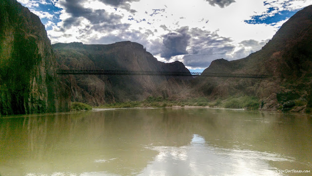
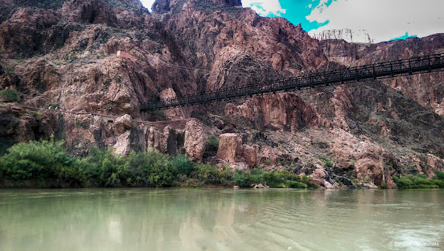
It's quite a sight to see the Kaibab trail bridge crossing the river after you've been rafting for a few days! Up the trail just a bit on the north side is Phantom Ranch, which has reservable cabins and some camp sites. All the experienced explorers I've talked to call it a "tourist trap," so take that for what you will.
The south end of the bridge is a short tunnel through the granitic rocks.
The north end of the bridge.
Another look at the north end of the bridge.
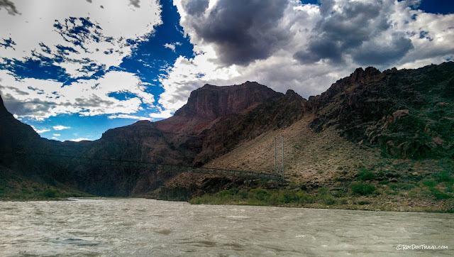
A little farther west is the Bright Angel trail bridge. See my other post about the geology of the Bright Angel Trail for more information.
Waving to hikers on the Bright Angel trail bridge.
This is the bottom of the Bright Angel Trail. See the dark brown outhouse? It has been a very welcome sight to many a hiker!
From time to time on the river, you get a peek at the high cliffs of the outer rim. That's the Supai Group and Redwall Limestone in the sunlight.
Here are polished amphibolite (black) and granite (pink).
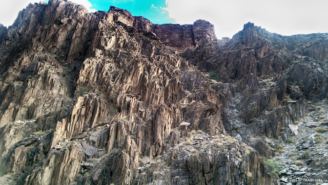
I wanted to stop and climb around on this granite fin! The basement layers here are nearly vertical because of intense folding while continents were smashing into each other over a billion years ago. Those continents collectively formed North America.
A camp spot at last.
One of the best parts of a rafting trip are the long evenings on the beach. The guides take care of all the food and logistics, leaving you free to bask in the sights and socialize.
The Great Unconformity
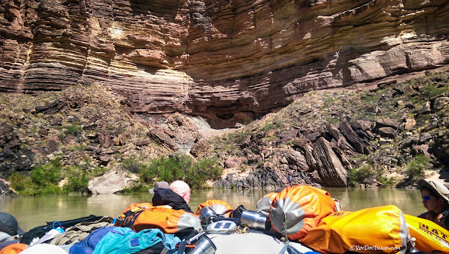
A morning view of the steep Vishnu layers with the sun just hitting the flat-lying Tapeats Sandstone.This stretch of the canyon is formidably steep and narrow because the basement rocks are very difficult for the river to erode. They're also quite solid, so that landslides and rockfalls, the processes that widen a canyon, are uncommon.
Most of the rapids are at the mouths of side canyons, where flash floods have deposited boulders and gravel into the river. Be sure to look up every side canyon - some of them are very long, and have beautiful views to the distant cliffs.
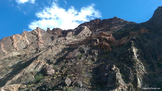
Here's a dramatic exposure of the steeply tilted layers of the Precambrian rocks. The Tapeats Sandstone sits atop the upper unconformity at the skyline. The steep layers were formed by folding when tectonic plate collisions occurred during the assembly of the North American continent.
A closeup of the Tapeats sitting on the Precambrian rocks. Just look for the boundary between nearly horizontal layered rock and the unlayered or steep rocks below.
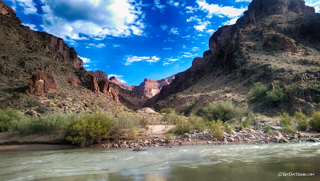
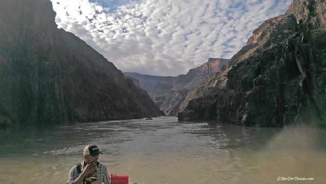
You'll find no shortage of placid views on the river.
Our guide takes a smoke on an easy stretch of river.
The rapids get all the attention, but you'll really enjoy the 90% of the river that is peaceful and relaxing.
This exposure shows dikes of pinkish granite intruding into the metamorphic rocks.
Yes, you do get wet even on the big rafts! It feels great!
Polished amphibolite, a metamorphic rock that forms under very high pressure and temperature.
This is paleontologist Forest Gahn standing on the oldest fossils in the canyon. The orangish layer is made of stromatolite mounds created by cyanobacteria up to 1.2 billion years ago. The bacteria created alternating layers of slimy bacteria and sediment in very shallow ocean waters.
Above the river to the left is the "Ross Wheeler" boat built by Bert Loper and rowed down to this point by Charles Russell and friends. It was abandoned on a fateful expedition in 1915. The location is the bottom of the South Bass trail. You can learn more about the boat here.
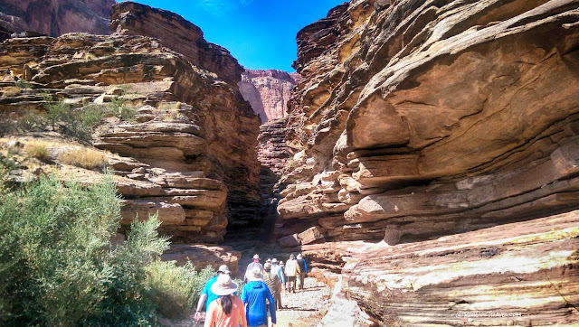
Your raft trip will likely include hikes into some scenic side canyons like this one. I think this is Shinumo Creek.
Most of the side canyons in this part of the canyon are very narrow and steep-sided, which limits their usefulness for trails.
Looking up-river from a calm spot below the rapids.
This fold formed about 70 million years ago when tectonic compression caused a kink in the strata. This is a miniature of the big monoclines we crossed farther east.
The layered sandstone on the right is the Tapeats, with the upper unconformity below it. It reaches river level near Blacktail Canyon (see below).
Elves Chasm is a gorgeous, refreshing stop. coordinates: 36.196923, -112.450511
This part of the canyon teased and intrigued our group of geologists because we saw the unconformity getting tantalizingly close to the river. It lingers just above river level for a few miles.
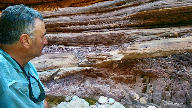
Here's a great view of the unconformity, with the layered Tapeats Sandstone sitting on unlayered (and locally weathered) metamorphic rocks that are hundreds of millions of years older. That boundary was the surface of the earth for unknowable millions of years.
Entering Blacktail Canyon. This canyon is famous among geologists as The Place to explore the great unconformity. coordinates: 36.240290, -112.472543
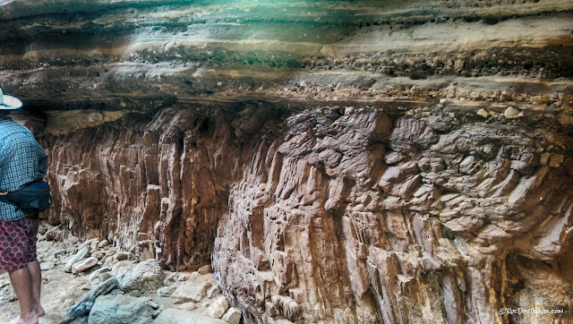
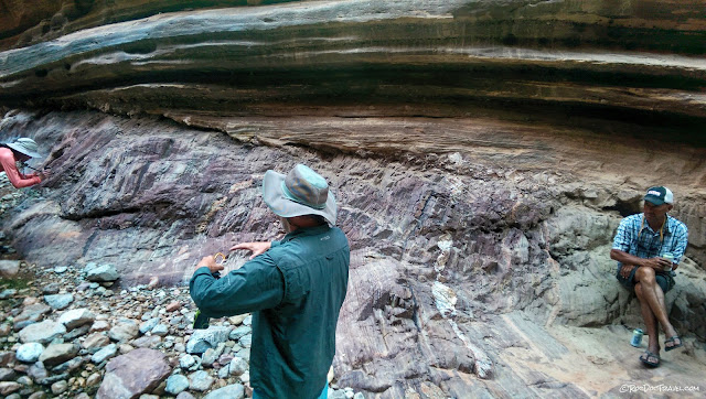
The layered sandstone is the Tapeats. It lies on a fascinating erosional surface on varying metamorphic rocks.
The lowest layers of the Tapeats includes eroded pieces of the underlying Precambrian rocks.
A geologist discusses the great unconformity while our river guide listens.
Pieces of the metamorphic basement were caught up, carried along, and buried on the erosional surface.
The weather-beaten Roc Doc studies this most remarkable of geologic boundaries.
You can hike along the unconformity for hundreds of meters up the slot canyon.
Heading back out to the main river canyon.
Next Up: Part 3, Side Canyons and Waterfalls.
