Beartooth Highway, Montana, Part 2
Beartooth Highway, Montana, Part 2
Explore the high-country geology along one of America's most scenic roads!
This is the road that put the "high" in highway! Always on the list of most scenic roads, the Beartooth Highway takes you all the way to 11,000 feet (3350 m) on good pavement. The only drama is the scenery - the road itself won't stress you or your vehicle like some others, but the twisties are enough to make the most of your sports car or motorcycle.
Travel to the Beartooth Highway
(Interactive Google Map)
Location: Northwestern Wyoming and south-central Montana near the Wyoming state line, just NE of Yellowstone National Park.
Lodging: Most travelers stay in Red Lodge, Montana; another smaller option is Silver Gate - Cook City, Wyoming near Yellowstone's NE entrance.
Vehicles: Even RV's take this incredible mountain road, but BE SURE your brakes, fuel, and cooling systems are in top condition. The pavement is good, suitable even for sportscars and motorcycles.
Logistics: There are no commercial facilities along most of the road, so this is a good picnic trip. Some food is available at Top of the World (see below). Camping: Campgrounds are numerous on the north side along Rock Creek. Two large campgrounds are located at Beartooth Lake and Island Lake. More are located on the south side along Clark Fork River in Shoshone National Forest.
Accessibility: One of the great things about this trip is its accessibility to anyone with a vehicle.
Hiking, Backpacking, Exploring: This is paradise! Check the Forest Service website or the Beartooth Recreational Trails Association. Many other websites have information on these fantastic, endless trails.
The tour here starts on the south side of the range and goes up to the summit.
Geology of the Beartooth Mountains
The Beartooth Mountains are one of the big crustal uplifts that formed the Rocky Mountains between about 70 and 40 million years ago. As this diagram shows, it is a thick block of crust uplifted above a thrust fault. This was all caused by the ancestral Pacific tectonic plate dragging under western North America, causing compression of the crust. Shallower sedimentary rock layers were eroded while the block was being uplifted.
As this map shows, the Beartooths are one of many related mountain ranges that comprise the Rockies in southern Montana, all of Wyoming, most of Colorado, and north-central New Mexico. The ranges in and around Wyoming share a lot of visual characteristics, including the Beartooths, Bighorns, Wind Rivers, Rattlesnake Mountain, the Laramie Range, and the Medicine Bow mountains. They're all wide, blocky uplifts cored by old (Precambrian) granite and metamorphic rocks, with sedimentary rocks tilted on one side of the range and steeply folded on the other.
Geology of the Beartooth Highway's North Side
This tour begins at the summit and progresses northward into Rock Creek Canyon in Montana. See Part 1 for the south side.The summit is just short of 11,000 feet (3350 m) in elevation. The rocks here are granite, gneiss, amphibolite, and granulite that are some of North America's oldest - up to 3.5 billion years old!
As you drive down the north side, take every turn-out, walk around and soak up the view. Typical of Laramide uplifts, the Beartooths have a relatively flat top - see it on the skyline? In this range, it roughly follows the "great unconformity," the eroded top of hard billion-plus-year-old (Precambrian / Archean) rocks and the younger sedimentary rocks that used to be on top of them. Since uplift began about 70 million years ago, water and ice have been digging into this resistant old bedrock, forming the canyons and slopes we see today.
The ice ages of the past 2 million years were the most effective canyon formers, removing tremendous volumes of rock and carrying it out to the canyon mouths and down the rivers. The top of the range was covered in 2000 to 4000 feet of ice, which slid and flowed down the valleys, plucking loose rock and carrying fallen rock as it went. Glaciers form characteristic U-shaped or flat-bottomed canyons with cliff sides, like those in this view.
Looking northward into Montana, the flat top of the range is easily visible. It represents the pre-uplift ground surface, now modified and deeply eroded.
The Rock Creek Canyon road is just visible in the bottom of the big canyon. It will be covered in a separate field trip. It follows the largest U-shaped glacial valley in this part of the range. Notice how talus (fallen rock) has accumulated in great slopes below the cliffs. All that rock accumulated since the glaciers melted away about 10,000 to 12,000 years ago. Without those slopes, the valley would be quite wide and flat-bottomed.
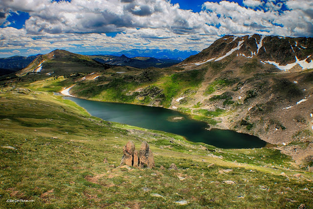
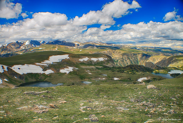
Another glacial feature in the Beartooths are the many lakes. Water accumulates where glaciers plucked out fractured, loose rock, forming depressions like these. Some lakes are blocked by moraines, the great piles of rock dumped at the melting end of a glacier.
In all the high glaciated ranges from central Utah and California northward into Canada, you'll find these smooth bedrock slopes. They form under an ice cap, the thick accumulation that piles up on top of the mountain range. The ice slides slowly across the slopes, pulling away any loose or fractured rocks and leaving behind smooth slopes like these.
This ice cap is in Banff in western Alberta, Canada. This is how the Beartooth Mountains appeared in the last ice age, with the ice sheet feeding ice down the valleys.
One of the first lakes you'll come to is Gardner Lake on the south side of the highway. It has a big parking area and trails galore. It occupies a low spot plucked out by glaciers, and the water is partially dammed by gravel.
Looking back toward the summit from the Gardner Lake pull-out.
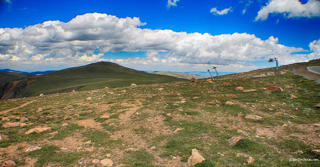
The road follows a long flattened area that formed under the ice cap. The ski lift is the Beartooth Basin Summer Ski Area, which is unusual because it is open May to July. I haven't tried it yet, but can hardly wait! Access is only from the north side via Red Lodge, Montana. See their website here.
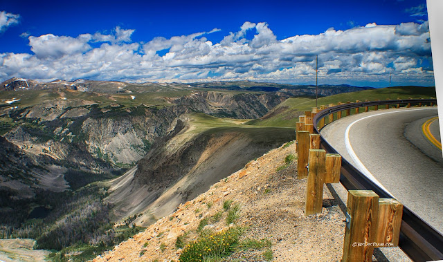
The awesome road meanders across the ice cap terrain. Notice how similar the flat areas are across the range - this reflects the original flat top of the Precambrian rocks.
The semicircular head of a U-shaped valley is called a cirque, and many of them have lakes like the one on the left. That's at the bottom of the Beartooth Basin ski area.
One of the most interesting and important aspects of Beartooth geology is the black igneous dikes. Part 1 shows where some are near the summit. This sign is located down the north side in Montana here: 45.027465, -109.407450 A dike forms when magma forces its way into a fracture, fills it, and hardens. Dikes can carry with them a variety of heavy metals, including chromium, which has been mined in several places in the Beartooths as the sign explains. Magma always heats the groundwater surrounding it, and that hydrothermal fluid can dissolve and carry metals like gold, silver, lead, zinc, and chromium. When the water cools, it deposits the minerals. The black rock itself is generally called gabbro, although different varieties are also present.
This is the big gabbro dike at the turn-out and sign. The orange halo around it is hydrothermal alteration, and that's where the valuable minerals can be found.
This turnout is called the "roller" turnout because of the crashed asphalt roller ("steam roller") down in the ravine, 350 feet below. That must have been some ride! The sign about the igneous dikes is in the same turn-out.
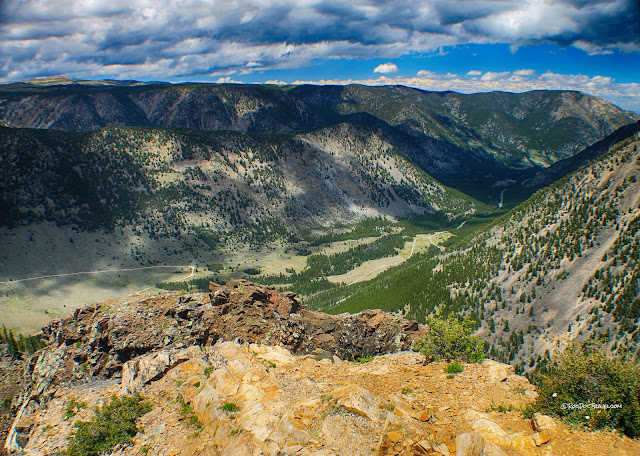
Rock Creek Canyon is over 2500 feet (760 m) deep, carved out mostly by a thick glacier. Picture ice flowing from the 3000 foot (910 m) thick ice cap on the high plateaus down into the valleys, filling them completely with plastic, flowing ice. The ice freezes into every available crack, tearing rocks loose and carrying them slowly down the valley. Over hundreds of thousands of years, glaciers removed all the rock that used to occupy the valley - imagine what a tremendous amount of rock that is! And it has all been deposited downstream as giant gravel piles (moraines) and river sediment.
Here's an aerial view of the big drop into Rock Creek Canyon from the Montana Dept. of Transportation.
The switchbacks and turn-outs are all labeled by the Montana Dept. of Transportation. If you look at the snow-clearing videos, they'll usually say where they are in reference to these places. It's also handy for describing where you take pictures or collect rocks. I like the one called "Mae West" (if you don't get it, look her up).
View from Mae West to two lower road levels over a thousand feet below. Picture this: the valley glacier was up to this level at its maximum.
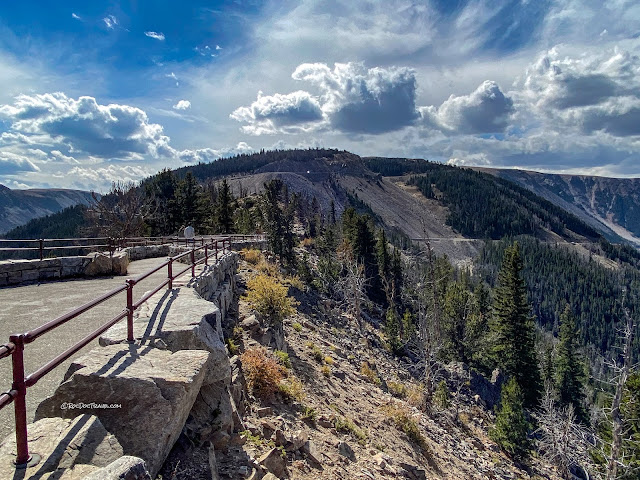
Park and walk out on the Rock Creek overlook. It has the only restrooms along the road, if you need more incentive than one of America's best scenic views. But hey, you might! Don't overlook this overlook!
Picture 3000 feet of ice on the plateaus, and the valley filled all the way with ice. And all of it was slowly creeping downhill, carrying rock with it. That's how such a big, deep valley like this forms.
Deep U-shaped glaciated valleys like Rock Creek Canyon typically have big debris fans, shown here in yellow. These are gravel and boulders from flash floods, debris flows, and avalanches from the steep, high slopes above. They're a significant hazard.
Here's a panorama of Rock Creek. Tempted to explore that road going up the far side? I was, too, but it was too rocky and rough for my vehicle. You'll need a very good, probably modified 4x4 or an ATV to go up the Hellroaring road. And maybe some motion sickness remedy. I'll try it in the near future and let you know!
Looking down Rock Creek toward Red Lodge from the overlook.
The Rock Creek Overlook. The yellowish rocks are hydrothermally altered granitic and metamorphic rocks and quartzite (metamorphosed sandstone).
An early autumn view from the Rock Creek Overlook back up to the Beartooth Highway.
The Quad Creek crossings are sites of regular road maintenance and repair because of the very rocky creekbed. Moving water can take with it tremendous volumes of loose rock, which can easily take out the road.
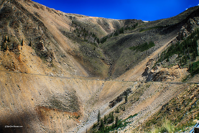
Another site of constant worry is the Streck debris slope. You'll usually see freshly fallen rock piled up by the road here.
Driving down the winding switchbacks on opening day. With this spectacular scenery, it's hard to keep your eyes on the road!
View from west of lower Quad Creek crossing. Notice how wide the valley is. That's one of the features that indicates it was formed by ice. Water cuts V-shaped valleys, with all erosion concentrated in and by the river channel. In contrast, ice distributes its erosive power across a wide base and on its sides, widening the valley and forming steep slopes & cliffs.
Looking up the lower Quad Creek crossing, you can see how incredibly steep and rocky it is. What an engineering and human feat it was to construct this road!
Maintenance is the way of life for crews on the Beartooth Highway. Snow, rock, and water incessantly attack the roadway and its slopes. Please pardon my cheap lense's attempt at a wide angle view! I won't use that one again!
Four levels of the snaking Beartooth Highway. The highest and fifth level is just out of view off the top right corner.
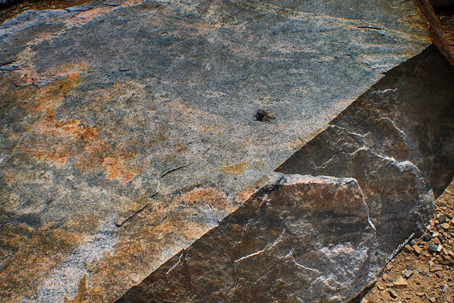
Pull out at the lowest "first" switchback to see good pieces of the bedrock. This Archean (>2 billion years old) gneiss was at one time so deep in the Earth's crust that its original minerals and textures were all changed, or metamorphosed. The rock stretched and flowed like Silly Putty through several tectonic events, forming the banding and folding you can see today.
This banded gneiss is nicely (gneissly?) folded.
As a geologist, I get quite intrigued by a rock like this. It raises (and sometimes answers) many questions. What was the original rock? How deep was it buried? When and how far was it uplifted? When was it metamorphosed? When was the original rock formed, before metamorphism? From the work of others, I've come to learn that this started out as a granodiorite (a granite with more dark minerals in it) about 3.6 billion years ago. It was metamorphosed multiple times, at 3.4 billion and 2.7 billion years ago. The mineral content in some rocks indicates granulite-grade metamorphism, which implies temperatures of 500 to 700 degrees C and depths of up to 50 km. What a history they've had!
On this trip, slope stabilization was taking place from lower Streck down to the second switchback. Spring melting causes loose slope materials to move downhill, especially in the drainages, which of course isn't good for the road.
View from west of lower Quad Creek crossing. Notice how wide the valley is. That's one of the features that indicates it was formed by ice. Water cuts V-shaped valleys, with all erosion concentrated in and by the river channel. In contrast, ice distributes its erosive power across a wide base and on its sides, widening the valley and forming steep slopes & cliffs.
Looking up the lower Quad Creek crossing, you can see how incredibly steep and rocky it is. What an engineering and human feat it was to construct this road!
Maintenance is the way of life for crews on the Beartooth Highway. Snow, rock, and water incessantly attack the roadway and its slopes. Please pardon my cheap lense's attempt at a wide angle view! I won't use that one again!
Four levels of the snaking Beartooth Highway. The highest and fifth level is just out of view off the top right corner.
Pull out at the lowest "first" switchback to see good pieces of the bedrock. This Archean (>2 billion years old) gneiss was at one time so deep in the Earth's crust that its original minerals and textures were all changed, or metamorphosed. The rock stretched and flowed like Silly Putty through several tectonic events, forming the banding and folding you can see today.
This banded gneiss is nicely (gneissly?) folded.
I didn't find any here, but the Beartooth Mountains also contain a fascinating rock called migmatite, which is a high-grade metamorphic rock that partially melted. You can recognize migmatite by its swirling bands of light-colored granite inside a banded gneiss, as shown in this USGS photo.
As a geologist, I get quite intrigued by a rock like this. It raises (and sometimes answers) many questions. What was the original rock? How deep was it buried? When and how far was it uplifted? When was it metamorphosed? When was the original rock formed, before metamorphism? From the work of others, I've come to learn that this started out as a granodiorite (a granite with more dark minerals in it) about 3.6 billion years ago. It was metamorphosed multiple times, at 3.4 billion and 2.7 billion years ago. The mineral content in some rocks indicates granulite-grade metamorphism, which implies temperatures of 500 to 700 degrees C and depths of up to 50 km. What a history they've had!
On this trip, slope stabilization was taking place from lower Streck down to the second switchback. Spring melting causes loose slope materials to move downhill, especially in the drainages, which of course isn't good for the road.
The same area on opening day. You can see some new, repaired pavement and expanded shotcrete.
Shotcrete is concrete hosed onto the hillside under pressure. It's handy for stabilizing soft slopes, but requires careful management of surface waters and water in the slope behind the shotcrete. See the crews on ropes?
The sides of Rock Creek Canyon are littered with boulders dropped by the retreating glaciers.
The Rock Creek Overlook is at the top of this pointed ridge. Look at the soft material in the roadcuts! Constant headaches for road crews is what I see.
The Rock Creek road is passable by cars if you drive carefully. On this day, I had to wait for a road repair crew to drive out so I could pass. This canyon will be another field trip post.
One last look back up at the Beartooth Highway switchbacks!
Related posts: Beartooth Highway part 1; Yellowstone East; Cody, Wyoming area; more to come in the Beartooth Mountains!
