Oroville Dam
Oroville Dam, California
At 770 feet, this is America's tallest dam, and one of the largest earthen dams in the world. It's the cornerstone of California's water system.
Oroville Dam gained notoriety in Febuary, 2017 when the main spillway was badly damaged and the reservoir rose to the overflow spillway in February 12th. Risk of failure of the overflow spillway spurred evacuation of nearly 200,000 people from Oroville and other towns down-stream.
In this field trip, we'll see some possible causes of the spillway failure and the reasons it didn't fail completely.
Travel to Oroville Dam
Interactive Google Map of the Oroville Dam.
Location: 80 miles north of Sacramento, California. Take highway 99 north to signs for Oroville, then highway 162 east to the dam.
Lodging: Good lodging is available in Oroville, Chico, and most surrounding towns. It's close enough that you could even stay in the Sacramento area.
Camping: See Reserve America here.
Vehicles: Any. Bicycling on the dam is a popular activity. Trailers are limited to 35 feet in the state park, and motorhomes to 40 feet.
Considerations: This part of California is HOT during the summer, with temperatures frequently over 100 F. Take plenty of water and dress appropriately in hot weather.
Facilities: There are picnic tables and restrooms near the dam, and a visitor center farther along the road at Kelly Ridge. State Park website here.
Oroville Dam
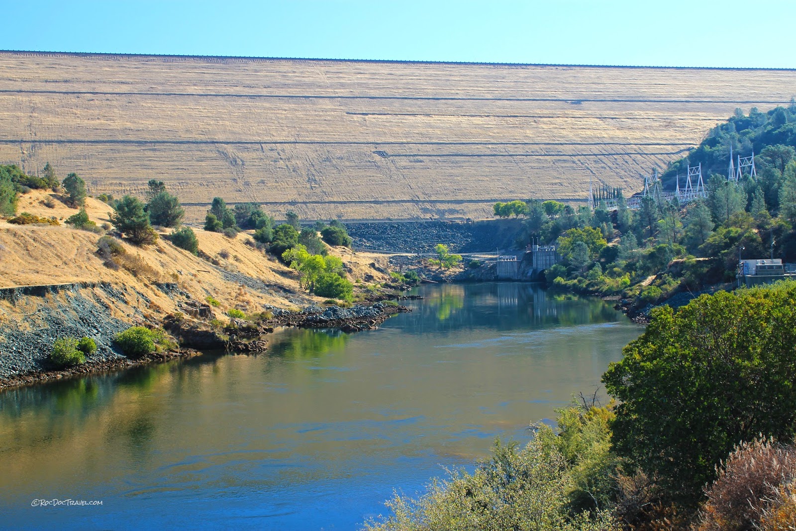
The dam is enormous! It's one of those things like the Grand Canyon and Crater Lake that pictures just cannot communicate. Picture anything you know that's 770 feet (230 m) tall, for starters (that's like a 77 story building!).These statistics are astounding! 3.4 million acre-feet would cover Yellowstone or Los Angeles County with 18 inches of water! This reservoir supplies water to irrigate 750,000 acres of farmland and feed 23 million people - it is vital to California!
Bedrock Geology
The main spillway in this picture is where the problems started in February, 2017. The spillway is on the bedrock hill north of the dam. The bedrock is Triassic age metamorphosed volcanic rocks (mostly basalt and associated rocks called the Smartville Ophiolite), which are quite hard and resistant to erosion.Somehow, a 200-foot section of the concrete was torn out by the water, leaving a gaping hole 30 feet deep. The hole kept growing for many days, deflecting water onto the bedrock alongside the channel, where it eroded deep channels. Pictures of the eroded hole suggest that it grew in a zone of hydrothermally altered bedrock. Superheated water corrodes bedrock, making it soft and easy to erode, and such zones are fairly common in this rock assemblage.
Reducing flow down the main spillway caused the reservoir to quickly rise something more than 20 feet, where it reached the emergency spillway (to the left of this picture), which spilled huge amounts of water down the bare hillside that threatened to undercut the emergency spillway and cause catastrophic flooding. Some fault the construction engineers (in 1964-1968) for not providing a concrete channel there.
The main spillway is on that bedrock hill, just out of view. The scale of this enormous dam is hard to communicate. It's a man-made mountain 770 feet tall!
View looking down all 770 feet (230 meters) to the Feather River. The spillways are on the bedrock hills out of view to the right. The hills in the far left distance are the Sutter Buttes, a complex of volcanoes that erupted 1.6 to 1.4 million years ago.
Another view down from the top center of the dam. The main spillway is on the hill to the right, just over the crest.
Looking north along the dam. The water level was over 100 feet low in August, 2016. The main spillway inlet is at the far end of the crest road.
Lake Oroville is vast and deep, and provides an important ecosystem for fish, birds, and game animals. It is the cornerstone of California's water system, providing irrigation water for more than 750,000 acres of vital farmland and water to 23 million residents.
Road across the top of the dam.
A map of huge Lake Oroville.
At the top of the main spillway, you can see the head gates and metavolcanic bedrock.
A look at the top of the main spillway. Emergency spillway is the slopes beyond.
The top of the main spillway. The bedrock is hard metamorphosed volcanic rocks (they look like sheeted dikes to me) that eroded fairly slowly when the emergency (overflow) spillway was topped. This probably prevented catastrophe. Most bedrock around the country would have eroded much faster. You can see two thin hydrothermally altered zones here, identified by their yellow-orange color and soft appearance. Layers like those may have been the culprits in the main spillway failure that started the problems in February 2017.
This geologic map shows the Oroville Dam on unit Trv, which is the Triassic Smartville Ophiolite (later named). It consists of volcanic islands that were accreted onto North America when their oceanic plate subducted under the continent. The islands and pieces of oceanic lithosphere were shoved into the subduction zone and metamorphosed a bit. Later uplift has revealed them at the surface.
Title:Geologic map of California, Chico sheet: Burnett, J.L., and Jennings, C.W., California Division of Mines and Geology, 1962. Map Scale: 1:250,000
These are the main spillway gates.
Gates (lake side) of the main spillway. The emergency overflow spillway (called a "weir") is the concrete wall beyond the gates. The reservoir went over the emergency spillway for the first time ever on February 12, 2017. What a change in only 6 months after these pictures were taken!
Hard bedrock at the top of the spillway entrance, possibly sheeted dikes of the oceanic lithosphere assemblage (the Smartville Ophiolite). From a geologist's point of view, this is good bedrock for a dam. The only flaw is the softer, hydrothermally altered zones in the area.
Entrance to the main spillway. The bedrock in the foreground is good, solid metabasalt.
View from the spillway inlet out over the lake at low water in August, 2016.
The main spillway inlet at low water in August, 2016. The reservoir flooded into the treeline in February, 2017.
The emergency (overflow) spillway (a wall like this is called a weir). The reservoir overflowed the weir just 6 months after this picture was taken!
View of the main spillway inlet at low water.
I suppose boating at low water requires caution for obstacles.
Lake Oroville became the symbol of California's drought. This floating barrier looks a bit forelorn! By February of 2017, the water was up into the treeline, and the floating fence was actually floating.
The lake level was historically low in August 2016. You can see big water intakes on the far side.
A view southward along the dam.
View down across Oroville in August, 2016.
Related posts: Lassen Volcanic National Park, Mt. Shasta, Lake Tahoe, Yosemite.


