California Landslides & Floods
California Landslides & The Great Flood of 1964
Discover where & why California has so many landslides, and learn about the biggest flood ever - the Great Christmas Flood of 1964!Travel to These Sites
Each site is accompanied by GPS coordinates for easy location.The sites in this guide are all easily accessible by main roads.
Lodging is available near all of these sites except the Mattole Road south of Ferndale. For that road, stay in Ferndale or Weott.
California's Hazardous Geology
Why does western California have so many landslides? The answer lies in its tectonic history. The Coast Ranges - most of the state west of the Central Valley - was formed in or near the subduction zone where the ancestral Pacific plate was subducting under North America. Anything on the oceanic plate that was soft or sticking up was scraped off and accreted onto the continent, including in some places pieces of the oceanic lithosphere itself. In the diagram below, this took place in the "accretionary wedge."USGS diagram showing subduction and the accretionary wedge.
Large swaths of the Coast Ranges are the ancient accretionary wedge. It's made of a lot of shale with isolated sandstone, chert, volcanic rocks, and metamorphic rocks. On the geologic map below, this mix of rocks is called the Franciscan melange (French for "mixture"), the green patterns on most of the northern coast.
Geologic map of California. See the full-size map at this link: Dept. Conservation
San Francisco Peninsula
For a detailed geologic map of the San Francisco Bay Area, click here.
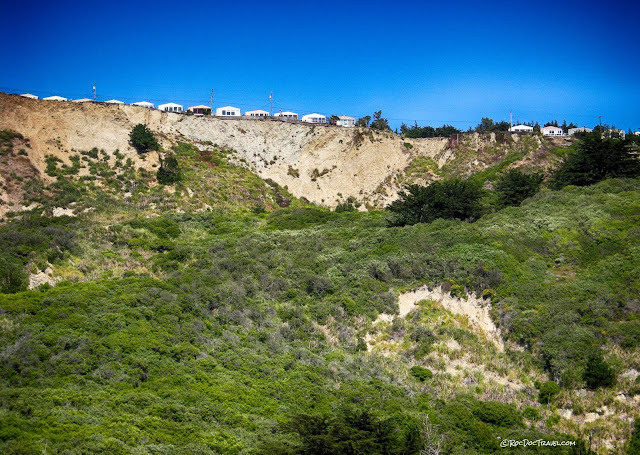
From the same viewpoint as the photo above, several surviving houses boldly overlook the landslides that have taken out their former neighbors. The bare scarp is the most obvious sign of a landslide, and you can see that it is made of relatively soft sandstone. The lumpy slope below is another sign of landslides. The San Andreas fault passes through the lower part of this picture.
While there, I spoke with an elderly lady whose house is in this view. She was walking her miniature poodle and wearing a pink scarf over her curled hair. She said she knows all about the San Andreas, and that she has lost several neighbors' houses to the landslides. I asked what she thought about still living there with all the risks. She said, "It's so lovely, I just love it here. I wouldn't live anywhere else."
I've gotten the same response from residents of Pompeii, Mt. Etna, Galveston, New Orleans, various riverside towns, and others. Human nature and personal perspective trump cold, objective analysis every time.
The surviving houses above this landslide scarp (the bare slope) have unparalleled ocean views, but at a price. To the right, some of their former neighbors have met the fate they all await. The San Andreas passes through the bushy slope. Note the small landslide near the bottom.
I appreciate a good ocean view like anyone else, but would have a hard time sleeping during rainstorms in any of these houses. The bare slopes are all landslide scarps.
When Highway 1 was built, engineers didn't know much about melange and how to avoid landslide hazards. They consistently cut the toes off ridges and over-steepened slopes like this one in San Francisco. As a result, Highway 1 is the most expensive highway to maintain in America. This roadcut is covered with shotcrete, which is sprayed-on concrete that holds soft slopes together. Coordinates: 37.777090, -122.512171
The Batteries (old military installations, not portable electricity supplies!) at the south end of the Golden Gate Bridge are excellent places to see landslides in the tectonic melange that underlies much of the peninsula. You can recognize melange by its distinctive soft shale slopes and pale blue & green colors. The shale is clay that is soft, slippery when wet, and changes shape with water content. That makes it just about impossible to build anything on. Coordinates: 37.807278, -122.477294
One of the characteristics of shale-rich melange is isolated blocks of volcanic or metamorphic rocks, like this block of bluschist - a piece of metamorphosed oceanic crust. The fabrics in the surrounding shale indicate shearing around this rigid block.
Sometimes signs are hard to read. Sometimes they're just hard to obey.
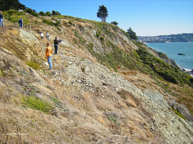
These curious travelers are exploring the landslide-prone melange below Battery Cranston.
In this view looking down over a melange landslide, you can see the green and gray shale and one little bit of tan sandstone near the top. The spring is a tell-tale sign of a landslide. It indicates that groundwater is being blocked by the shales below, forcing it out in the slope. When heavy rains saturate the hillside, it loses all strength and slides.
Northern Coast
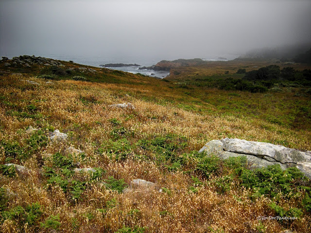
Melange of the accretionary wedge forms a distinctive landscape of low slopes, rolling low hills, poor vegetation, and isolated blocks of harder rock seen here at Nicasio Reservoir just east of Point Reyes Station. The high clay content and high iron & magnesium content make melange poor for food crops. Note the lack of cliffs - none of the bedrock is hard enough or laterally continuous enough to form cliffs. Coordinates: 38.086241, -122.752727
These slopes along Tamales Bay are typical melange. Note the isolated blocks of metamorphic rocks. So why do the hills on the far side of the valley look steeper and have more vegetation? It's because the San Andreas is in the middle of the valley, and the far bedrock is granite that has been transported along the fault all the way from near San Diego. Coordinates: 38.087177, -122.812862
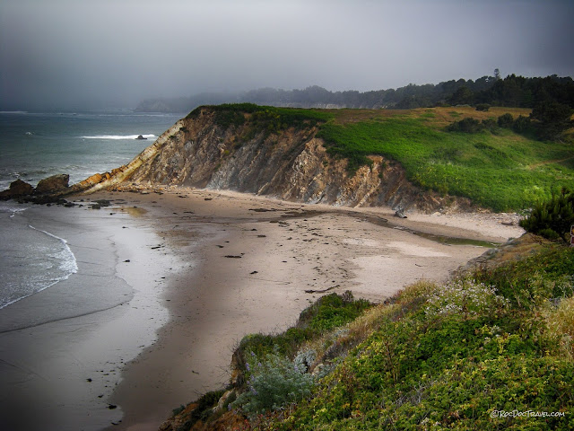
But there's more to this story. You can see various attempts to protect the cliffs from erosion, none of which have worked. Concrete poured over the slope has simply been eroded from the sides. Cement blocks put on the beach were counter-productive because they focused storm wave energy on the sand, causing it to erode away and undermine the blocks. The remaining houses can thank the metamorphic blocks for protecting them! Coordinates: 38.390258, -123.084723
This metamorphic block is at the same location north of Bodega Bay. You can see how the soft shale around it has been eroded away. The rocks out in the water are also metamorphic & volcanic blocks.
This melange was exposed by a landslide at Shell Beach near Jenner. The shale matrix contains abundant blocks of blueschist, which is pieces of the basalt ocean floor that were shoved deep into the subduction - 30 to 45 km! - and metamorphosed. Coordinates: 38.417532, -123.105185
Isolated bedrock blocks in the waves are called sea stacks. These are at Shell Beach and are blueschist like the blocks above.
This is a shear zone (like a cohesive fault) in the melange at Shell Beach. The melange is mostly shale, with isolated blocks of blueschist, chert, sandstone, and limestone.
This is typical melange terrain, with low slopes of shale and isolated blocks of harder rock. Near Sea Ranch.
Within the melange are some large blocks of harder bedrock like these sandstones that were deposited along a coast. Subsequent tectonic movement has tilted them to near vertical. Near Point Arena. Coordinates near here: 38.881414, -123.674988
Uplifted marine terraces at Westport show California's ongoing tectonic activity. They were planed flat by wave erosion, but were later uplifted by movement associated with the San Andreas (which is offshore here). California isn't sinking into the ocean, it's rising! The cliffs are made of melange with overlying beach sand deposits, and are constantly being cut back by wave erosion. Coordinates: 39.652690, -123.784212
This landslide and debris flow complex is along Mattole Road in a section of the melange that contains more sandstone than elsewhere. We call a mudflow that is mostly rocks a "debris flow" to distinguish its more powerful nature. Coordinates: 40.419656, -124.391542
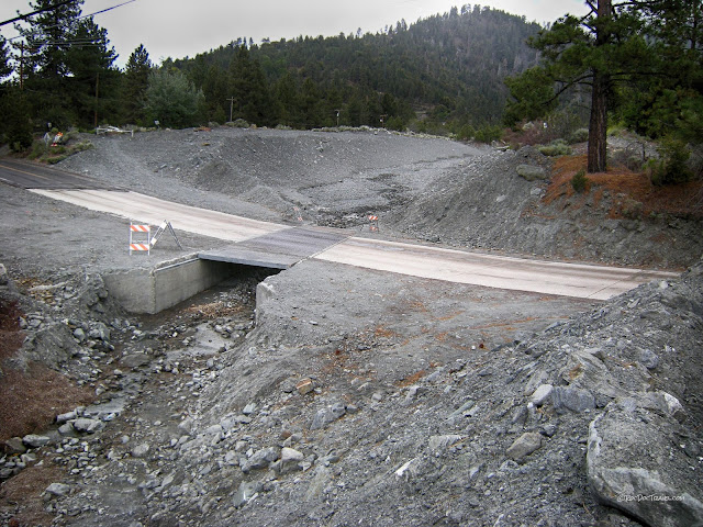
When a flash flood occurs on soft soils or bedrock, it can become a mud flow. If a mud flow picks up enough rocks, we call it a debris flow, like this one along Mattole Road. Coordinates: 40.417520, -124.398021
I highly recommend taking the Mattole Road loop from Ferndale south to Petrolia, then east over the mountains to Humboldt Redwoods State Park just north of Weott. It's nearly a day-long drive, but it's incredibly scenic, has great geology, passes through redwood forests, and is a great road for sports cars! In fact, I've seen some car commercials that were filmed along the coastal section of Mattole Road. This picture shows one of many landslides along the road. Coordinates: 40.273092, -124.078978
Southern Coast
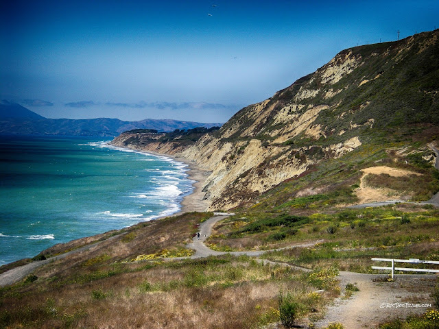
Much of California's southern coast has a different set of problems from the northern coast. Down south, several big active faults have caused dramatic uplift of the coast that put soft beach sand into the hills.
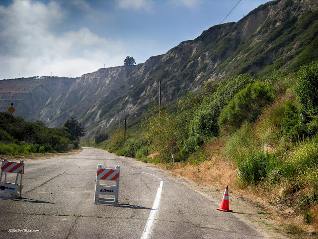
Another view of the landslide-prone slopes near Punta Gorda. Coordinates: 34.352281, -119.427554
Looking more closely at the landslide, you can see that the hillside is made of fairly soft sandstone.
Landslide mitigation is a more tricky proposition than you might think. All kinds of things can be done to a hillside - terracing, surface drainage, deep drains, vegetation, and so forth - but there's still a chance that another landslide may occur. What then? If the State or County had stepped in after the 1995 slide and taken any significan mitigation measures, they would have incurred liability in the deadly 2005 slide. (As it was, they built a small retaining wall that was pushed over in 2005). And so after 2005, the State merely put up this sign, which effectively says, "We're not going to assume liability by doing anything to this hillside, so live here at your own risk."
Located along highway 1/101 and a stone's throw from beautiful beaches, La Conchita has undeniable appeal that proved to be its downfall. These steep slopes are well-known ancient landslides that are certain to move again. The neighborhood should never have been built here.
USGS photo of the 1995 landslide at La Conchita.
USGS photo of the 2005 landslide at La Conchita. It was more fluid, and flowed faster and farther into the town than the more coherent slide in 1995.
USGS photo from the top of the 2005 La Conchita landslide.
The Palos Verdes peninsula south of downtown L.A. is one big landslide complex. This road and parking lot in San Pedro are called the "Sunken City" landslide. Soft sand originally deposited at the beach has been uplifted by tectonic activity, and someone was unfortunate enough to build on it. Wave action continually undermines the cliffs, leading to collapse. Coordinates: 33.706533, -118.287990
The Portugese Bend landslide complex is one of the most well-known and studied landslides in America. I just love this sign - it means this road is about to get very interesting. This is Palos Verdes Drive westbound. Coordinates: 33.738577, -118.357810
The Portugese Bend landslide complex has had houses, roads, and other developments on it at various times in the past. Only Palos Verdes Drive remains. In this view you can see many scarps, some bare and some lightly vegetated, that mark the tops of landslides. The generally lumpy terrain is the remnants of landslides.
Palos Verdes Drive was level at one time. Because of frequent landslide movement, however, it is now nearly like an amusement park ride. Note the several scarps on the hillside.
This view shows one of the larger landslides, marked by the long bare scarp. Landslides will continue here until the entire slope - all the way from ocean to the top - reaches the angle of repose (the angle of stability). Can you predict the future of those very expensive homes at the top of the hill? It may not be for a very long time, but their demise is inevitable.
Southern San Andreas Fault
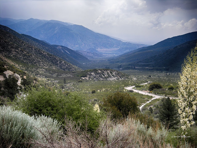
This debris flow channel near Wrightwood is one of many that developed when flash floods carry rock off the slopes. Movement along the San Andreas has uplifted the San Bernardino and San Gabriel mountains very rapidly, resulting in rapid erosion. Coordinates: 34.349015, -117.614803The small hill in the foreground is a landslide that likely came off the hill during an earthquake. This long, straight Lone Pine Canyon formed by erosion of crushed rock along the San Andreas fault. Landslides and all kinds of land movement are abundant all along the San Andreas. San Bernardino is at the foot of the mountains in the distance, and you may just be able to see I-15. Coordinates: 34.341650, -117.599834
The Great Christmas Flood of December, 1964
From San Francisco and Sacramento northward, California suffered incredible rains December 19-27. Some places received over 30 inches of rain in three days, and local amounts of 50 inches were recorded! Every river flooded, every canyon road and railroad was destroyed in places, landslides were too numerous to count, many towns were completely cut off, and the state suffered almost incalculable damage. These were the state's worst floods since the state-wide floods of 1861-62. Those floods filled the entire Central Valley and all of the valleys in southern California. If/when either of these floods is repeated, it could be the worst, most costly natural disaster in American history.
My family just happened to move to northern California in December, 1964 during the state's heaviest-ever rains. I was small, but remember a couple of things about it. I couldn't play outside for a couple of weeks because of the incessant rain. Then one day the houses across the street from us disappeared off the hill in a landslide. I guess I was destined to write this blog!
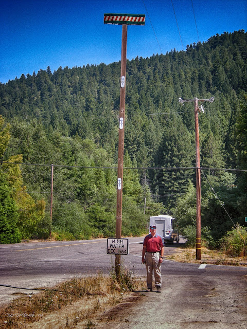
This marker is in Humboldt Redwoods State Park north of Weott. It doesn't look like much until you know that the river valley here is about 50 feet (15 meters) lower than the bottom of the sign! Intersection of Avenue of the Giants and Dyerville Loop Road. Coordinates: 40.352571, -123.926147
The following diagrams and photos are from California Department of Water Resources Bulletin 161, published in 1965. It's available here. If the link changes, you can find it by searching at water.ca.gov for "flood 1964."
The condition that set up the floods is called an "atmospheric river." Small versions of this are often called the "pineapple express" because they draw moisture from near Hawaii. When a persistent low offshore from Washington and British Columbia is paired with a high off the Mexican coast, they act like gears to channel a narrow band of moisture from subtropical waters near Hawaii to the West Coast. In December 1964, the atmospheric river pulled in the remains of a typhoon from the western Pacific, and the results were catastrophic.
This map shows the areas affected by floods in December - January 1964-65.
Holmes along the Eel River was destroyed. Look how wide the river is! Coordinates: 40.420579, -123.949077
One of the towns hardest hit was Klamath. Like Weott, the town has since been moved to higher ground. Coordinates: 41.530025, -124.040512
This view of the area round Ferndale is mind-boggling! The river filled the entire wide valley and delta area! Look at it in Google Earth if you can. Coordinates:40.584446, -124.259719
In December 1964, the Oroville Dam was under construction. This is the same dam that caused evacuation of 200,000 people in February, 2017. This view is just downstream from where the dam was rising, showing dramatic outflow from the diversion tunnels. The bridge in this view no longer exists. Coordinates: 39.535760, -121.501456
The flood destroyed hundreds of bridges, including this major bridge on US 1 / 101 at Rio Dell, just south of Fortuna and Eureka. Coordinates: 40.509678, -124.121051
Related Posts: California Northern Coast parts 1, 2, and 3
San Andreas Near San Francisco
San Andreas I-15 to I-5
Oroville Dam


