Glacier National Park
Glacier National Park, Montana
Visit one of America's most spectacular landscapes, and home to one of the world's most incredible roads!
Glacier National Park is located in northwestern Montana adjacent to the U.S. - Canada border. Access from the west is through Kalispell and U.S. highway 2. Access from the east is through East Glacier, Montana and highways U.S. 2 and 89.
What You'll See: On this trip, we'll stick to the roads to see deeply glaciated valleys and peaks, a package of billion year-old rocks that are some of North America's thickest, and some of the best thrust fault exposures on the continent. It's the interplay of these three geologic factors that created the unique landscape of Glacier National Park.
Seasons: GNP is open all year, but the Going To The Sun Road discussed here is only open when snow conditions permit, typically June through September.
Website: Glacier National Park. Have a look at their webcams page, too.
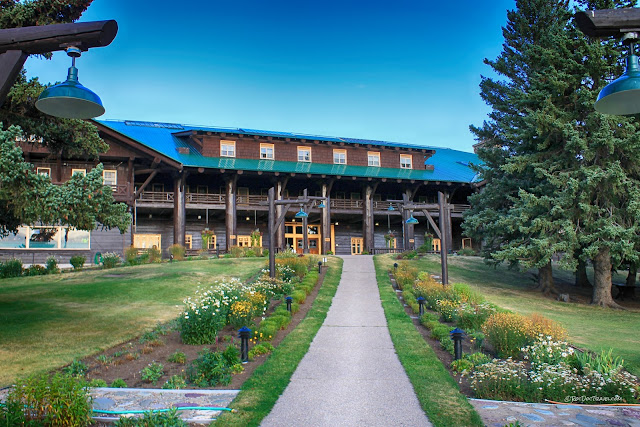
Lodging: The most abundant lodging options are in and around Kalispell on the west side of the park. On the east side, there are facilities at East Glacier and Browning. I've stayed at the 110 year old Glacier Park Lodge in East Glacier, and highly recommend it. You can find information about lodging and camping in the park at the park's website.
Travel and Vehicles: This is a drive-to park, although commercial flights are available to Kalispell. RV's larger (21 ft. max) or wider (8 ft. max) than a pickup camper are not allowed on the Going To The Sun Road, and no trailers are allowed. Rock overhangs limit vehicle height to only 10 feet. To get across the park with those vehicles, use the southern route, U.S. highway 2. Bicycles are restricted to early morning and late afternoon hours on the GTS road (and personally, I think it's crazy-dangerous to ride on such a narrow, shoulderless road with drivers of random abilities!).
Hiking and Backpacking: GNP is renowned for its world-class hiking and backpacking, and a surprising number of easy trails are available. Find full information at the park's website.
Accessibility: If you stay on the roads, the park is accessible to anyone. Shuttles are available to all major sites.
Logistics: If you're going up high, like Logan Pass, you need to be self-sufficient for food and water and weather. Even in mid-summer, temperatures can drop rapidly and thunderstorms can arise with little warning, so be prepared.
The Going To The Sun Road is the red one in the upper middle of this map. U.S. highway 2 goes south around the bottom. We'll start this trip at Lake McDonald on the west side.
Geology of Glacier National Park: Going To The Sun Road
Let's start on the west side of the park.
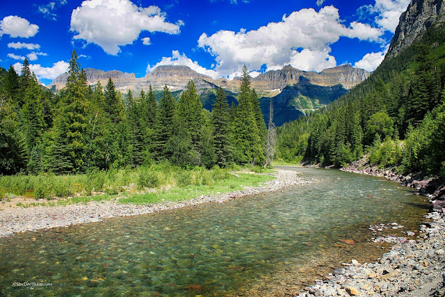
Lake McDonald occupies a valley scooped out by glaciers, and blocked in by moraines (the piles of gravel dumped at the end and sides of the ice). "Scooped out" is perhaps not the right description, because glaciers are conveyor belts, not bulldozers. They carry gravel that falls on them from the mountain slopes above, and they carry gravel beneath them when the gravel freezes into the ice and is dragged along. When the ice melts, the gravel drops.These cascades on McDonald Creek are located right along the park road between Lake McDonald and Avalanche Creek.
Just driving into the park is an awe-inspiring experience! Glaciation creates round-bottomed valleys with cliff sides, perfectly represented here.
Beyond McDonald Creek, you can see the "Garden Wall," an imposing line of high cliffs. The bedrock there is part of the Belt Supergroup, a billion year-old stack of sedimentary rocks more than 15 km thick and slightly metamorphosed into very hard rock.
See the road cutting diagonally across the mountain below the Garden Wall? That's where we're going!
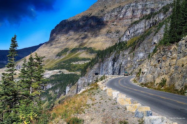
The Going To The Sun Road is one of the continent's most breath-taking roads. It slices across the mountains at a fairly constant grade of about 5.5%, and tops out at 6646 feet at Logan Pass. It was built from 1921 to 1932, and is a national historic civil engineering landmark.
To me, one of the things that makes driving on this road so challenging is the scenery - you don't want to look at the road! The peaks here are Oberlin, Clements, and Cannon. Logan pass is on the far left.
Here's a hazy look at Heaven's Peak, 8986 ft (2739 m). It's typical in August to have some smoke from distant forest fires.
Here's another look at the Oberlin-Cannon peaks. The valley going off to the middle right distance is the entrance road you came in on.
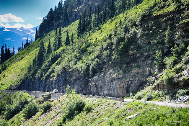
The road was designed by landscape architect Thomas Chalmers Vint, whose goal was to minimize the road's visual impact on the landscape. He achieved that by carving the road into bedrock and building support walls out of local rock. He crossed creeks and waterfalls by making the road look like a natural bridge - it's really quite remarkable to see!
Take a lot of turn-outs and enjoy the view! This view looks back down the road and up the McDonald Creek valley to the northwest.
As you get closer to Oberlin and Cannon peaks, waterfalls come into view. These pictures were taken in a very dry year, so it's likely the falls will be bigger when you visit. What were glaciers in a colder climate are now reduced to year-round snow fields. To be called a glacier, the ice has to be thick enough to flow under its own weight, typically about 100 feet (about 30 meters). If it doesn't flow, it isn't a glacier.
Continuing up, you'll get a view down the entrance road and McDonald Creek.
These pictures will show you only the widest parts of the road, because my white knuckles wouldn't allow me to take pictures of the narrow parts!
Glaciers pull bedrock out of the cliffs wherever they can get their icy fingers into fractures. The ice jacks the fractures open and pulls out the rock, carrying it away down the valley. The Belt Supergroup bedrock in GNP is so hard that even millions of years of glaciation haven't been able to cut these cliffs back any farther. The waterfall is currently working on it, though.
Onward and upward to Logan Pass!
The roadcuts give you a good look at these sedimentary rocks. They were deposited in a rift valley that was at the continent's west coast. We're not even sure what highlands were being eroded to produce so many sediments - it could have been part of Siberia or some other continent!
Even in August, snow drifts remain. This road is known as the hardest in North America to snowplow. Snow can be as much as 80 feet deep at the summit, and it can take 100 days to plow!
Here's a view back down the road, showing its constant grade.
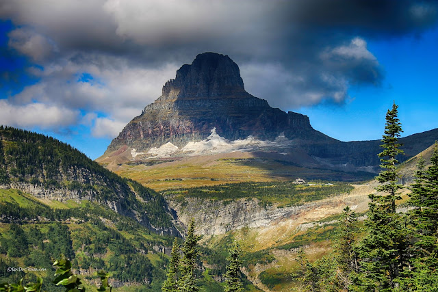
Nearing the summit you'll get a view of the iconic, triangular east end of Clements Mountain that looms over Logan Pass.
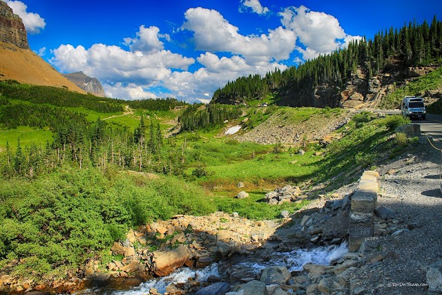
One of my favorite parts of the Going To The Sun Road is its intimacy with waterfalls. This cascade is just below Logan Pass, and is over 60 feet tall.
Close-up of the map of Glacier National Park focusing on the Going To The Sun Road (GTS Road).
Here's a look toward the top of Logan Pass.
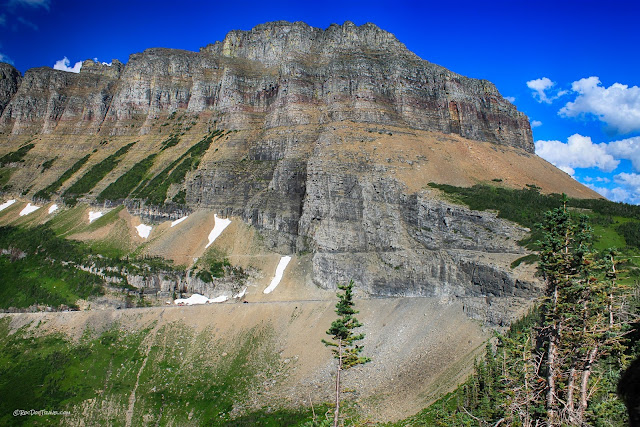
The Garden Wall looms ominously above the GTS road. Compared to other roads, the GTS has very little rock debris dumped below it, thanks to its genius designer.
In the park we see only a small section of the Belt Supergroup's 15-20 km thickness, but it's enough to be impressively imposing. You can see the spectacular Highline Trail just above the highway. It's a stunning and easy hike.
Each time I've stopped at the view area below (west of) Logan Summit, I've seen mountain goats up close.
Be sure to stop at this pull-out below Logan Summit. You'll see mountain goats and waterfalls.
Here's a look back westward at Heaven's Peak.
The Logan Pass visitor center has restrooms and a gift shop and snacks, but no food, so be prepared to picnic!
This is the south end of the Garden Wall above Logan Pass. Some of the sedimentary rocks have a bit more iron in them that turns them reddish. The spectacular Highline Trail starts at Logan Pass and follows the Garden Wall just above the GTS road.
Take the easy trails behind the visitor center for spectacular views. This is Mt. Clements.
Southwest of the visitor center is Heavy Runner Mountain. The meadow area at Logan Pass was covered with perhaps 2000 feet of ice during the ice ages. This is the accumulation zone for the glaciers, the area where ice piled up deeper every year. The thick mass spread and flowed down all the surrounding valleys. The accumulation area tends to be smoothed fairly flat as ice dragged away any fractured or loose rocks.

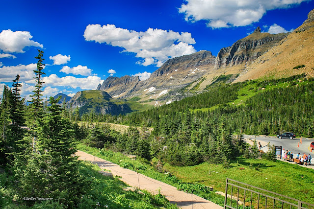
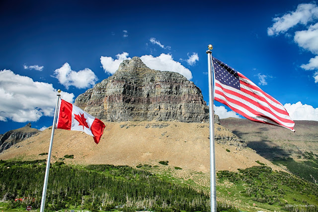
The Logan Pass parking lot is not very big, and fills up quickly because many hikers leave their cars all day or overnight. The people by the flagpoles are wisely using the park's shuttles. You can see the GTS road slanting down the canyon to the right.
The visitor center flies both flags because Glacier and Waterton National Parks are considered unified.
The GTS road heads eastward down the Reynolds Creek valley. Just below Logan Summit at left in this picture is a spot known as "Big Drift" because the snow here can be over 80 feet thick and requires weeks to remove. The snow drifts there from the Garden Wall.
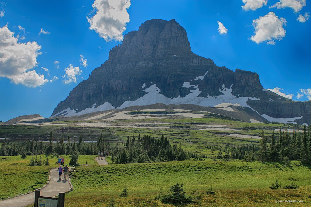
Mt. Clements' iconic pyramid presides over Logan Pass. You can just see the visitor center to the right of center.
The eastern GTS road has extensive cuts into the Belt Supergroup rocks, providing excellent fresh exposures where you can see bedding, cross-bedding, ripples, and grains.
Glaciers and streams have carved out the Reynolds Creek valley, but the very hard Proterozoic rocks are putting up quite a fight, forming resistant cliffs.
From a few places, you'll get a view farther into the back country, like this view southward to Jackson Glacier.
The rocks at one of the pull-outs are hand-split Belt sandstone and siltstone. The ridges on this piece are "plumose structure" formed while the rock split. The circular ridges crossing from lower right around to top center are arrest lines, which represent instant snap-shots of the fracture as it propagated. The sharp ridges are "twist hackle" where the fracture propagation stepped from level to level.
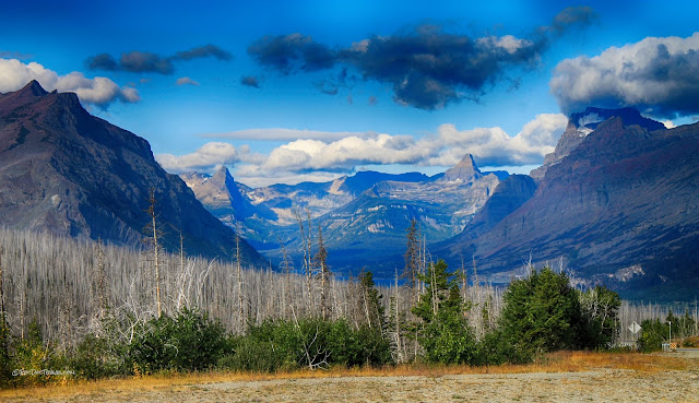
The road along St. Mary's Lake has terrific views westward into the park. All the bedrock you can see is still the Belt Supergroup! When Forest Gump said he saw a lake where you couldn't tell where the lake begins and the sky ends, the picture shown in the movie was here along St. Mary's Lake.
Geology Along U.S. Highway 2
The southern route across the park on U.S. highway 2 has some of the world's best exposures of thrust faults.
USGS cross-section along highway 2 in southern Glacier National Park, showing the Proterozoic Belt Supergroup (those labeled with "Y") thrust over Cretaceous and other Mesozoic rocks (shown as white). From the geologic map referenced at the end of this post.
This location is about 10 miles west of East Glacier on highway 2. The cliff-forming layers in the upper part of the mountain are the billion year-old Belt Supergroup. The Brave Dog (love that name!) thrust fault is at the bottom of the tan sandstone across the middle of the mountain. It places older Belt rocks over younger Belt Rocks. Just below valley level, the giant Lewis thrust places the Belt rocks over much younger Cretaceous (140 to 65 million years) sedimentary rocks. The Lewis Thrust is exposed at the eastern side of the park.
This is one of the best exposures of a thrust fault in North America! The Brave Dog thrust is at the light-colored line at the break in slope (bottom of the cliffs) on the long mountain front. This is about 10 miles west of East Glacier on highway 2. The Belt Supergroup rocks above were thrust about 50 miles eastward on the Brave Dog and related thrust faults when volcanic islands and pieces of continents collided with North America between 140 and 70 million years ago. The Cretaceous rocks (below valley level here) include extensive shales that are slippery and provide favored slip planes for thrusting.
Geology Along U.S. 89 and State Highways 49 and 17
(east side of Glacier National Park to Waterton National Park)
The Glacier Park Lodge in East Glacier was built in 1913 by the Great Northern Railroad, and is spectacular! It's a cousin of the amazing Old Faithful Inn in Yellowstone. Visit their website here.
The geology on the park's east side is a bit different because younger (Paleozoic to Mesozoic) rocks are exposed beneath giant thrust faults. This is a view up Sherburne Valley.
See the tilted light-colored sandstone layer? It was carried upward and tilted by a ramp on the giant Lewis thrust that sits just below it. In fact, the light sandstone lower on the hill is the same layer! It has been thrust up and over itself in this mountain. The thrusting took place between about 140 and 70 million years ago when pieces of continents and volcanic chains collided with North America. The collisions shoved deeper, older layers eastward up and over younger layers.
Lower Two Medicine Lake and Rising Wolf mountain along highway 49. The red units are the Grinnell and Empire formations within the Belt Supergroup. They are mostly sandstone and siltstone with oxidized iron-bearing minerals in them that create the distinctive reddish colors.
Chief Mountain on the right and Yellow Mountain on the left are parts of the thrust belt. They are north of St. Mary's near the Canadian border. Yellow Mountain is a thrust duplex, consisting of shingled stacks of thrusted rock slabs.
Chief Mountain is probably the most famous "klippe" in America - an eroded remnant of the sheet of rocks that were thrust tens of miles eastward. In Chief Mountain, the Proterozoic Altyn Formation (part of the Belt Supergroup), made mostly of dolomite, makes up the cliffs. The lower lumpy slopes are softer, much younger Cretaceous sedimentary rocks that formed in and adjacent to an interior seaway that extended from northern Alberta to the Grand Canyon.
No wonder it feels so peaceful here!
At Waterton park, you'll be greeted by this giant fold. It formed at the same time as the thrust faults as a result of tectonic collisions.
M.S. - More Science
Geologic map of Glacier National Park by the U.S. Geological Survey
Ph.D. - Piled Hip-Deep
Structural Evolution of the Lewis Plate by Yin and Kelty (abstract to a published paper)


