Burney Falls, California
Burney Falls, Northern California
Bet you couldn't name California's most beautiful waterfall -- 129-foot hybrid river/aquifer Burney Falls between the Lassen and Shasta volcanoes!Travel to MacArthur-Burney Falls Memorial State Park
Route: From Redding on I-5, California take state highway 299 east 55 miles to state highway 89, and go north for a bit over 5 miles.
From Mt. Shasta (the town), take state highway 89 south for 49 miles.
Logistics: Combine this trip with Lassen Peak Volcanic National Park and/or Mt. Shasta (see list of topics on right side of this page). Visit the park's website.
Time: Just an hour or two here will do, but you may want to stay in the area longer to enjoy Lake Britton, extensive forest roads, or the nice campground at the falls.
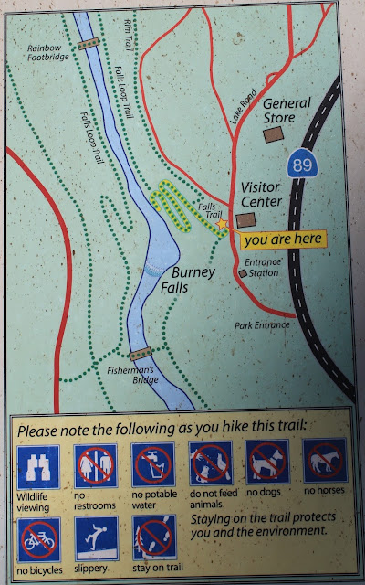
Difficulty: Easy. One thing I love about this park is that it is accessible to everyone. The falls are right by the park's road, parking lot, and visitor center. There is wheelchair access to the trail upstream from the falls, but not down the trail shown in the pictures below (it has some stairs near the top). You can read more about accessibility at the park's website.
Geology of Burney Falls
This waterfall is quite unusual because most of the water comes out of an aquifer - a permeable layer of bedrock full of water - and from the river above. As this sign in the park explains, headward erosion of the waterfall has cut into the aquifer not far downstream from where the river emerges from its own aquifer. The area is underlain by layers of highly fractured lava flows and ash flow tuffs, with permeable gravels in-between laid down by paleo-rivers.From the high beginning of the trail, you can see the river flowing to the falls. But look closer! There's water flowing out of the cliff far to the left and right of the river! And that water is coming out of the rocks below river level! The falls produce 100 million gallons of water every day! And because they're fed by aquifer, their flow is more steady seasonally compared to a purely river-fed falls.
At 129 feet (40 meters) high and 250 feet (76 m) wide, the falls are big! Niagra Falls, for example, are only 38 feet (11.6 m) higher. The trees here include enormous ponderosa pine, Douglas fir, California black oak, and Oregon white oak. I think by comparison, Burney Falls makes the falls in Yosemite look boring!
These huge, bark-covered roots along the trail had me acting like a kid again! They became exposed by erosion along the trail (which is quite old), causing the roots to cover themselves with bark. If you have kids in your group, prepare for a slight delay getting down the trail!
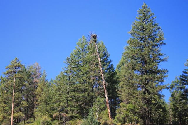
Look for the eagle's nest on top of the tree to the right of the falls.
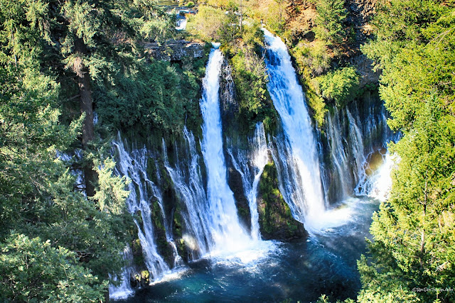
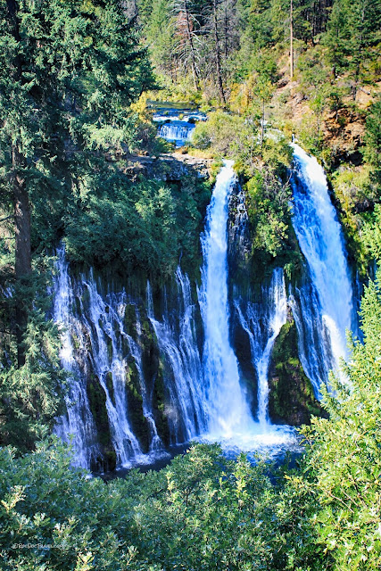
These are two-level falls - river and aquifer.
The falls have created a gorgeous, mist-filled plunge pool. Just look at that 250-foot (76 m) curtain of falling water!
It takes a wide-angle lens to capture the entire falls.
The broad plunge pool begs for a visit! I recommend going in the morning when you'll see the rainbow in the mist.
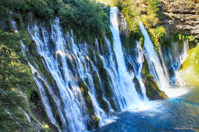
This close-up of the left side aquifer falls shows how water flows out of several layers in the gravels.
The right side aquifer falls also come from several layers within the gravel.
The two main falls from the river plunge over the wide curtain of aquifer falls.
The plunge pool water looks so inviting! Wade in!
The falls are in the middle of old-growth forest with beautiful, enormous trees. Walk around, sit and enjoy, and just soak in this amazingly beautiful place!
Hopefully you'll see one of the eagles fly out of the nest high atop this tree.
Related Field Trips: Lassen Peak, Shasta (look for "California" or "Volcano" under the Places and Topics on the right side of the page).
