Guatemala Volcanoes
Guatemala Volcanoes
See Pacaya, Fuego, and Atitlan in this incredibly active volcanic chain!Travel to Guatemala
This trip is based out of Panajachel and Antigua Guatemala, both west of Guatemala City.
Logistics: Use extreme caution when traveling to Guatemala! Study the information from the U.S. embassy here. You will likely want to visit other sites in the country like Tikal (which I highly recommend!).
Vehicles: I strongly recommend you hire a private shuttle/van/bus service for both security and navigation issues. Your safety depends on staying in well-traveled tourist areas.
Time: Plan on 1-2 days at Panajachel and 1-2 at Antigua Guatemala.
Fuego, Agua, and Acatenango Volcanoes & Earthquakes
Fuego (left) and Acatenango (right) volcanoes rise behind Antigua Guatemala. Fuego has been very active recently, including ash, pyroclastic flows, and lava in September, 2012. Eruptions are ongoing today. In 1974, pyroclastic flows decimated the vegetation around the volcano. Fuego is massive at 3,763 m (12,346 ft) high. Acatenango last erupted in 1972. Both volcanoes produce periodic damaging mud and debris flows during heavy rains.Agua volcano looms close and high over Antigua Guatemala. At 3,760 m (12,340 ft) high, it dominates the landscape for miles around. It got its curious name from a lahar (a volcanic mudflow) that destroyed the country's original capital in 1541. It has not erupted in historic times, but has been the source of damaging mudflows many times.
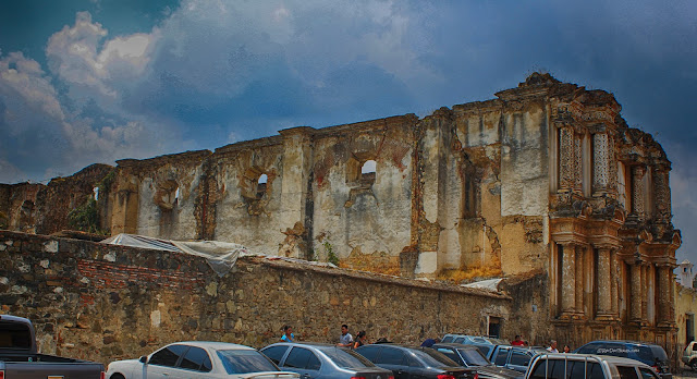
The city of Santiago de los Caballeros de Guatemala was destroyed by earthquakes many times, including in 1717 and 1773, after which the capital was moved to the present site of Guatemala City and the old city was ever after referred to as Antigua Guatemala. Some of the damaged buildings were left in Antigua untouched as memorials.
Despite its stout walls, this church was destroyed by the earthquake in 1773, and has suffered minor damage in earthquakes since.
Buildings damaged in past earthquakes sit with ominous Agua volcano in the background. For centuries it was thought that the volcanoes were the source of the earthquakes, but we now know that the two are related by plate tectonics. The Nazca plate (part of the Pacific ocean floor) is subducting under Central America.
Pacaya Volcano
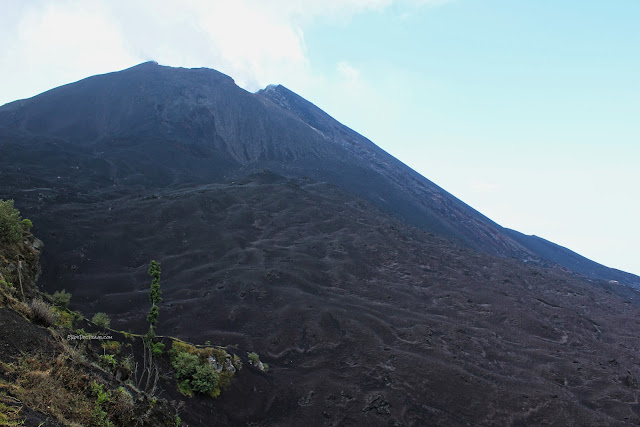
Steam rising from the Pacaya volcanic cone. Pacaya is located just southwest of Guatemala City and southeast of Antigua Guatemala, and is quite accessible. You can drive right onto its slopes, and hike right up close to its crater. It has erupted frequently since 1980, and may be closed to hiking at times. But Guatemala isn't the U.S. OSHA, and you may be able to hike during active lava flow events. Just don't hike during explosive eruptions when bombs are flying through the air - the danger is real, and high.
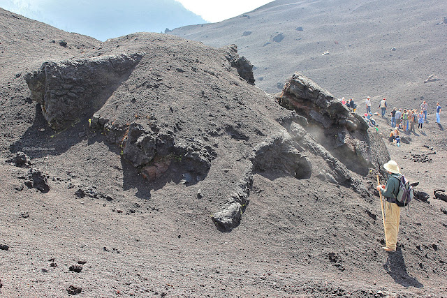
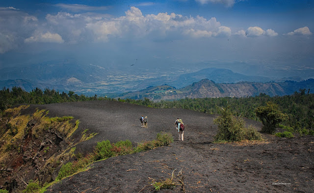
The trails vary from year to year based on Pacaya's eruptive activity. Consider this: these paths wander across tephra (ejected material) that is younger than all of the hikers.
The reddish slopes are the site of lava flows just a few years ago, and by "few" I mean single digits. They have since been covered by even younger tephra and lava flows.
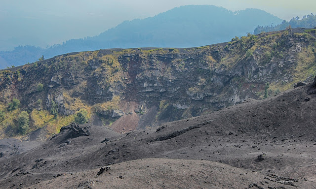
In places, you can see the way the volcano was built up layer by layer. Cliff-forming layers are lava, and softer layers are tephra.
This is a small, local lava vent (the point of eruption). It had become a fumarole (gas vent) when we visited. You can identify sulfur-emitting fumaroles by the bright yellow deposits in them. Be careful if you smell rotten eggs - hydrogen sulfide is poisonous, and it deadens your sense of smell at high doses so that you lose the warning sign.
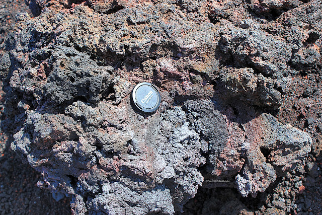
Here's a close look at spatter - fallout from the eruption that was molten when it hit the ground, welding it to other rocks. These rocks are just babies, only about 3 years old! Aren't they adorable?
Agua volcano viewed from Pacaya. While we were on Pacaya, we heard booming explosions from Fuego, which is off to the left in this picture. They were explosions as gases expand suddenly, blasting apart the lava, and they sounded like huge cannon shots.
Beautiful Antigua Guatemala
I highly recommend staying in Antigua Guatemala to visit Pacaya and Fuego. It's historic, charming, and gorgeous!

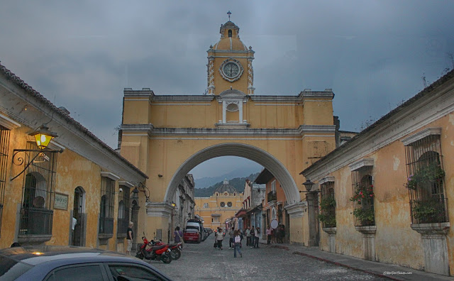
Because of frequent earthquakes and a long history of destruction and damage, the city has adapted its architecture. Churches like this one have foregone the tall steeples in favor of more seismically stable stout ones, and outer walls reinforced by shorter ones.
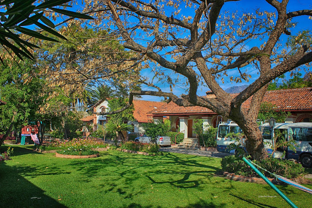
Our hotel was a converted Spanish villa with wonderful courtyards, Posada Hermano Pedro. It's incredibly scenic, comfortable, affordable, and convenient. You can find several like it in Antigua.
Atitlan Caldera & Panajachel
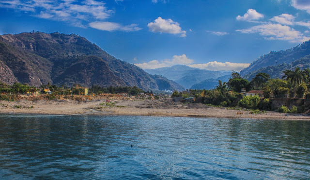
The Atitlan caldera formed in a massive eruption of 300 cubic km about 84,000 years ago. Ancient Mayan ruins have been found around the lake and under its surface (the water level has varied quite a bit over time). Mayan people and culture still dominate the towns that rim the lake, and (interestingly) they include some colorful religious mixes of folk religion, Catholicism, and Spanish Conquistador worship.
Interactive Google map to Panajachel on the rim of the Atitlan caldera.
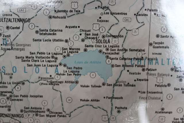
This map was on a billboard in Panajachel. The towns visited on this trip are Panajachel, Santa Catarina, and Santiago.
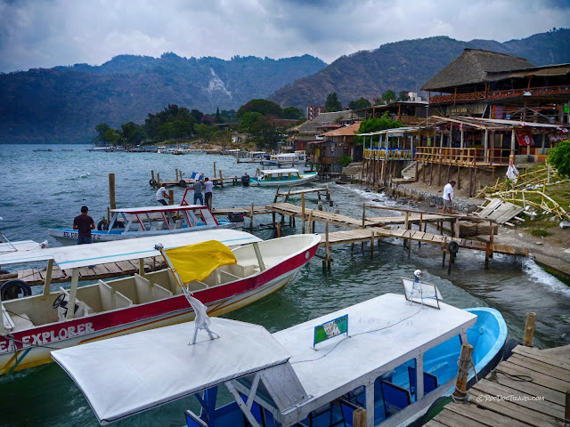
The boat docks at Panajachel also feature some very good hotels and restaurants. The people are helpful, so don't be afraid to ask questions and socialize!
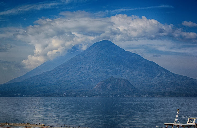
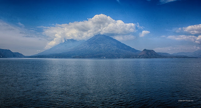
The Atitlan (left) and Toliman (right) volcanoes cast a nice reflection in the caldera lake. Toliman is 3,158 m(10,361 ft) high, and has not erupted in historic times. Atitlan is 3,158 m(10,361 ft) high, and its most recent eruption was 1853. Both are considered hazards for mudflows and future eruptions.
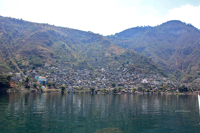
The town of Santa Catarina clings to the slopes above the lake.
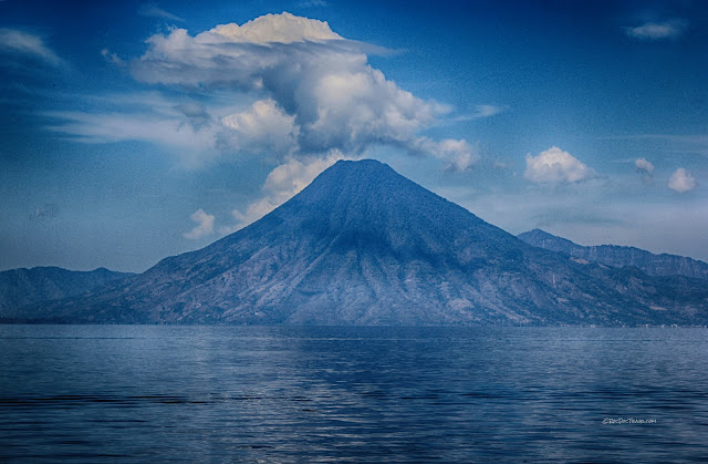
The clouds above San Pedro look like a steam eruption, but we weren't so lucky. The volcano hasn't erupted in about 40,000 years.
The cinder cone at Cerro de Oro in front of Toliman was likely active around the same time as the bigger volcano.
Atitlan and Toliman, lookin' good! The lake is very deep - over 1100 feet (340 meters)!
From left to right: Atitlan, Toliman, the cinder cone, and San Pedro.
Hill towns rim the caldera. They're quite colorful and are largely agriculture based, but are fairly impoverished.
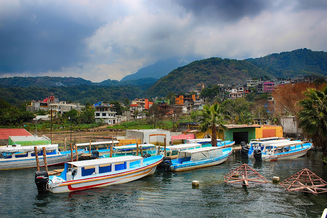
Boats are docked at Santiago under the watchful gaze of San Pedro volcano.
One of the things I loved about visiting Guatemala was the colors. The people are not shy with paint colors! These boats are docked at Santiago, the largest town on the lake's shores. Near Santiago, over 1000 were buried by a massive mudflow from the Toliman volcano in 2005.
The slopes of San Pedro show the typical profile of a composite volcano. The slope is formed by lava flows and pyroclastic flows from the summit crater.
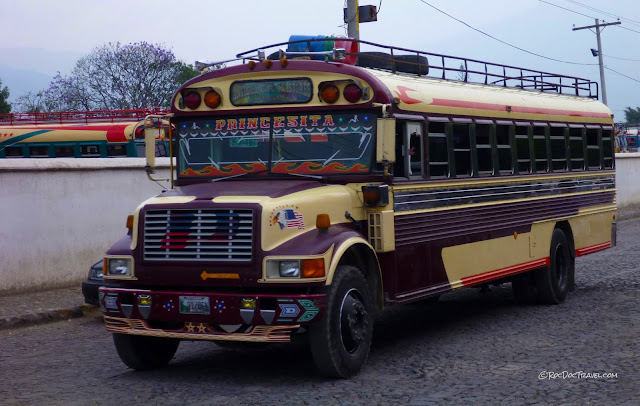
Visiting Guatemala is full of surprises, like this informal school bus. Can you just picture transportation safety officials shrieking at this!
The Guatemalan "chicken buses" are everywhere! They're called that for their frequent cargo/passengers. To me, the colors and decorations are endlessly interesting! And what you hear is true - the buses positively fly over the mountainous roads at speeds that would make a rally car driver nervous. The buses are bought at U.S. school district auctions, and given second and third and fourth lives in Guatemala.


