Central Salmon River, Idaho in Autumn
Central Salmon River, Idaho: Autumn
From Stanley to Salmon, IdahoDiscover the varied scenery and why I call this America's strangest river!
Why Explore the Salmon River?
The Salmon is America's longest undammed river, and certainly one of its most scenic. It traverses diverse geology, changing course at three distinct places. In this field trip, we'll explore the bedrock it crosses and discover why it is located where it is and how it got that way.This trip explores the center section of the Salmon River from Stanley to Salmon, Idaho. Other trips explore the upper and north fork sections.
Travel to the Salmon River
Route: Get to the Salmon headwaters by heading north on highway 75 north of Sun Valley, Ketchum, and Hailey). This trip will follow the river via state highway 75 and U.S. 93.
Lodging: Available in Stanley, Challis, and Salmon. Can be pricey in peak season in Stanley. Save money by camping (many campgrounds are available along this route). I highly recommend Challis Hot Springs for good camping and lodging, friendly staff, and wonderful warm pools.
Seasons: Any, but never during a winter storm! This post shows the river in Autumn; a previous post shows it during early Spring.
Roads: All good, with no steep grades on this route. Galena Pass (at the Salmon headwaters) has 7% grades, so use caution with RV's. The dirt roads in Yankee Fork are smooth gravel, so any car will do fine.
Weather: Don't hesitate to go in all but the worst weather! As you'll see below, clouds and rain can make your trip more beautiful.
Time: Allow about 4-7 hours from Stanley to Salmon to visit Yankee Fork and enjoy the scenery. You can do this trip and the upper Salmon trip in one day.
Geology and Scenery of the Salmon River
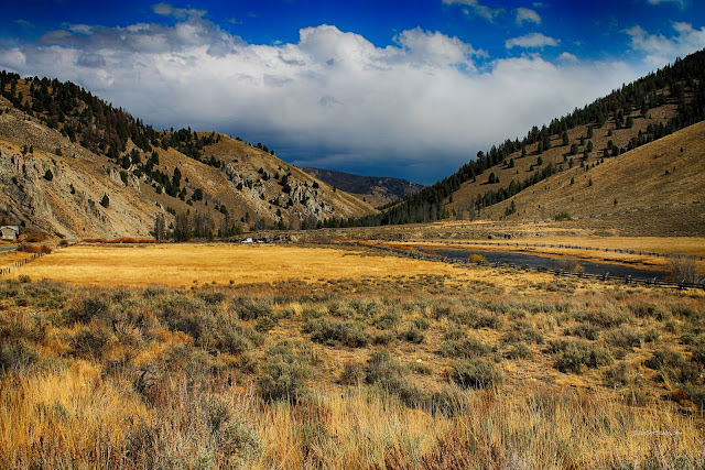
The lead picture of this trip shows the river where it exits Sawtooth Valley near Stanley. Curiously, the river leaves the valley by making a 90 degree turn eastward and crossing formidable mountains with hard bedrock! It likely captured an older river's canyon and enlarged it.
East of Stanley, the river crosses 80 million year old granite that gives the canyon a rugged, well-forested scenery. The granite formed as magma rose above the subducting Pacific lithospheric plate (actually, its ancestor called the Farallon), and has been fractured pretty well by tectonic events since it formed, which makes the canyon more accessible for travel and construction of a highway.
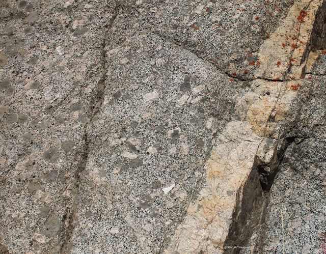
In places the granite bedrock is fresh and white like this. Granite is a 3-D mosaic of crystals. The glassy clear minerals are quartz, the bright white are plagioclase feldspar, the pinkish are orthoclase feldspar, and the black are biotite mica. The granite is actually many granite bodies that coalesced in the crust like the wax blobs in the top of a lava lamp, and so its appearance changes from place to place. It's actually quite interesting to stop every mile or so just to see the changes.
You could snap pictures continuously along the river and have nearly endless lovely scenes! Granite bedrock makes a pleasant canyon.
This granite body betweeen Stanley and Clayton has dikes of quartz and orthoclase feldspar. The granite itself has a bit higher biotite content than elsewhere.
In parts of the canyon, especially near Yankee Fork, the granite has been altered and stained by hot groundwater in the distant past. The alteration makes the granite more crumbly and easy to bulldoze for the road. It was hydrothermal waters like this that created the gold and precious metal deposits in the region. Mines developed only where the metals were concentrated enough to be valuable.
In the autumn the river seems so calm, like its work for the year is near an end. The water level is low, the trees and bushes are turning colors, the crowds are gone, and the canyon is peaceful.
My favorite sign!
Nearing Yankee Fork is this "porphyritic" granite with its big orthoclase feldspar crystals (the pink rectangles). They indicate different magma conditions that favored rapid growth of the feldspar. This granite is intruded by abundant quartz-orthoclase dikes. Prospectors always get excited when they see dikes because they can carry gold, silver, or even gem minerals. These ones don't, at least in minable amounts.
Geologists like road cuts because they expose fresh bedrock for us. As you'll see in this canyon, most of the bedrock is covered by trees and soil and so is not very visible. This roadcut exposes the porphyritic granite and some dikes.
Where the granite is solid and not weathered, the river is rocky and rough. I like the tree that seems to be leaning out to get a better view of the river!
The Salmon's water is nearly always clear. In autumn it gets a greenish tinge from plant life.
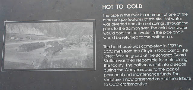
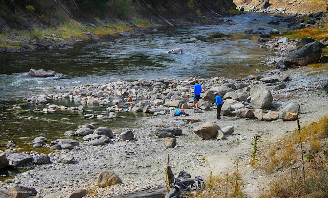
Near the mouth of Yankee Fork are the Sunbeam hot springs. They're right on the river and the highway and worth a quick dip!
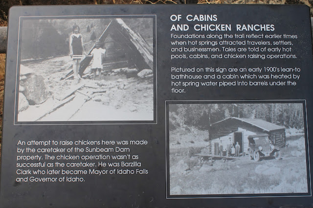
These springs have quite a curious history!
The Sunbeam hot springs are too hot to bathe in directly, so hearty travelers have made rock-rimmed pools to mix in the river water to a nice temperature. The spring water flows under the highway and through a culvert from the right side of the picture.
The springs come out of the hillside above the highway, and through culvert under to the river.
More of the river near the springs.
Yankee Fork
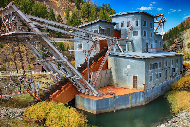
No trip to this part of Idaho would be complete without a visit to Yankee Fork. The lower canyon where it meets the Salmon River is gorgeous and very narrow, and then suddenly you see the dredge piles.These are dredge piles left behind by the dredge's constant sweeping back-and-forth motion as it dumped gravel out its back side.
Here's a view of the dredge at the end of its gravel piles.
The Yankee Fork dredge is open for tours during summer. It scooped river gravel down to bedrock with these giant steel buckets.
The inside of the dredge is a big sluice, a series of riffles that capture gold and reject gravel. The gravel is dumped out the back side.
The dredge didn't capture all that much gold in its 12 years of operation compared to other mines, but it sure made a mess of the canyon! You can visit similar operations at Virginia City in southern Montana and the Yuba River in northern California, but this dredge and its gorgeous mountain setting are unique.
Farther up the Loon Creek road (just past the dredge) is a closed and remediated open-pit mine just visible in the distance.
Past the dredge, Yankee Fork is serene.
Custer is a well-preserved mining town worth a visit. A couple of original buildings house a fascinating collection of items that give a good look at mountain life in the distant past. I particularly like the 10 foot-long skis and their spring-loop bindings.
Custer still has a few residents. You may end up feeling a bit of jealousy in such a beautiful place, but then you'll likely remember the convenience of grocery stores, hospitals, theaters, and restaurants, and then you may not feel so bad.
Autumn in Yankee Fork - sublime!
West of Challis
Back in the Salmon River canyon near Clayton, the bedrock is complexly faulted Paleozoic sedimentary rocks and Precambrian metamorphic rocks. They promote forest growth and give the topography a steep and rugged look.You'll know when the bedrock changes to a thick pile of the 42 million year old Challis volcanic rocks. They are mostly andesite, and most plants don't like their high iron content and poor ability to hold water. The river makes a distinct turn to the northeast when it gets into the volcanics, following the northern boundary of the Basin and Range geologic province. The Basin and Range is characterized by crustal extension (widening east to west) and normal faulting. The northern Rocky Mountains province to the north is more stable. The Salmon follows the boundary through the volcanics.
Maybe you'll see some of the natives!
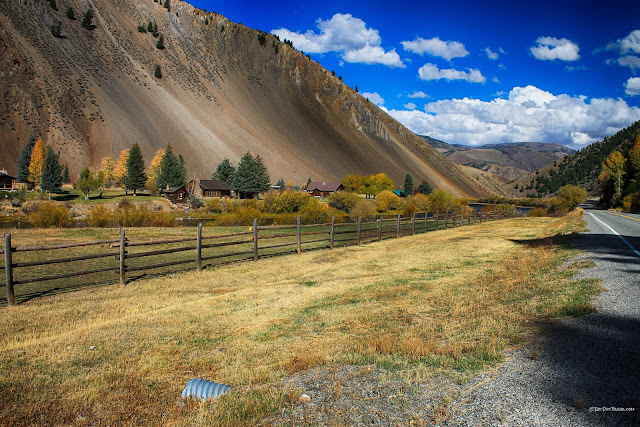
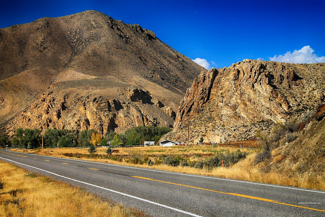
In the northeast-trending section of the river from Clayton to Salmon, the river is quite different. It feels more like it's flowing through vast desert mountains, even though this area gets as much rainfall as farther west. The volcanic bedrock simply won't support a forest.
West of Challis is a fault between the orangish Challis volcanic rocks (42 million years old) on the left and the gray Ordovician Ramshorn Slate (450 million years old) on the right. This is one of the few places where a fault is easy to see (once you know what you're looking at!).
Flowing through the Challis volcanics, the river is an oasis.
Sometimes, it's about the clouds.
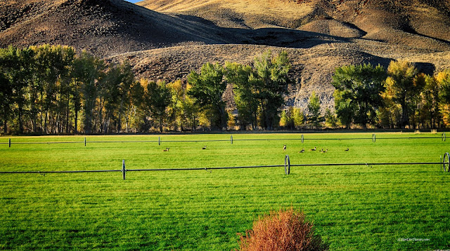
The river canyon in this section has several wide spots like this where farms line the river.
This beautiful little valley is about half-way between Clayton and U.S. 93. The Challis volcanics include oxidized sections like the red cliffs here, just a result of varying chemistry during and shortly after eruptions.
The wavy, near-vertical layering here is flow foliation in a lava dome, which is a very thick lava that oozes rather than flows.
Some of the pyroclastic flows formed softer layers like these. Some have been altered to greenish clay since they formed.
You don't have to tell me twice!
This little valley has colorful tuff (pyroclastic rock) that has been altered to beautiful greens. If you get a handful, you'll see that it's a green clay.
As you get closer to Challis, the volcanics become more solid cliff-formers.
What section of the river is not beautiful?
You'll know when you're getting close to Challis by the distinctive jagged cliffs. They are enormous lava flows and pyroclastic tuffs that have well-developed columnar joints.
Don't miss the Land of the Yankee Fork museum and visitor center! It has fascinating artifacts, displays, and demonstrations suitable for all ages.
East of Challis
Just east of Challis, you can see the Twin Peaks. These mark the center of the Twin Peaks caldera, one of the big eruptive centers that was active about 45 to 42 million years ago, forming one of America's biggest volcanic fields by volume.The cliffs east of Challis have been altered by extensive hydrothermal alteration. Hot water flows upward along mountain-front faults from depths as great as 10,000 feet, where the crust is hot. Magma is not necessary to create hot springs in the Basin and Range region -- the geothermal gradient is high enough to do the job. The Challis Hot Springs resort is along this same hydrothermal system.
Looking south across the Challis valley, you can see the snow-capped peaks at Borah, Idaho's highest peak at 12,662 feet. It was the site of the M6.9 earthquake in 1983 that caused extensive damage in Challis and Mackay, and was felt from Salt Lake City to Calgary, Alberta. Tragically, the only two fatalities in that earthquake were two children walking to school in Challis. An old brick storefront fell on them. It's one of the saddest geologic stories I know.
From Challis to Salmon, the river continues through Challis volcanics, but here they are more solid and cliff-forming than in the previous section.
Wow - I love the autumn! It brings out the colors of the rocks.
Doesn't a scene like this make you want to paint, or picnic, or fish, or just breathe?
These seem to be some very contented horses. What a lovely variety!
You'll see a lot of this fluorescent green and orange lichen on the volcanic rocks. Lichen is the geologist's enemy because it covers and digests the rock, masking its true appearance and turning it to dirt.
At Ellis you'll find this interesting slate. It is the Proterozoic Apple Creek formation, which is about a billion years old and very platy. It formed in a huge basin called the Belt Basin, and is made of clay and silt deposited from uplifted areas that are long gone. Some of this is now in my front yard.
I found more of the natives lounging in this field. To get them to look at you for a photo, try the old detective's trick - honk!
The Salmon River, autumn colors, and brown volcanic rocks make a unique landscape. You won't mistake this river for any other.
A few miles east of Ellis, the river suddenly enters this narrow, steep canyon where the volcanic rocks are particularly hard. They are likely more andesitic lava flows and fewer pyroclastic tuffs.
This canyon is unique along all the Salmon in being so barren, steep, and brown. Notice how much rock falls from the volcanic cliffs -- that's because volcanic rocks fracture when they solidify & shrink. Ice jacks open the cracks.
These boulders near Rattlesnake Creek fell from the cliffs above (off the right side of this picture). That would have been a great splash! They represent the very real hazards in this canyon.
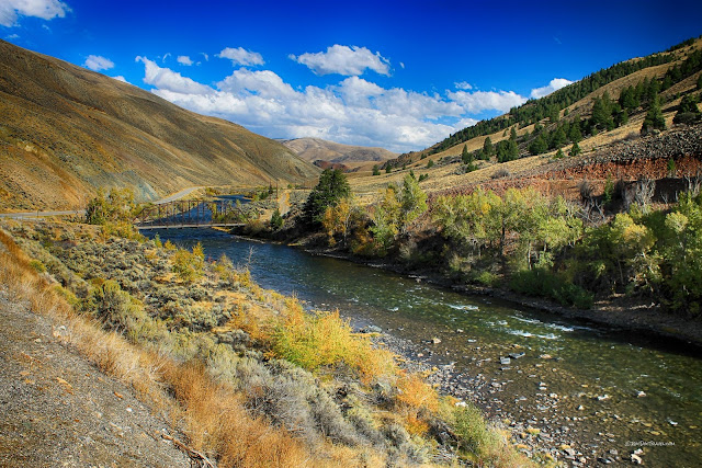
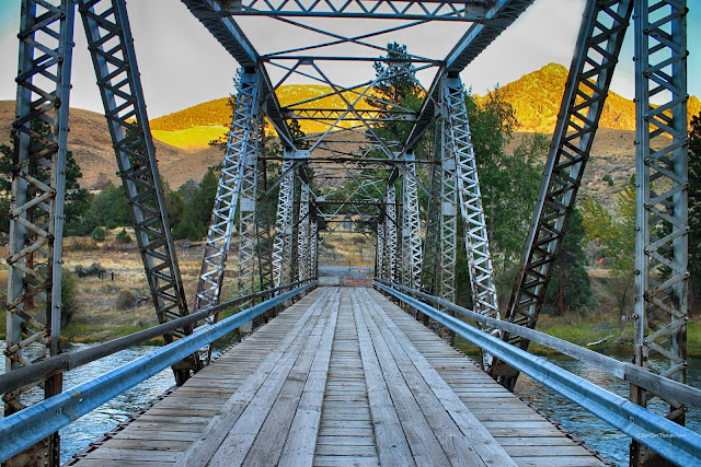
Looking downstream near Rattlesnake Creek, you can see one of the few bridges that cross this section of the river.
This old, scenic bridge is closed. I wish we made more beautiful bridges today.
Looking downstream toward Salmon, you can see big cliffs of the Challis volcanic rocks. They make up all the mountains you can see from Salmon to the west and south.
In early June, 2017, the Salmon River reached its highest level ever because of rapid snow melt in the Sawtooth and surrounding mountains. It flooded the riverside parks in Salmon, spanning end-to-end under the highway bridge.
Sunset over Salmon High School is a fitting end to the trip.
Related posts: Upper Salmon, Salmon North Fork, Salmon in early Spring.

