Salmon River, Idaho, Early Spring
Salmon River, Idaho
Early Spring
Tour North America's longest undammed river, the Salmon in Idaho, from its headwaters to the canyon where Lewis and Clark had to give up and turn around. In this trip, we'll see it in early Spring when the snow has just melted off the lower valleys but still caps the peaks. I'll take you there in Summer and Fall in later trips.
Summer and Fall trips will show additional features like Redfish and its cousin lakes (closed to wheeled vehicles during this April 5th trip), Yankee Fork and the Custer ghost town, and the farther reaches of the North Fork Road.
Here's a Google map that shows the river's circuitous route: click here. This trip starts on Highway 75 north of Ketchum and Sun Valley.

(Above) Interactive Google map of the Sawtooth valley. Move the map around to follow the route.
Travel the Salmon River
Route: Start at Ketchum & Sun Valley on highway 75. Go north toward Stanley, then take the same highway eastward to Clayton and Challis. Go north on US Highway 93 to Salmon and North Fork, then take the north fork road west along the river.Time: You can do this route in a day, but it's nice to get out, hike, fish, and linger.
Vehicle: Any. If you want to go farther down the river at the end of this route, you'll be on a good gravel road suitable for any vehicle. Galena Summit at the beginning of the route is the only steep section, and it is steep.
Lodging: The best lodging on this route is at the ends, in the Ketchum-Sun Valley-Hailey area or at Salmon. There is lodging in Challis.
Food: There are small food joints all along the route.
Seasons: This is a 3-seasons trip, not advised in bad winter weather. I have posted Summer and Fall trips as well. The route starts at elevations around 7000 feet and ends up low, around 3300 feet at Shoupe, where it can be hot in the summer.
Geology of the Salmon River
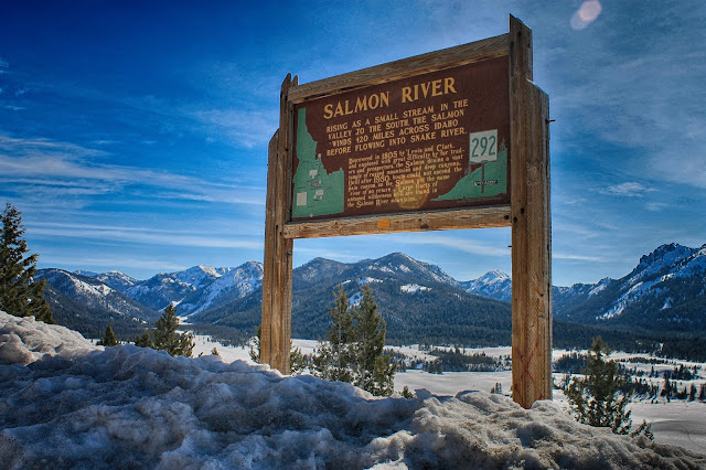
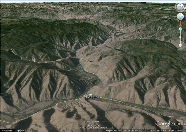
(Above) View of the Sawtooth Mountains from the sign explaining the headwaters of the Salmon River. The Sawtooths are the granite roots of a Cretaceous volcanic mountain chain that formed above a subducting Pacific plate between 160 and about 70 million years ago. Yes, the edge of the continent used to be where the Idaho-Oregon state line is today! At that time, the Sierra Nevada and Sawtooths were active volcanoes like the Cascades are now. The granite in the mountains is the crystallized roots of the volcanoes. The Sierra Nevada and Sawtooths (and all of the central Idaho granite) became separated by opening of the Basin and Range province that encompasses all of Nevada, western Utah, and southern Idaho. The Sawtooths were uplifted along a normal fault that runs through the trees at the eastern foot of the range. It is capable of infrequent moderate magnitude earthquakes.(Above) Google Earth view to the NNW. The Salmon River follows the northern edge of the Basin and Range province from Stanley to Salmon. At North Fork, it makes a conspicuous westward turn and crosses central Idaho.
Stanley, Idaho
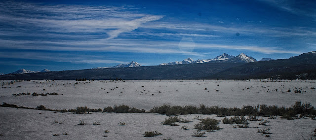
(Above) View southward from Stanley. The long forest-covered ridge at Redfish Lake is a lateral moraine, which is gravel carried along the side of a glacier and deposited when the ice melted. The Sawtooth glaciers were enormous! Some were more than 25 miles long and a thousand feet deep. They extended far into the valley
(Above) View southward from Stanley. Granite bedrock forms uniquely jagged peaks where ice has plucked away at the rock, forming cliffs, narrow ridges, and sharp peaks.
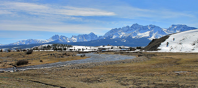
(Above) Sawtooth Mountains and Valley Creek at Stanley.

(Above) One more view of the river and Sawtooth Mountains, looking across Stanley.
Salmon River Canyon
(Above) The Salmon River flows northeastward away from Stanley into a long section of canyon. The bedrock at left is part of the giant Challis volcanic field that formed about 45 million years ago.(Above) During the height of mining in the region, the Sunbeam dam was built at the Yankee Fork confluence in hopes of generating electricity to help the milling operations. The mill went bust in a year, the dam was blown up in the 1930's, and the Salmon is again dam-free.
(Above) Because the dam was breached on its right side, it forced the river against this slope, causing extensive erosion.
(Above) When the snow is off the road, Yankee Fork is one of the most interesting places to visit along the Salmon. I'll show you these and discuss the mining in a later-season post.
(Above) A view up the Yankee Fork of the Salmon River in early April.
Challis, Idaho Area
(Above) In the Challis area, the bedrock is mostly the 45 million year-old volcanic rocks. Most are andesite, which is moderately high in iron and magnesium and dark brown and gray colors. Most are tuffs, which are pyroclastic flows that blanketed the region in giant eruptions. You'll notice that the forest doesn't grow well on the andesite because of its high iron content and poor ability to hold water.(Above) The Challis volcanic rocks are quite colorful in places.
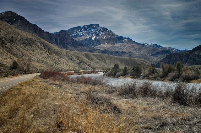
(Above) The river northeast of Salmon. There is something wonderful about the early Spring landscape's subtle shades of browns, reds, and blues.
North Fork, Idaho
(Above) Google Earth view westward from North Fork, where the river turns west and enters the long canyon across Idaho.(Above) A pastoral scene along the river just west of North Fork. I love the unique early Spring mix of subtle colors.
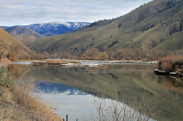
(Above) The river has one of its few calm stretches just west of North Fork at Deadwater. I know brown isn't a popular color for photography, but isn't this scene marvelous?
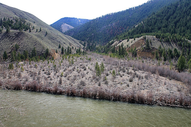
(Above) Debris flows and floods at the mouth of this canyon have pushed the river to the near side. Look at the size of the rocks in this fan! It takes a powerful flood to carry those rocks down the canyon!
(Above) Be sure to take a lot of picture capacity with your camera! You could take a good picture every hundred yards. It was only a few miles from here where the narrow, rocky canyon forced Lewis and Clark to turn around and go a different way in 1805. Sacajawea and her home tribe had warned them the river was impassable, but I guess the explorers had to see for themselves. I've discovered that even today, if the natives tell you, "Don't go that way!" you had better listen.
(Above) Through the first 40 miles of the canyon you'll see evidence of the boom-and-bust mining of the past 130 years. You can even tour an old mine at Shoupe, which I highly recommend in warmer months.
