Guadalupe Mountains National Park
Guadalupe Mountains and the National Park, Texas and New Mexico
Visit the best preserved ancient reef on Earth!
Why Visit Guadalupe Mountains?
The mountains offer fantastic geology, scenery, hiking, and exploring, and the highest peaks in Texas. For the curious traveler, they offer completely unique geology that I'll try to explain below. And as a bonus, Carlsbad Caverns National Park is at the northern end of the range.Permian Reef Geology
As the diagram below from the visitor center shows, the Guadalupe Mountains are an ancient reef. But as Inigo said to Vicini, that doesn't mean what you think it means - they were made of sponges, algae, and various shelled critters, not coral! The result is a rock rich in small fossils.The reefs grew during the Permian period, about 260-280 million years ago. That makes them older than the dinosaurs, and even older than the supercontinent, Pangea.
Now for what makes the mountains really amazing. The ancient Permian sea was eventually closed off, and it filled up with various stuff like salt, gypsum, thin limestone, and gravel, and it sat like that until about 5 or 10 million years ago when the Rio Grande Rift opened up and the region was uplifted by thousands of feet. That caused the rivers to erode deeply into the old ocean basin, removing the salt and gypsum from the mountain front, and revealing the original height and shape of the reef! When you stand on the Guadalupe mountains, it's just like you're standing on the reef 280 million years ago and looking out over the original ocean floor!
In this diagram, the Rustler, Salado, and Castile formations are the ones that have been removed from the ancient sea. The cliffs in the Guadalupe Mountains are the Capitan Reef. (NPS diagram)
Here's a little more colorful diagram of the reef layers. (From SEPM)
In McKittrick Canyon there are trails leading up onto the reef. I suggest the "Permian Reef Trail" on the north side of the canyon where I took the pictures below. I was there with an expert guide (not from the park), and the Park can provide one for you, too. (WTGS photo with my annotations)
Travel to Guadalupe Mountains
Location: The park is in far west Texas tucked up against New Mexico. The nearest cities are Carlsbad, New Mexico and El Paso, Texas.
Time: You can see the basics in a day, but I strongly recommend taking at least one hike back into the mountains where you can really see the scenery and geology. The park's website has good trail descriptions.
Seasons: July and August are pretty hot, so if you're not used to heat I wouldn't recommend visiting then. Spring, early Summer, and Fall are best. The mountains do get snow in the winter, but are also far enough south to have delightfully warm days, too.
Vehicle: Any. Even many back-country roads in the northern part are paved.
Park Website: Click Here. This is an unusually good, thorough website. It has good descriptions of all the trails.
Cautions: There are rattlesnakes throughout this area. They're usually timid, but it's up to you to spot them and not surprise them. Most plants in the desert can poke or scrape you in some way, so don't step on them or brush up against them. This is not a good place to hike in shorts and thin shoes! Make sure you take plenty of water wherever you go. Follow the cautions and rules on the park's website and in the visitor center.
The Permian reef was nearly circular, with an ocean outlet to the south. The red areas are the parts exposed at the surface today by uplift and erosion. (NPS map)
Guadalupe Mountains Geology
McKittrick Canyon
Geologists from all over the world come here to study one of the world's best examples of an ancient shelf-edge reef and the effects of sea level fluctuations on sedimentation. I'll try to show you what they come to see along the Permian Reef Trail.
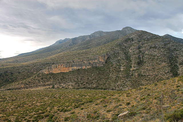
The south side of McKittrick Canyon exposes the Lamar Limestone (the nearly horizontal cliff-forming layer) that represents the ancient seafloor. To its right are reef debris desposits made of slabs and boulders fallen from the reef above. The high cliffs are the ancient reefs.
The Lamar limestone is easy to recognize by its thin nearly horizontal bedding. It is made of calcium carbonate sediments that were transported off the shelf, over the reef, and onto the seafloor. After the Lamar was deposited, the reef began to die because it cut itself off from the open ocean, and the sea basin began to fill with carbonates, gypsum, and salt. Fortunately for us, those basin fillers have been eroded away here, so what we see is pretty close to the original reef.
The trail has a lot of pleasant little spots like this one along the Lamar. It really is a delightful hike!
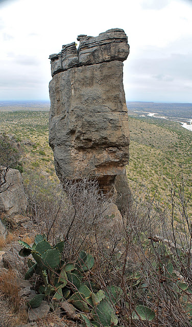
This section of the Lamar fractured off the rest of the cliffs and slid gently a few yards down the slope.
Once you're past the Lamar cliffs, the trail goes for a long way across the reef slope deposits. In a few places, you can find boulders and slabs of reef rock that fell from above (anciently) and were cemented together with the rest of the debris. It's kind of a big jumbled pile. Many of the rock layers are full of fossils - sponges, gastropods, crinoids, ammonites, and their friends.
The trail gives you breath-taking views into the Guadalupe Mountains and McKittrick Canyon. Most of the canyons follow a dominant fracture network that is parallel to the reef front, so the canyons take an immediate left turn into the range. Flash floods are a major issue here because the bedrock is not very permeable - all the rain runs down slopes to the creek beds, then goes roaring down them.
We hiked the trail on a cloudy day, which is nothing to complain about when you're getting sweaty!
The trail makes a big switchback and slants upwards to the solid reef cliffs above.
This is the reef up high on the ridge. Don't look for corals - this reef is made of sponges cemented together by algae (see close-ups below).
White's City Area
This is the edge of the reef below the Carlsbad Caverns parking lot. It's amazingly close to the original slope of the Permian reef, and the flatlands below are pretty close to the level of the ancient seafloor. It's truly phenomenal that a 260 million year old reef is so well preserved!
At first I thought this dead-looking sticks were just that - dead. But then we found some in bloom! They are ocotillo plants, and they have beautiful blooms in April.
These beautiful red ocotillo blooms were a pleasant surprise!
This hole gives a good three-dimensional view of the internal structure in the sponges. The hole is about 5 inches in diameter.
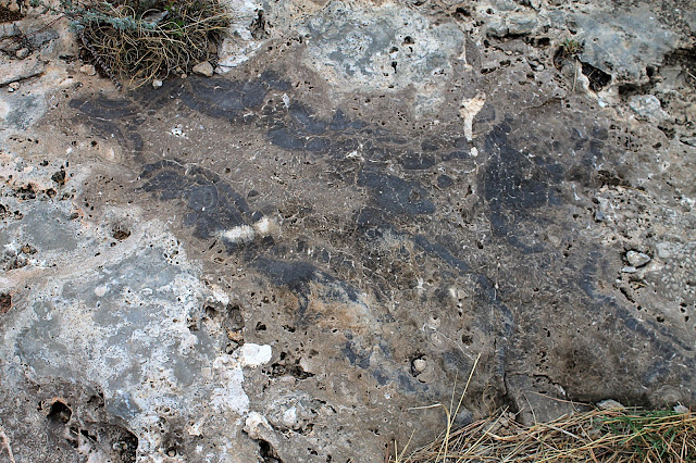
The sponges here are light gray and elongated. The tan section is cement made by algae. All the holes are parts of fossils.
The reef was quite a crowded neighborhood with sponges, gastropods, echinoderms, and ammonites, with algae surrounding everything.
The desert only looks barren and unattractive from a distance. Up close it's full, alive, colorful, and fascinating. Get out there and enjoy it!
These metates were carved into the limestone by natives to grind their corn. Who knows how many generations of families worked here!
I almost stepped on this little guy, but I'm glad I didn't for several good reasons.
Queen Plateau Area
Southwest of Carlsbad on highway 137 (The Queens Highway) is the old town of Queen on the shallow back-reef shelf of the Permian reef.
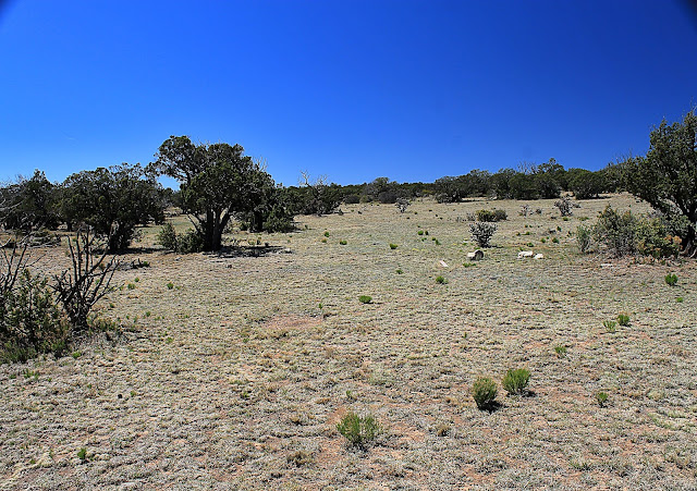
The desert is neither barren nor unattractive!
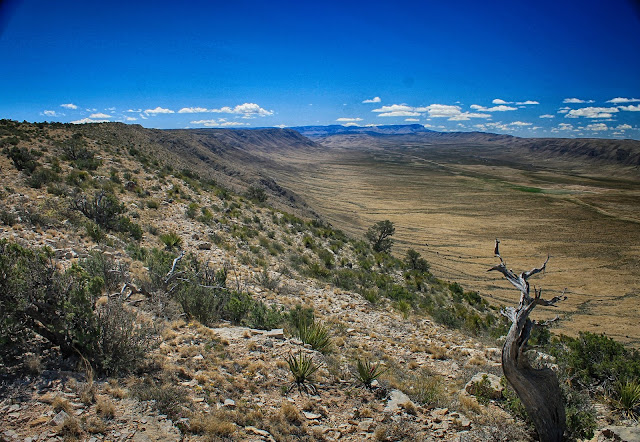
The distant mountains to the north are the Sacramento Mountains, which are made of the same carbonate rocks as the Guadalupe Mountains and Queen plateau.
I really enjoyed being out in this unique desert landscape! The old Boy Scout in me wanted to start a game of "Capture the Flag" here! I could just imagine hiding my flag in a big cactus and daring the other team to get it.
More of the enchanting Queen Plateau landscape.
Stone Canyon
Geologists by the score go to a place called Stone Canyon to study the effects of sea level on sedimentation. They have mapped out sea level rises and falls in minute detail here so they can interpret the oil-rich rocks out in the petroleum basins to the east.In Stone Canyon we came across these cross-bedded layers that formed in faster moving currents.
I love pinion pines for many reasons. They provide shade where shade is highly valued. They provide food where food is scarce. They provide greenery in a brown landscape. They provide soft, rounded shapes in a jagged land. And they smell good, too. This beauty is about 10 meters across.
So there we were in the middle of nowhere, when a UPS truck drove by! Those guys are everywhere!
At the parking lot to Sitting Bull Falls is this magnificent mountainside. The layers record hundreds of thousands of years of sea level fluctuations on the shallow shelf.
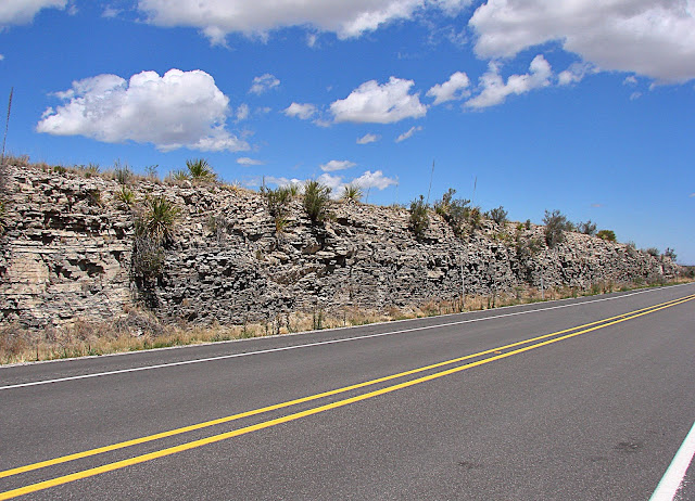
When you're driving around, don't ignore the road cuts! They provide good exposures of the bedrock layers, like this one of the seabottom Lamar limestone.
Related Pages: Carlsbad Caverns
B.S. - Common Misconceptions
"The desert is barren, ugly, and always hot!" False false false! This desert has a real winter complete with snow, and if you'll take the time to get into it, it is full and lovely.
M.S. - More Science
A thorough description of the Capitan Reef from the State of Texas.
A good field guide from New Mexico Tech.
Another good field guide, sponsored by NASA.


