Buffington Window, Nevada
Buffington Window, Nevada
Explore this scenic geologic wonder just 32 miles NE of Las Vegas, Nevada, next to Valley of Fire State Park.
Why Visit Buffington Window?
For The Geology!
And the scenery ain't bad, either.The Buffington Window is one of the most spectacular examples of a thrust window in the world. Thrust faults formed in the western U.S. during tectonic collisions between North America and large islands and volcanic mountains on the Pacific plate and its ancestors. When these large masses were carried to the subduction zone where the Pacific plate dove under North America, they slammed into and were pasted onto the continent. One result was strong compression that shoved the continental shelf eastward over more coastal rocks along horizontal faults called thrusts Here in southern Nevada, the Muddy Mountains - Keystone thrust placed the Cambrian Bonanza King dolostone (which formed on the continental shelf) over the Jurassic Aztec sandstone (which formed on land). Dolostone is a limestone that has been infused with extra magnesium. This thrust formed between 160 and 70 million years ago. The result is visually spectacular -- dark dolostone over colorful pink-white-orange-red sandstone, and makes the thrust quite easy to see even for a first-time, non-geologist visitor.
(Above) Geologic map and cross-section showing the Muddy Mountains Thrust. Fault displacement was east-northeastward into the cross-section, not down to the left as shown. (Fossen and others, 2015; reference below)
Keep in mind that the gray Cambrian rocks are about 300 million years older than the sandstone below! The equivalent rocks in the Grand Canyon area are down at the inner gorge (Cambrian) and up north at Zion National Park (Jurassic). In fact, the Aztec is the same layer of rock as the Navajo Sandstone that forms the spectacular, cross-bedded cliffs in Zion National Park and west of Las Vegas in Red Rock Canyon.
Total displacement on this fault is estimated at more than 50 miles! In places here and in the Spring Mountains west of Las Vegas, the fault traveled over the land surface, covering local stream channels filled with gravel from the rocks above.
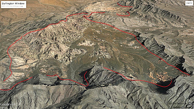
On maps this spot is called Buffington Pocket because it is a topographic depression, but geologists call it a "window" because it is an eroded hole through an over-thrust sheet.
The red sandstone in nearby Valley of Fire State Park is this same Aztec Sandstone and is below the same thrust fault as in the Buffington Window, but younger faulting in the park has eroded away most of the thrust exposures.
Groundwater carried minerals, particularly iron, through the Aztec sandstone before and after thrusting, staining the rocks various shades of red. Fractures near the thrust isolated the porous sandstone into various sized blocks, causing the groundwater staining to form oval and circular bands of color.
(Above) Interactive Google Map of the Buffington Pocket area. Zoom out to see Las Vegas. From I-15 north of Las Vegas or south of Moapa, take the Valley of Fire exit. It has a tribal smoke shop and fireworks store that's hard to miss. After about 1.4 miles at the big left bend, go straight on the gravel road (coordinates 36.459480, -114.735234). This will take you into the heart of the Buffington Window.
Travel to Buffington Window
Vehicle: This trip requires a truck, SUV, or off-road vehicle. Four wheel-drive is necessary if you're going to go up the canyon into the window (you can get to the mouth of the canyon in a car, but no farther). The canyon is the only difficult place; there is sand farther on. There are some spots where 2WD vehicles will get stuck. Good ground clearance is essential to get over large rocks. This area is heaven for dirtbikes and off-road vehicles!Location: The Valley of Fire exit is 32 miles north of downtown Las Vegas, and is well marked.
Summer: Expect July and August temperatures of 105-115 degrees. Not recommended for you or your vehicle. Heat ruins tires, batteries, and cooling systems, and is potentially life-threatening for you.
Lodging: Of course Las Vegas is hotel paradise. You can also find lodging in Moapa and Overton, farther north on I-15 and about half an hour to 45 minutes from the freeway exit.
Safety: I'm going to be overly cautious here. Take lots of extra food and water, just in case. Don't go when it's over 100 degrees. Thoroughly inspect your vehicle's cooling system, tires, A/C, oil, and transmission before going. If you haven't done much off-roading, go with 2 or more vehicles. This isn't serious off-roading by any stretch, but it is not visited often and would be a long way to walk for help. Get the tribal store's phone number when you go by, so you could call for help.
Tip: If you get stuck in sand, lower your tire pressure to about 10 psi so your tires will stay on top instead of digging in. I do that before hitting the sand every time.
Geology of the Buffington Window
(Above) Vertical view from Google Earth of the Buffington Window. The thrust fault is outlined in red. The colorful Triassic Aztec Sandstone is below the thrust, and the dark gray Cambrian Bonanza King formation is above.
(Above) Google Earth view toward the north of the northern half of the Buffington Window. The rock quarry shown in pictures is labeled. This rock quarry belonged to my father-in-law in the 1990's, who sold the most beautiful landscaping rocks available. We used to joke that a selling point was, "Rocks are highly drought-resistant."
(Above) Google Earth view of the northernmost part of the window. This is the best place to see a long, continuous exposure of the thrust fault.
(Above) Google Earth view of the southernmost Buffington Window. This area is harder to get into, with only one ATV/dirtbike trail that enters up a wash from the southeast. The narrow sandstone divide is only passable on foot.
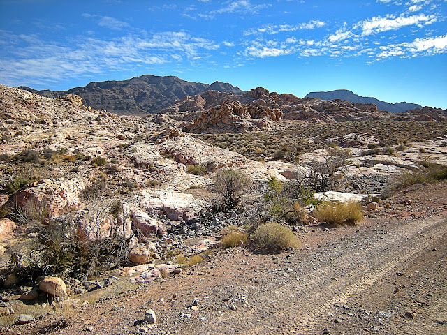
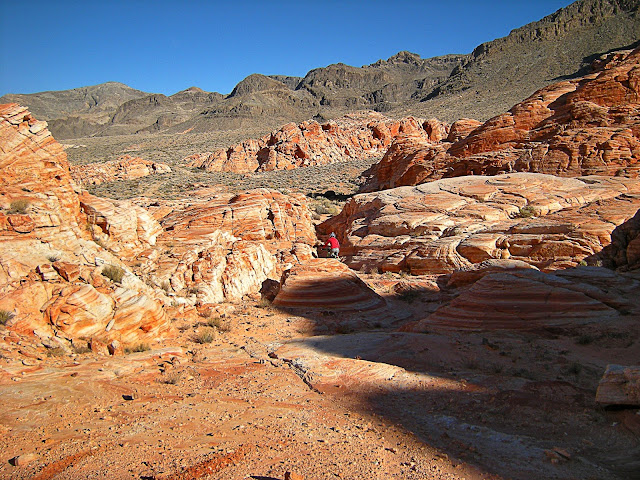
(Above) View in the central Buffington Window, with the Aztec Sandstone in the foreground and Bonanza King dolostone on the distant peaks.
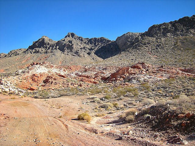
(Above) View of the thrust fault in the hills below the dark cliffs.
(Above) The thrust fault is in the slope between the dark cliffs and the reddish sandstone outcrops.
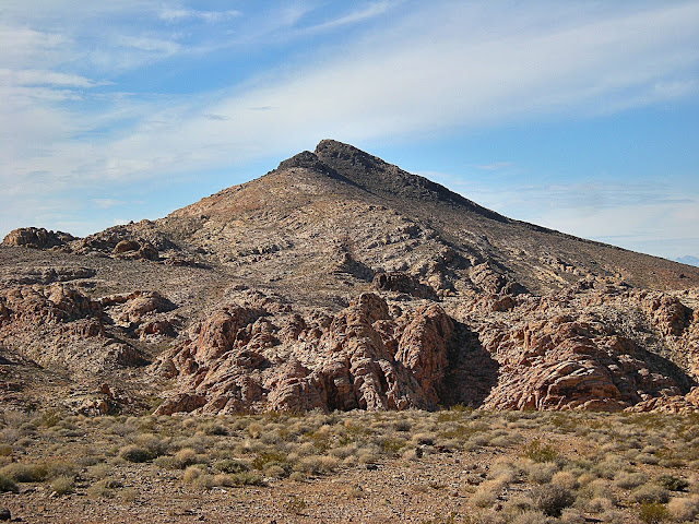
(Above) View to the north of dark-topped ridges of Bonanza King formation sitting on top of reddish Aztec Sandstone below.
(Above) When you get to this scene, you've arrived at the rock quarry. It's one of the best places to get out and examine the thrust fault close-up.
(Above) My father-in-law's landscaping rock quarry. See if you can spot the thrust fault on the distant hills (it's the color change). That's the outside rim of the window.
(Above) The gray Bonanza King formation is intensely fractured near the thrust fault. That's typical of rock near faults. This block is actually a few feet out of place, but this is what the fault contact looks like.
(Above) Lisegang banded sandstone just below the thrust above the rock quarry. Groundwater circulated iron in the small fracture-bounded blocks, forming the colorful banding.
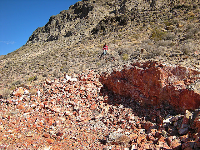
(Above) A view along the thrust fault just above the rock quarry. All the gray is above the fault.
(Above) A geologist sitting on the thrust fault above the rock quarry.
(Above) The Aztec Sandstone formed in a giant inland sand desert larger than the Sahara. The colorful banding you see here is cross-bedding, the layering of sand inside the dunes. The sand was stained by iron-bearing groundwater long ago. This is the same dune desert that formed the sandstone at Zion National Park in southern Utah. This outcrop is surrounded by fallen rock from above.
(Above) The colorful cross-bedded fossil dunes form some of the most interesting scenery in the West.
(Above) This outcrop of cross-bedding has a prominent erosional surface across the center. The dune below the surface was eroded down before the dune above migrated across it. There's another erosional surface below the top piece.
(Above) This ridge is capped by the dark Bonanza King formation. The thrust fault is immediately below it.
(Above) Spot the fault! This is immediately northwest of the rock quarry.
(Above) Another ridge that shows the thrust fault between the gray and reddish rocks. That's the western rim of the window.
(Above) Another ridge that shows the thrust fault around the edge of the window.
(Above) A fold in the rocks above the thrust just outside of the Buffington window. It is buried in gravel that has eroded off the surrounding hills.
(Above) The long exposure of the thrust fault at the northern end of the Buffington Window.
(Above) Sandstone in the low hills below the thrust fault in the northernmost Window.
(Above) The sandstone in the northern part of the Window is fun to explore!
(Above) Fun!
(Above) View across the eastern Valley of Fire State Park. All of the rocks in this view are below the Muddy Mountains thrust.
(Above) A view across eastern Valley of Fire State Park. The conspicuous flat surface is the valley level about 5 million years ago, before the most recent regional uplift caused rivers and streams to erode deeper.
(Above) A close-up of the 5 million year-old valley level on the distant mesa. The mesa in the middle distance has the same erosional surface on it, capped by layers of dark gravel eroded off the surrounding hills.
(Above) View westward across the eastern Valley of Fire State Park. The Buffington Window is on the other side of the far ridge.
(Above) This is my favorite way to explore! My old Honda XR400 eats up the miles quickly and sounds like a tiger.
Related posts: Grand Canyon, Thrust Belt, Nevada labels
M.S. - More Science
An article on deformation associated with the thrust.
Here's a big PDF about the entire Cretaceous (Sevier) orogeny.
Reference for figure: Fossen, H., Zuluaga, L.F., Ballas, G., Soliva, R., Rotevatn, A., Contractional
deformation of porous sandstone: insights from the Aztec Sandstone, SE Nevada, USA, Journal of Structural Geology (2015), doi: 10.1016/j.jsg.2015.02.014.


