Banff South
Kananaskis Trail, Highway 40

Why Visit the Banff Area?
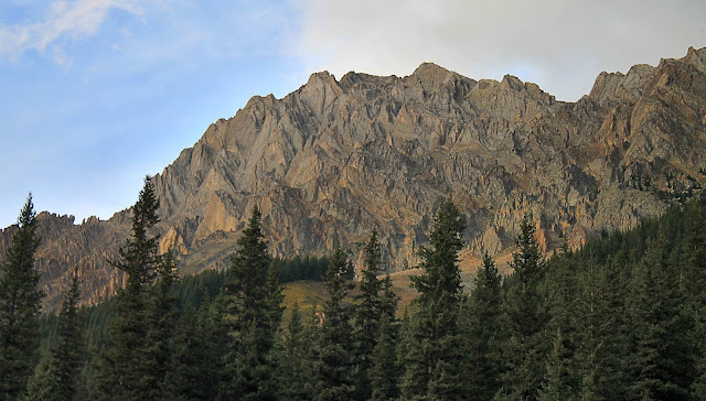
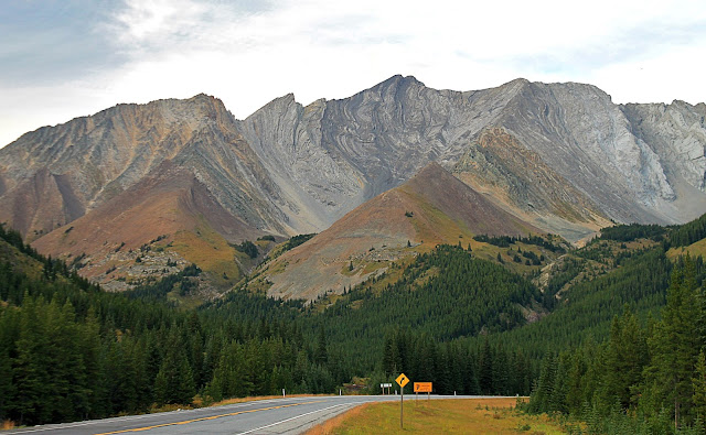
The valleys north and south of Banff are perfect for a wandering, lazy, inspirational, and relaxing road trip. Just stop often, breathe deeply the fresh forest air, and let the sights dazzle your brain. Give yourself plenty of time to just enjoy.The high, long mountain ranges north and south of Banff are known by geologists as the Thrust Belt. They were created over 50 million years ago by tectonic plate collisions that shoved the continental shelf up onto the continent like shingles onto a roof. Uplift and erosion since then has dissected these complexly folded and faulted strata to give us some of the world's most spectacular scenery. And as a bonus, it has all been sculpted by glaciers, some of which are still at work north of Banff.
Travel to Banff
This is a strictly summertime trip. The Kananaskis Trail, highway 40, is closed December through June.
(Interactive map) Highway 40 extends from Highway 1 just east of Kananaskis, about 75 km west of Calgary, southward through the mountains, and back to the plains at Longview at highway 22.
Time: 1 day. The highway is about 150 km (90 mi) long from Highway 1 south to Longview. You'll want to stop often.
Food & Fuel: Food and fuel are only available in the northern part of the road near Mt. Kidd at the RV park and golf course, and the ski areas during their seasons. I suggest starting with a full tank.
Lodging: There are some resorts in the northern part of the road, but it's close enough to Calgary, Canmore, and Banff that it's easy to stay in one of those larger towns.
Road: The road is suitable for any type of vehicle including sports cars and RV's.
Hiking & Camping: Numerous trails take off from this road, and there are resorts and provincial parks for camping, boating, and recreation. Kananaskis Lakes and Peter Lougheed Provincial Park have inspirational scenery and trails that could keep you captivated for days.
Geology of Banff
The diagram below shows a cross-section through the thrust belt near Banff. Each color represents a different rock layer. The heavier black lines are thrust faults, and you can see that the rock layers above the faults have been shoved eastward (to the right) like a stack of shingles. As a result, most of the rock layers in the mountains are tilted, and that creates the spectacular jagged peaks, flatirons, and colorful banding that make this area so visually captivating.
(Above) Geologic cross-section near Banff from the Canadian Geological Survey.
The gray limestones and sandstones that form the longest continuous mountain ranges are generally Paleozoic in age, between about 550 and about 250 million years old. They have been thrust up and over younger rocks, some as young as Cretaceous, about 70 million years old, in the eastern foothills. The farther west you go, the older the rocks get.
(Above) Colorful strata near Mt. Lipsett. To me, autumn is the best time to visit because of the spectacular interplay between colorful foliage and colorful bedrock. The pictures here were taken on about September 1st when color changes were just beginning.
(Above) View toward the south of the southern valley near Mt. Lipsett. The long gray ridge on the right is one of the thrust sheets that was shoved tens of miles from the west up and over younger rock layers.
(Above) These strata are nearly vertical, forming triangular slabs that geologists call flatirons, after the pioneer-era triangular irons used on clothing. This is south of Elpoca Mountain.
(Above) Folded strata at Storm Mountain. Erosion has cut through these steeply tilted and folded strata, giving the illusion of additional folding.
(Above) The ridge at Mt. Lawson, just north of Kananaskis Lakes. One of the thrust faults runs through the forest on the lower slopes of this ridge, having brought the gray limestone layers on the peaks from the continental shelf that used to lay tens of miles to the west.
(Above) Debris and avalanche chutes like these are common on these mountain slopes. They are part of the reason the road is closed in winter -- too dangerous!
(Above) The Lewis Thrust is one of the longest and most important thrust faults in the region. It extends from central Montana all the way to near Banff, and is the source of much famous and spectacular landscapes like Chief Mountain, Montana, and this peak, Gap Mountain in Alberta. Kananaskis Lakes are just west (left) of this view. Google Earth view with my annotations. Fault locations from Canadian Geological Survey maps.
(Above and Below) This diagram snows the Lewis Thrust at Gap Mountain. Thrust faults do something quite interesting -- they put older rocks on top of younger. When rocks are deposited, it's always the other way around. It takes tectonic movement to put rocks out of order. Diagram from an AAPG/CSPG Field Trip Guidebook, 1992.
(Interactive Map) Location of Gap Mountain.
(Above) The northern end of highway 40 has my two favorite sights, shown in the two photos below. The road swings far to the east to meet up with Canada 1, the Trans-Canada Highway. From there, it's an easy drive east into Calgary or west to Canmore and Banff, and there's not a boring mile in there anywhere.
(Above) This fold is at the northern termination of the Lewis Thrust in Kidd Mountain's south peak. The thrust is at the core of the anticline on the left, its displacement dying out into the fold. Photos of this fold are in nearly every textbook on Structural Geology, so when I first saw it in person I felt like an archaeologist first seeing the Great Pyramid, or something like that -- it was a thrilling moment!
(Above) A few km north of Mt. Kidd and just south of Barrier Lake is this spectacular exposure of a thrust ramp -- a thrust fault where it cuts upward through the strata below it. This is perhaps the best exposure of a thrust ramp in North America. It's part of a duplex, which is a body of rock surrounded above and below by thrust faults. It's in the Palliser Formation, a Devonian age layered limestone.
(Interactive Map) Location of the fold on the Lewis Thrust. The Palliser duplex is a few km to the northeast, just south of Barrier Lake.
Related Posts: Banff North, Burgess Shale, Glacier National Park
M.S. - More Science
Search Canada geologic maps HERE.
Kananaskis Lakes area geologic map
Large-scale geologic map in black and white
Good poster explaining the geology of this region


