Northern California Coast 3
Best Geological Sites on the Northern California Coast - Part 3
Ferndale - Mattole Road - Cape Mendocino - Tectonic Triple Junction - Eel River - Point Arena
Travel to Ferndale and Petrolia
Interactive Google Map. The trip starts in Ferndale.
Lodging: Stay the first night in Ferndale. It's one of California's most charming towns! Just look at this Google street view:
Roads: Mattole Road from Ferndale south to Petrolia is narrow, winding, and rough in places. Not recommended for low-riding sports cars, although I've seen car commercials that were shot here. RV's should take it slow and use caution. Fill your tank before leaving Ferndale - there is limited fuel in Petrolia, and it's 70 miles over to U.S. highway 101.
Time: Plan all day from Ferndale to Humboldt Redwoods, or back to Ferndale.
Logistics: You can eat at the Yellow Rose Bar & Grill in Petrolia, or get groceries at the general store, but that's the only available food along this route. You'll find plenty of great picnic spots along the coast and in the redwoods!
Weather: Because this road crosses severe landslide terrain, don't go during or shortly after heavy rain storms.
The entire low-lying area from Ferndale to Eureka is in the tsunami danger zone. While the odds of a tsunami happening at any given time are very small, the long-term odds are 100% and the consequences would be devastating, so the warning signs are a good idea.
Cape Mendocino - Mattole Road
Take Mattole Road south from Ferndale. This is California's greatest secret road!
Watch for the landslide areas along the coast. The bedrock here is the Jurassic Franciscan formation, made mostly of shale, mica-rich shale, and graywacke (gray sandstone). Add in frequent earthquakes and high winter rainfall, and you have a sure recipe for instability.
Landslides are easy to spot where they have stripped off the vegetation. This particular one is a series of debris flows. The boulders here are mostly graywacke sandstone.
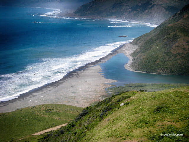
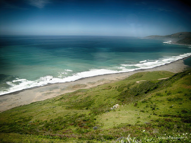
When you're at Mattole Beach, it's hard to believe you're still in bustling California! It's one of the most secluded spots in the state. The gray tint to the sand comes from the graywacke, which itself was originally laid down as sand washed from long-vanished volcanoes to the east. The tectonic triple junction is just offshore.
Little Domingo Creek has been deflected to the north by longshore drift of sand on Mattole Beach.
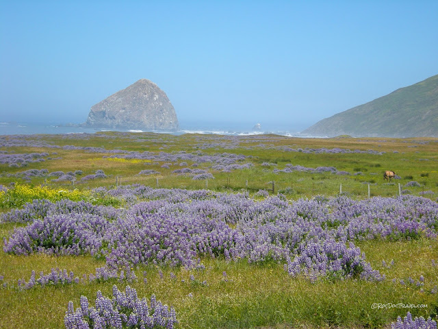
The sea stacks in this area are made mostly of graywacke blocks. The tectonic triple junction is just offshore from this spot.
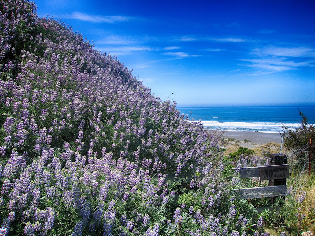
Take the pull-out where the road leaves the beach and starts inland toward Petrolia. A couple of trails lead down along the beach, and it's just a wonderfully scenic spot.
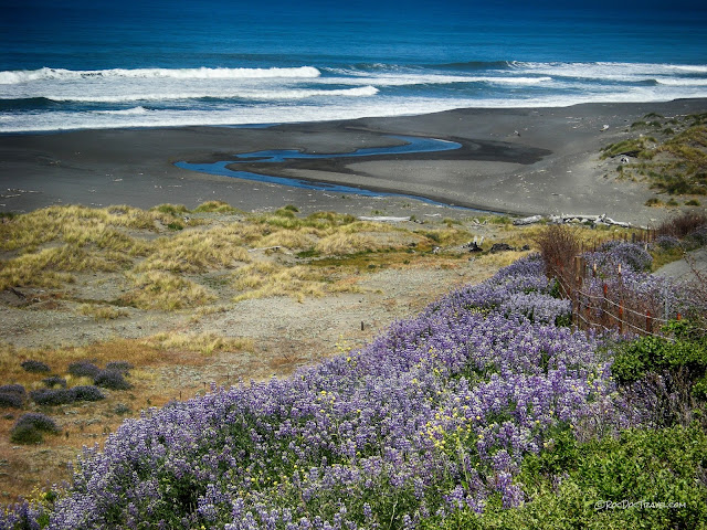
The Petrolia River is also deflected northward by longshore drift of sand across its mouth. To get to this spot, take Lighthouse Road from Petrolia to Punta Gorda Recreation Area and Mattole trailhead. Roads high on the hills here provide tremendous views over the coast and ocean. They're smooth when freshly graded, but extremely treacherous when muddy.
Because it flows across shaley bedrock, the Petrolia River provides enough sediment to discolor the beach water for some distance out.
Eel River - Great Flood of December, 1964
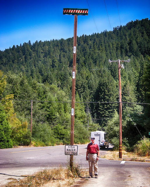
If you take Mattole Road all the way east to highway 101, you'll be right here in the Humboldt Redwoods (one of my favorite places on earth!). Look for this sign at the intersection of Avenue of the Giants and Dyerville Loop Road. It marks the high water in the Great Christmas Flood of December 1964. What makes this really remarkable is that the riverbed is more than 40 feel lower than this road! And the river valley here is about 1/2 mile wide. The Eel River flooded the entire plain from Ferndale to Humboldt Bay, and had a peak discharge of 750,000 cubic feet per second (21,200 cubic meters per second), which is equal to the flow of the Mississippi PLUS Columbia rivers!
You'll also see a marker near this sign that describes the flood. The local mountains got more than 30 inches (76 cm) of rain in 3 days, with local amounts of 50 inches (127 cm). Such a flood is now called an "ARk storm," meaning an Atmospheric River storm in which a low pressure system off the Oregon coast meets up with a high pressure system off the Baja California coast to capture subtropical moisture from near Hawaii and funnel it in a narrow "river" to the California coast. A minor version of this type of storm is referred to as the "pineapple express," but when fully developed it is the worst-case scenario for California. It will happen again.
Point Arena
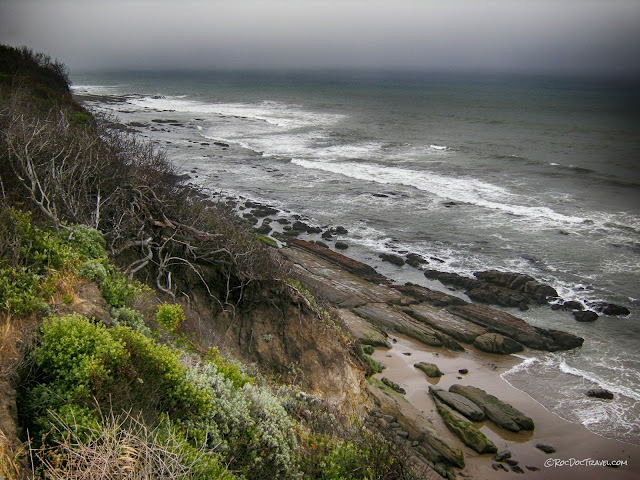
One more intriguing geologic spot along the coast is farther south at Point Arena. The San Andreas fault is inland from here, so the shale-rich subduction zone rocks are inland away from the coast. The bedrock here is sedimentary layers (mostly coastal sandstone) that have been transported along the coast as part of the Pacific plate. Yes, Point Arena is on the Pacific plate along with Bodega Head, Gualala, Point Reyes Seashore, and all of the central and southern coasts of California, including Los Angeles and San Diego! The rest of the state is on the North America plate, including the Cape Mendocino area.
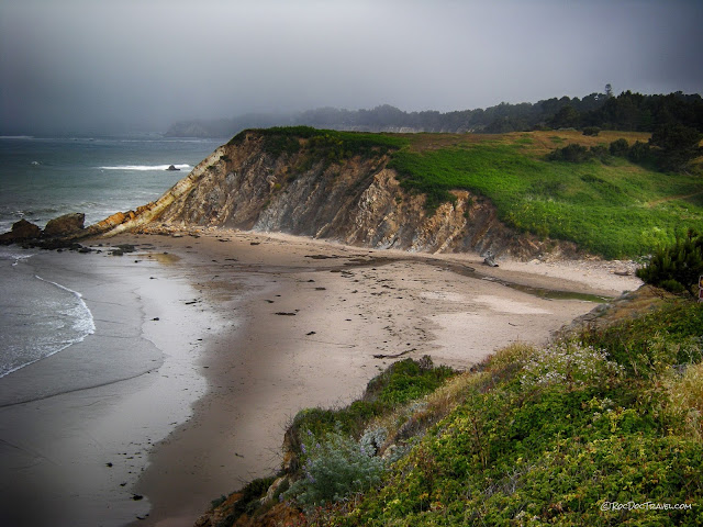
The rocks were steeply tilted by deformation along the San Andreas. It's intriguing to think that these rocks are completely disconnected from and unrelated to the rocks a few miles east on the other side of the fault!
