Northern California Coast 1
Northern California Coast
See cool geologic sites that you may overlook otherwise!Travel to the Northern California Coast
It's highway 1, baby! It's famous for its fabulous scenery and winding road. It's also famous to geologists for its amazing geology!
This trip begins north of Point Reyes Station and ends at the Humboldt Redwoods on highway 101 inland. From the San Francisco Bay Area, take Highway 1 north past Tomales Bay to Bodega Bay. Follow the signs to Bodega Head. Part 2 of this trip will include stops around Crescent City, and part 3 will be the Cape Mendocino area.
What You'll See:
In addition to fantastic coastal scenery, you'll see the San Andreas fault, bedrock that has been transported several hundred miles from the San Diego area, former subduction zone rocks, and a huge chunk of oceanic crust and lithosphere. Oh yeah, and the Redwoods! This is a favorite field trip among geologists.
Lodging: You'll find wonderful lodging options all along the coast - just pick a town and do a search! For the budget-minded, the best options are in Marin, any of the inland towns, Fort Bragg, Eureka, and Crescent City.
Vehicles: On weekends, you're liable to see Ferraris, Porsches, Corvettes, and other high-end cars enjoying Highway 1's unmatched driving experience. But any car will do! The road has a lot of low-speed, curvy sections, so driving or riding in a big RV can be cumbersome.
Seasons: Just avoid winter storms, and you can do this trip any time of year. You'll see the greenest hills in March through June.
Accessibility: All of the sites described here are easy walks. Only Shell Beach requires going down stairs.
Cool Geologic Sites on the Coast
Tomales Bay
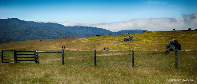
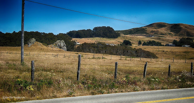
Tomales Bay was formed along the San Andreas fault. Notice that the hills on the far (west) side are steeper and higher, and that trees flourish there, while the east side where Highway 1 is is flatter, lower, and has less vegetation. That's because of the bedrock. The granite bedrock on the west side was transported along the plate boundary hundreds of miles from near Baja California. The east side of the fault is old subduction "melange," a mixture of shale and metamorphosed oceanic crust. The difference is obvious, once you know what you're looking for.
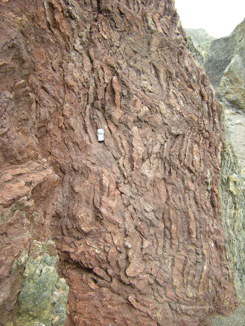
Melange is a mixture of rocks that were jumbled together in a subduction zone (in this case, where relatives of the Pacific plate subducted under the North American plate). Along much of the northern California coast, the melange is dominated by shale, which is soft and slippery when wet. Shale erodes down to the low, lumpy slopes covered by grass and oaks that is characteristic of the Coast Ranges. Pieces of the oceanic crust - the boulders seen here - were shoved down deep into the subduction zone and metamorphosed, turning them blues and greens.
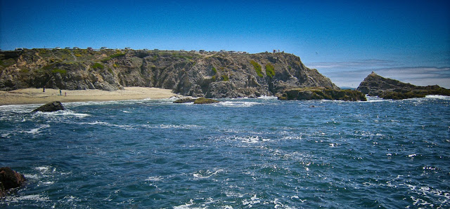
The San Andreas passes through the east side of Bodega Bay, seen here from Bodega Head on the west side. Over the past century, engineers have constructed jetties in carefully calculated locations and orientations to trap sand that drifts along the coast and keep the harbor open.Bodega Bay
Doran Regional Park
...occupies a spit in Bodega Bay that is controlled by jetties and rip-rap (piles of boulders). That's a Coast Guard station on the left side.Geologic map of the Bodega Bay area. The red lines are branches of the San Andreas fault. "Kgr" is the Cretaceous granite at Bodega Head, transported hundreds of miles along the plate margin faults.
Bodega Head
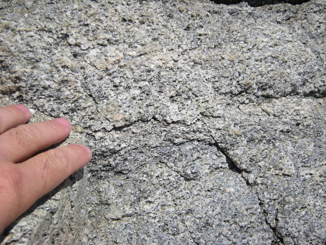
Bodega Head has outcrops of the "Salinian" granite, so named because it is found around Salinas, farther south. This is the granite that was transported hundreds of miles along the San Andreas and its ancestors. The flat top was planed off by wave action before the bedrock was uplifted by tectonic activity in the region. Go to the Bodega Bay Trailhead at coordinates 38.304296, -123.064044 .
The top of the granite was eroded flat long ago, and coastal sediments were deposited on top of it. The flat boundary between the two is called an unconformity, specifically a nonconformity. You can see it here just in front of the geologist and in the lower part of the far hills.
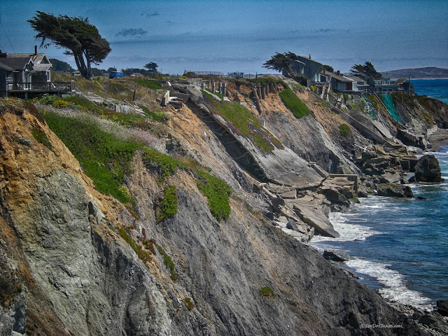
A few miles north of Bodega Bay are infamous houses that were destroyed by coastal erosion. See the remnants of foundations and structures? Attempts were made to stop the erosion by putting concrete highway dividers at the base of the cliffs, but that was a mistake. Such a "seawall" is counter-productive because it focuses waves' erosive power on the beach. Once the beach disappears, waves undermine the seawall, and now there's no beach to protect the cliffs, so erosion accelerates. The remaining houses are protected by giant boulders of metamorphosed oceanic crust sitting out in the waves. Erosion here has gotten so bad that there has been recent road construction to address the problem. Coordinates of the pull-out for this view: 38.390257, -123.084674
I happened upon this scene that stereotypes both the Volkswagen Van and northern California culture.
All along the coast is evidence of recent tectonic uplift. The terraces in the melange shown here are old beach levels, eroded flat by wave action. The old urban myth about California falling into the ocean is exactly backwards - it isn't sinking, it's rising!
Jenner - Shell Beach
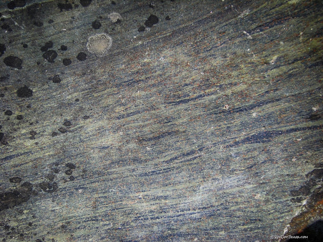
This phenomenal boulder was along the trail from the parking lot down to Shell Beach. It is an unusual and amazing combination of eclogite (greens and browns) and blueschist, all stretched and flattened together in one rock. It began as a piece of basalt in the oceanic crust, and was subducted to perhaps 45 km depth. More recent tectonic activity has uplifted it to the surface. I was recently extremely dismayed to discover that someone had removed this museum-quality boulder from the trail. Whoever you are, please put it back!
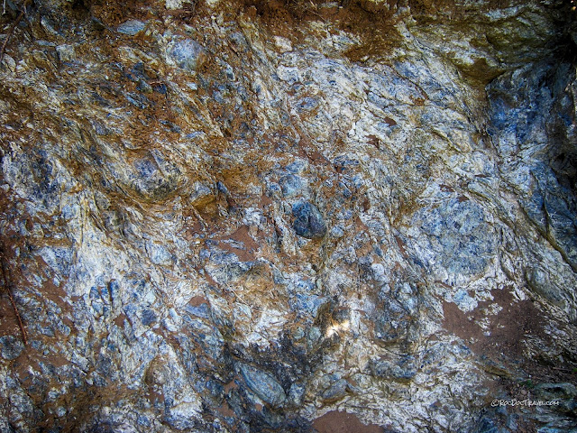
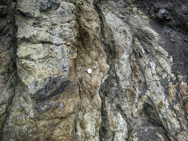
Blueschist blocks in a matrix of sheared shale. This exposure was made when a landslide took part of the hill and put it on the beach. It's just south of the trail to the beach, and easy to get to.
The blue minerals in blueschist are glaucophane and some lawsonite. Glaucophane forms under high pressure but low temperature, like the conditions found in a subduction zone.
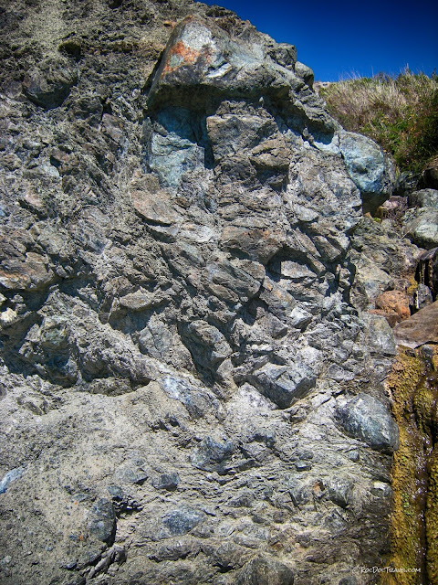
This 3-meter-wide outcrop of blueschist shows how it has been broken and sheared into blocks by shearing & movement in the subduction zone.
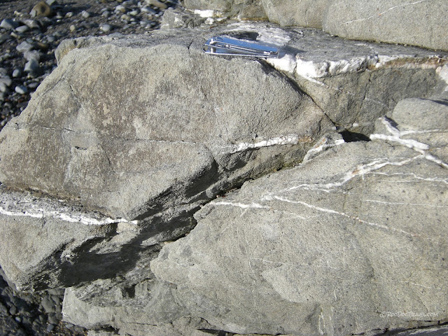
This is a boulder of oceanic crust (basalt) altered to greenstone. It originated on a Pacific plate where new crust is generated along the spreading ridge.
Shell Beach also has this large chunk of bedded chert from the ocean floor.
Bedded chert is one of the rock types that indicates a specific origin, in this case on the deep ocean floor. The object on the rock is an old cell phone.
This blueschist - greenschist block has been sheared along the dark surfaces. The boundary between two colliding plates, the subduction zone, is a giant fault zone that can be a few of kilometers thick. All of the rocks in the zone are crushed and sheared.
One of the exciting rocks for geologists to find in the melange at Shell Beach is eclogite, this rock with green and brown minerals. It forms under very high pressure and temperature, and contains almandine garnet (the roundish brown minerals) and omphacite pyroxene (the grey-green groundmass).
Graywacke is gray sandstone made of volcanic clasts. It forms in one specific location between the volcanic arc and the coast at convergent plate boundaries. You'll see it in many places along the northern California coast.
Shell Beach is remarkable for its assortment of melange rocks. In this one picture are greenstone (altered seafloor basalt), basalt (greenish gray), limestone (blue-gray), sandstone (brown), chert (pinkish, at center), greywacke (dark gray), and blueschist (blue and green). All were transported hundreds or even thousands of miles on the Pacific plate's ancestors, then were accreted onto North America.
Jenner - Russian River
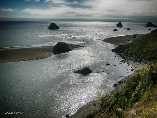
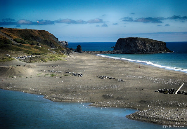
At Jenner is the mouth of the Russian River. "They call it that because it's always in a hurry," as my Dad once quipped. Longshore drift of sand stretches the sand spit across the river's mouth, growing fastest during winter storms. In most years, the sand completely blocks the river. Coordinates of the Russian River mouth turn-out: 38.452546, -123.128412 This view also shows "knockers" of blueschist or greenstone that form sea stacks after the surrounding soft rocks have eroded away.Here's a view of the sand spit blocking the Russian River. Incessant longshore drift drags the sand along the coast, and where the coast has an inlet like this river mouth, the sand grows inch by inch across the inlet's mouth.
Sometimes I think the seals and birds have the right idea of life.
In this cove, steeply tilted bedrock is exposed in the cliffs. This isn't common along the coast because most of the bedrock is melange (described above). In this view you can also see an uplifted marine terrace - the flat area above the cliffs. That was beach level for a long time, and the bedrock was eroded flat by wave action. Tectonic activity has since uplifted the terrace and forced the waves to go to work on a new set of rocks.
The Redwoods
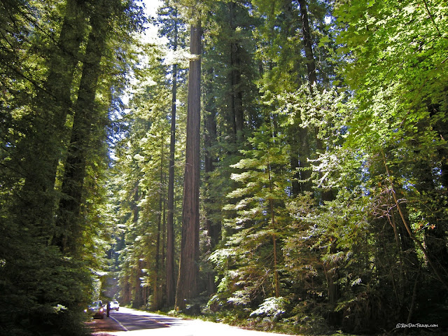
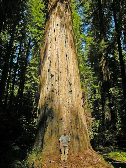
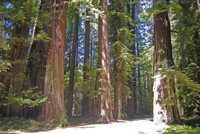
North of Rockport, Highway 1 goes inland to avoid the incredibly steep and rugged coastline. Continue north up highway 101 to Humboldt Redwoods State Park. If it looks familiar, it may be because several movies have been shot here including the "Moon of Endor" scenes with the Ewoks in Star Wars movies.The first time you see a really big tree, it feels like reality has warped. It feels like when the kids came across a giant Oreo cookie in "Honey I Shrunk the Kids" -- trees aren't supposed to be this big in the reality we've known! And yet here they are. Plan to spend as much time as you can in the redwoods to wander, explore, marvel, and just try to absorb the unique peaceful feeling they exude.
Redwoods have very specific requirements for a growth environment - frequent fog, moderate temperatures, low maximum wind speeds, and abundant winter precipitation. That's why they are found chiefly from southern Oregon to central California within about 50 miles of the coast. The roots are shallow and long, intertwining with those of surrounding trees, which helps them resist wind and, near rivers, flood waters. Their bark is even fire-resistant! Many of the redwoods you'll see are over 1500 and even 2000 years old.
Related Posts: Northern California coast part 2 and part 3
San Andreas in the San Francisco area
San Andreas along the northern California coast


