Carlsbad Caverns part 1
Carlsbad Caverns National Park, New Mexico
Explore this giant cavern network that developed in an ancient reef!
Carlsbad Caverns National Park
Park website: Click Here.New in 2016+ is an LED lighting system throughout the caverns! If you've visited the caverns before, you'll be amazed at how much better all the features look and how much more you can see. The ranger said lighting work is still ongoing. The signs have all changed as well, labeling fewer of the features with their fantasy or animal names. "Whale's mouth" is the only old name I noticed on this trip.
Travel to Carlsbad
(Above) Interactive Google Map of the park. Zoom out to see highways, towns, and regional location.
Location: Southeastern New Mexico (zoom out on map above).
Travel: Nearly all visitors arrive by car. Limited air service is available to Carlsbad and Roswell.
Lodging: I recommend staying in Carlsbad. White's City also has lodging, but you'll have more dining and amenity options in Carlsbad, and it's only about a 20 minute drive.
Seasons: At an elevation of 3600 feet in the desert, the park gets the best parts of winter and avoids the worst of summer. Weather is only a concern during winter storms.
Difficulty: The hike down the caverns is moderately strenuous, and not for folks with leg, joint, heart, or breathing problems. There is an elevator for the ride up (note: the elevator was not working in early 2016). Wheelchairs can only access limited trails at the bottom of the elevator.
Considerations: I wouldn't recommend taking any small children into the caverns. It'll be too much of a hike for them, and the logistics are not kid-friendly. It's not dark enough to be scary or anything, it's just physically difficult and they won't be happy. Sound carries extremely well in the caves, so noisy children would potentially spoil the experience for everyone else in the caves. Strollers are not allowed, but baby backpacks are. NO FOOD OR DRINK other than pure water are allowed - no gum, candy, tobacco products, or ANYTHING.
Other Attractions:
Guadalupe Mountains National Park is close to the south, and is famous for its mountain hiking trails and the highest peaks in Texas.
Bottomless Lakes State Park by Roswell has amazingly deep sinkhole lakes to swim in.
The Sacramento Mountains to the north claim the southernmost ski area in the U.S. at Cloudcroft, the National Solar Observatory, and horse racing and other attractions at Ruidoso, and great camping and hiking.
12,000 foot Sierra Blanca is an easy climb (a walk, really) and it overlooks White Sands and the Trinity Site where the first atomic bomb was tested.
White Sands National Monument is NW of Carlsbad near Alamogordo, and has a sea of blinding white gypsum dunes.
Carlsbad Geology
(Above) Geologists come from all over the world to study the Permian (260-280 million year old) reef complex of the Guadalupe Mountains. And while they're there, they visit Carlsbad Caverns. I suppose normal human beings come for the reverse priorities, but let me see if I can let you in on the hidden-in-plain-sight secrets of this remarkable place.The Guadalupe reefs developed between about 280 and 260 million years ago on the edge of the sea geologists call the Delaware Basin. At the time, this was near the southern end of North America - what's now Mexico wouldn't be added until much later. The reefs were made of sponges and algae, not like the coral reefs that would show up in later geologic time. West and north of the reef was a shallow shelf that variously flooded and dried up, causing deposition of salts and gypsum, and occasionally spilling sediments over the reef into the Delaware basin. Sea level fluctuated a bit up and down, and the reefs adjusted up and down accordingly and grew toward the basin. The edge of the reef was right at Carlsbad Caverns, and it was steep. The edge dropped down several hundred feet to the seafloor below, just like in big modern reefs.
Here's the really remarkable part: what you see today is the original height and length of the reef! The flat lands below have been eroded back down to the ancient seafloor, and the hard rocks of the reef remain high above just as they were 260 million years ago. The edge of the reef is the curved line of hills and mountains extending from near the town of Carlsbad southward to Guadalupe Peak in the Guadalupe Mountains National Park (see picture below), where the southern end has been eroded away. Nowhere else in the world can you walk on an ancient reef so completely and remarkably preserved.
Geologically speaking, the caverns are just a bonus!
The Caverns
Like most great geologic sites, Carlsbad Caverns simply cannot be appreciated via photographs. They have to be seen to be believed. But the photos here will give you an idea of the fantastical things you can expect.A few geologic facts about the caves:
- The bedrock is limestone created largely by shelled organisms 260-280 million years ago in and near an enormous reef.
- Limestone is a rock cemented together by calcium carbonate ("lime"). It's the same stuff in antacids like Tums.
- The caves in this area vary in age, but based on radiometric dating the Carlsbad Caverns formed between 6 and 4 million years ago.
- The caves were dissolved by weak sulfuric acid created by microbes and natural hydrogen sulfide. That makes Carlsbad different from other caves, including Mammoth in Kentucky, which were dissolved by carbonic acid in groundwater.
- When the region was uplifted, the water table drained away along with the sulfuric acid, leaving behind the caves.
- Water dripping in from the surface brings with it some of the limestone and redeposits it as speleothems (cave features) including stalactites, stalagmites, curtains, straws, columns, and so forth.
- The speleothems are all less than a million years old, and most are no longer growing because of the dry climate. They were much more active during the last ice age that ended 10,000 years ago.
- Regular tours only visit a small percentage of the known caverns. More caverns are expected to be discovered well into the future.
The photos will show you the caverns in the order you'll walk through them.
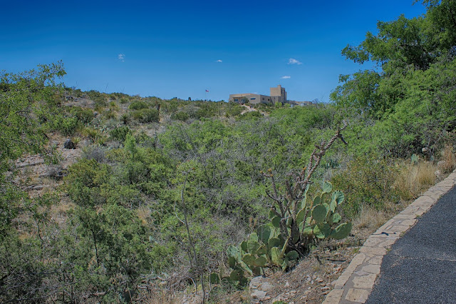
(Above) The path from the visitor center to the amphitheater and cavern entrance.
The natural stone park buildings fit their surroundings as well as any buildings I've seen.
A look back up at the visitor center.
The amphitheater is the place to be every summer sunset when millions of bats swarm and swirl out of the caves to go eat millions of insects in the Pecos River valley.

Bats exit the caverns nightly throughout the summer (NPS photo).
The entrance to the caverns is steep and dramatic! It doesn't look like much from the trail and amphitheater, but the deeper you go, the deeper it gets!
You'll descend through a series of linked caverns. The earliest explorers had to use ropes and ladders. I'm glad for the paved trail!
On your way down, be sure to keep looking back up to keep track of how deep you've gone.
Down, down, down, away from the sunlight you go.
Soon the natural light starts to look blue compared to the cave lighting.
The outer caverns are not nearly as decorated as the deeper ones. You'll see a lot of rubble that has fallen from the ceiling, and the occasional stalactites and stalagmites.
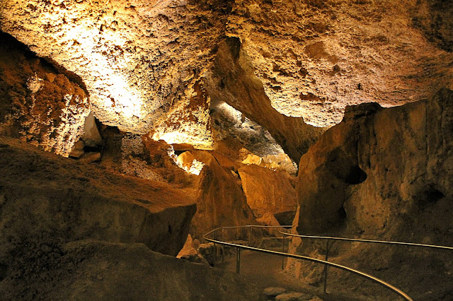
The trail takes you close to the ceiling of the first big cavern before it winds down to the floor.
And down you go, into the bat cave! (That's really what it's called)
The high, far part of the main corridor is more than 1000 feet away. The height is over 200 feet.
Soon you get to some of the really big cave features, like this ghoulish cascade.
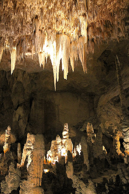
The cave decorations get more numerous and bigger as you go deeper. Note the walkway and handrails at lower right for scale.
Descending into Devil's Den is more heaven than hell.
I like the name of this spot - "the bone yard."
Relatively small passages connect the giant caverns.
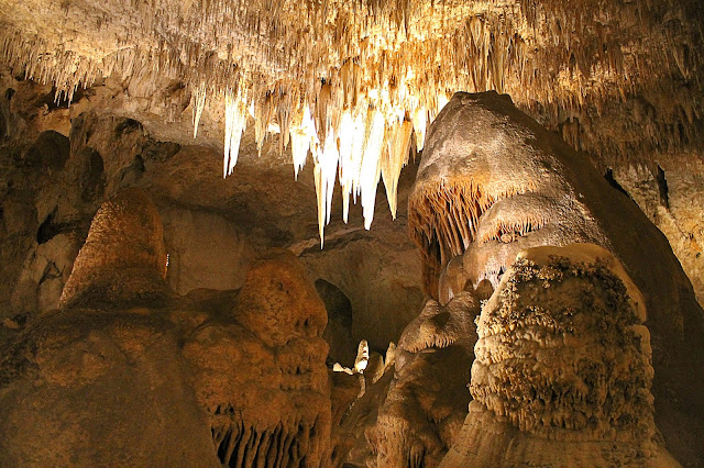
Heading into the Green Lake room, the fantastic sights just don't quit. Notice how the lighting highlights so many great features.
Growing one thin layer a year, it's easy to imagine the thousands of years it took to make massive deposits like this.
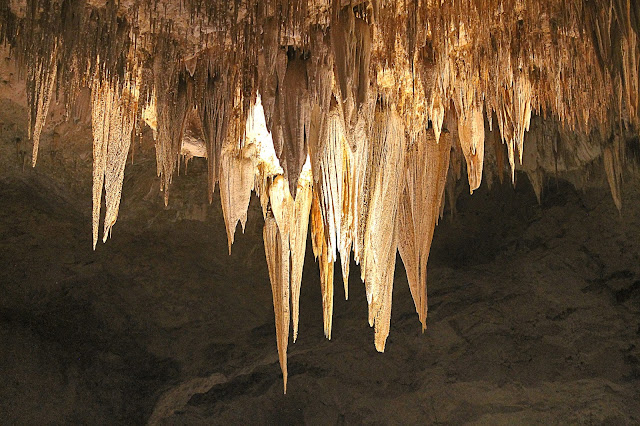
Do some neck stretches before visiting Carlsbad, because you'll be looking up a lot.
This used to be called the "sword of Damocles."
These towers in the Hall of Giants are over 60 feet tall!
These fantastic blades are something like 25 feet long.
More towers (or domes) in the Hall of Giants.
Counting stalactites in the caverns would be nearly as daunting as counting stars in the Milky Way. But candy bars are not allowed in the caverns, so...
When Harry met Sally.
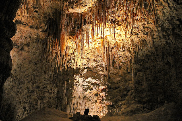
This view is looking a couple hundred feet across a huge room. Photos just can't convey the scale.
I don't know about you, but sleeping under these spikes would be a nightmare to me.
Up high in the center of the Big Room are these enormous blades. They're hard to take your eyes off.
Close-up of the blades.
Below the blades are the receptive stalagmites.
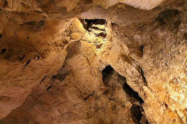
Most of the rooms were formed along fractures. Acidic water flowing through the fractures dissolved the rock and widened the fractures into caverns. The biggest and tallest caverns formed where two sets of fractures intersect, as here in the Big Room.
Another ghoulish tower. I kept seeing Star Wars characters in the caverns.
Early explorers left this rickety ladder. "No thanks," I heard myself say.
Note the people and handrails for scale.
Mirror lake.
Keywords: Carlsbad Caverns National Park, New Mexico caves caving geology travel trips roadtrips


