Banff Part 1
Banff National Park, part 1
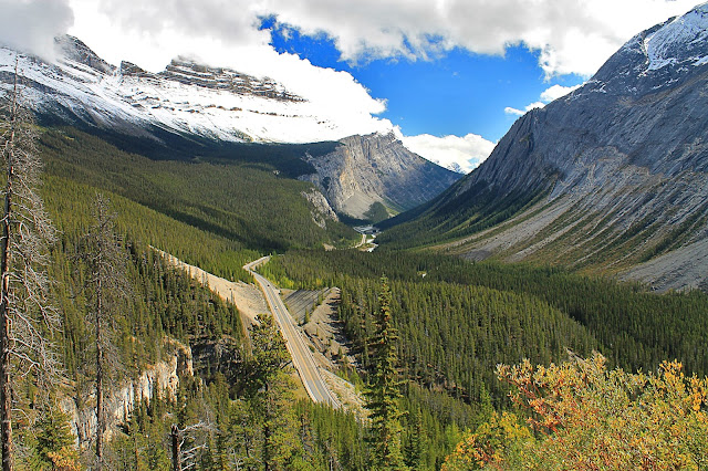
When you visit Banff National Park bring a thesaurus, or you'll run out of synonyms for "WOW!"
Why Visit Banff?
Banff National Park is one of everybody's favorite scenic places -- just ask anyone who's been there! The mountains, lakes, forests, and glaciers will deplete your vocabulary for words expressing beauty and awe. "Breath-taking" is a literal thing here -- your lungs will forget to breathe while your eyes soak up the beauty and your brain tries to comprehend the magnitude of it all!You can even walk on a glacier at Athabasca -- how cool is that!?
Travel to Banff
Time: Minimum of 3 days by car, more for hiking. You'll want to stay forever! This trip will guide you north into Jasper National Park, so you might want to add time to explore that park, too.Difficulty: You can see most of the good stuff from a car. Endless hiking is available.
Lodging: Banff and Canmore have plenty of hotel/motel options, and not all are expensive. Lake Louise has its famous Fairmont Chateau. Lodging elsewhere is sparse. I've stayed at The Crossing Resort up in the middle of the park, and it was worth the spectacular setting (as a motel, it's just okay). If you're going west to Yoho National Park and the Burgess Shale, Golden is an easy place to stay. Field has a few lodges. Athabasca Glacier also has a hotel and restaurants at the Icefields Parkway Discovery Center.
National Park Fees: Find them here. They're very reasonable. Coming from Calgary you pay along Highway 1 just north of Canmore.
Considerations: Banff and surrounding parks have long distances and few gas stations, so fill up whenever you can. Ice Field Parkway is loooong, and spectacular every kilometer. Food and lodging are also far apart, so plan ahead.
Tips: Take plenty of camera memory! A polarized lens and gradational filter are also important here because of the bright clouds and snow. You'll also appreciate bringing binoculars to see details like waterfalls and glaciers. Don't forget weather gear, picnic gear including coolers, good hiking boots, and a basic emergency roadside kit.
Geology of Banff
Banff is located in the thrust belt, which formed between 185 and about 45 million years ago when North America collided with islands and volcanic mountains on an oceanic tectonic plate while it was subducting under North America. The collisions shoved the continental shelf rocks landward, up and over younger rock layers along thrust faults. The displaced rock layers were folded like an accordion in places, and tilted nearly everywhere. The rocks range in age from over a billion years old in the west to Jurassic, about 150 million years old, in the east. The big cliff-formers are limestone and sandstone that formed in the ocean and along the ancient coastline. Shales that formed in shallow water form breaks and slopes.
(Above) Google Earth view of Banff and field trip locations. Major thrust faults are shown in red. Each of these faults places older rocks on top of younger.
The whole area was uplifted and eroded beginning about 10 million years ago, gradually forming the valleys and topography we see today. For more than 2 million years, the area has been under ice about 90% of the time. Glaciers carved out the deep U-shaped valleys the parks are famous for and created numerous lakes, including Moraine and Louise. Glaciers are still active in northern Banff and Jasper National Parks.

(Above) Geologic cross-section through the thrust belt in the Banff area. Thrust faults carry the slabs above them eastward over younger rocks. Published by the Canada Geological Survey.
Lake Louise and Moraine Lake
These are the most beautiful places I've ever been!
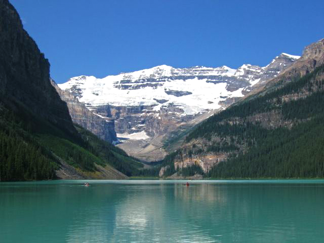
(Above) Lake Louise filled the valley behind a glacier's end moraine, which formed when the glacier paused at that location long enough to accumulate a huge pile of rock and dirt. Glaciers are essentially big conveyor belts that carry rock on their sides and drag it along their bottoms, ceaselessly depositing it at the glacier front. The unique green color of the lake is from rock flour, powdered rock formed under the glacier from the scraping of rock on rock.
(Above) How do you describe how beautiful Lake Louise is? Shakespeare himself would have run out of vocabulary!
(Above) Past the lake you can see the box-shaped valley carved out by the glacier. Glaciers move loose rock by freezing it into the ice and dragging it out, or by carrying fallen rocks on their sides. Above the cliffs is a shelf glacier that frequently drops ice down into the box valley.
(Above) Geologic cross-section south of Lake Louise. The bedrock at lakes Louise and Moraine and at Castle Mountain is in an unusual flat spot in the thrust belt. Cross-section published by the Canada Geological Survey.
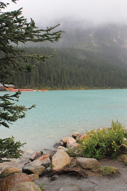
(Above) Lake Louise is even beautiful on cloudy, rainy days.
(Above) Fairmont Mountain above Lake Louise is made of early Cambrian quartzite and sandstone of the Gog Group. They formed in shallow ocean water, and contain trilobite fossils.
(Above) The lake invites contemplation and easy strolls. Even on this rainy day, there were a lot of people strolling under umbrellas all day long.
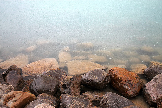
(Above) The rocks nearest the hotel were carried down the canyon by the glacier, and so they show you all the rock types that are farther up the canyon -- sandstone, quartzite, limestone, and some iron-stained altered rocks.
(Above) The Fairmont Lake Louise is a fabulous hotel in an unmatched setting. It's Very Expensive.
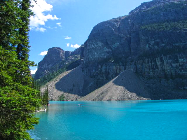
(Above) Moraine Lake was, ironically, not formed by a moraine like Lake Louise was! It was formed by debris flows & avalanches off Mount Babel. On the north side you can see the high wooded slope that is a lateral moraine -- a pile of rock and dirt carried there on the side of the former (huge!) glacier that melted away thousands of years ago. The height of the moraine shows you how high the ice was. The Moraine Lake Lodge has a deli, restaurant, and lodging. Rooms are expensive, but much less than the Fairmont.
The Moraine Lake Road is closed September through May.
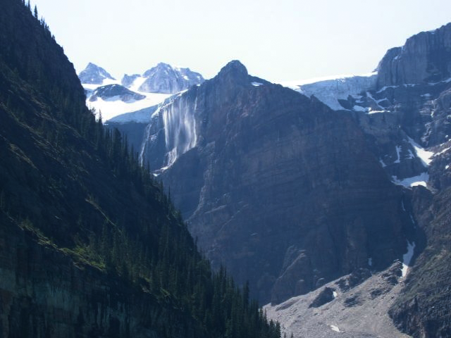
(Above) Mount Bowlen and Mount Little across the lake have ice shelves on them that form "bridal veil" type waterfalls in the summer. See them?
(Above) The cliff-forming rocks in the Wenkchemna Peaks are the Cambrian Mount Whyte, Cathedral, Stephen, and Eldon Formations, which are mostly limestone formed in the shallow ocean.
(Above) Strolling along the lake is easy and oh-so relaxing. Take a picnic. Take the kids. Take Grandma. Take a hike!
(Above) Here's a closer look at the ice shelf's waterfalls. Mid- to late summer is the only time you can see them.
(Above) These debris fans formed in the past few thousand years since the big glacier melted away. That's a big volume of rock falling off the cliffs in not such a long time!
~ Continue to Banff Part 2, Icefields Parkway and Athabasca Glacier ~
Related Posts: Banff Part 2, Banff South, Burgess Shale, Frank Slide, Glacier National Park
Park Website: Banff National Park
Canada Geologic Maps: Natural Resources Canada This site is awkward to use unless you know the exact name of the map you want. The "search using map area bounds" function doesn't always find geologic maps.
Canada Geologic Maps: Natural Resources Canada This site is awkward to use unless you know the exact name of the map you want. The "search using map area bounds" function doesn't always find geologic maps.
