Natural Disaster: The Frank Slide, Alberta
The Frank Slide, Alberta
Come see Canada's deadliest landslide, one of the biggest and most accessible rock avalanches anywhere -- the Frank Slide in Alberta. It even has its own visitor center!Why Visit the Frank Slide?
Frank is one of those rare places where Geology has human faces. The stories of the avalanche survivors is both inspirational and tragic. It's one of the most accessible natural disaster sites anywhere, and its sheer size will astound you. As a rare bonus for a site like this, it even has a visitor center. It's a place you'll never forget.I had studied the Frank avalanche before ever going there. I knew all the statistics, the death toll, the speed, the volume, and so forth. I understood the geology and why the mountain had failed. But I wasn't prepared for the jaw-dropping scale of this avalanche! It is breath-taking. And I am sure I will never forget the incredible stories told by survivors.
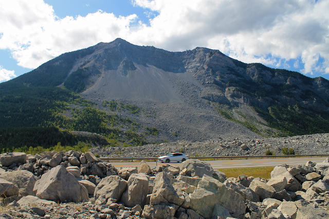
(Map) Frank is in southwestern Alberta along highway 3 near Crowsnest Pass. Look how big the boulders are by the highway!
The Frank Story
Turtle Mountain above the mining and railroad town of Frank, Alberta, was known by the native peoples as "the mountain that moves" because of its frequent rockfalls. Suddenly, 30 million cubic meters, about 90 million tons of rock, gave way in the predawn hours of April 29, 1903. Over 70 people lost their lives in just over a minute. Rocks the size of big-rigs rolled over a mile from the mountain slopes, devastating and burying everything in their path.(Above) The Frank "Slide" (it's really an avalanche) spread gigantic boulders more than a mile from the mountain front. (Visitor Center photo)
Survivors told of loud cannon-like sounds as the mountain broke loose, and a hurricane-force blast of air in front of the avalanche that blew in windows and knocked them off their feet. The ground rumbled and shook. Houses at the edges of the avalanche were knocked off their foundations first by the blast of air and then by flying boulders. A large part of the town disappeared forever in the dusty night.
(Above) Aerial view of the slide. (Visitor Center photo with my annotation)
Frank Slide Geology
Turtle Mountain is part of the "thrust belt" that extends from northern British Columbia south to Glacier Nat'l. Park, Salt Lake, and all the way to Las Vegas. The thrust belt formed when islands and small continents riding on the Pacific tectonic plate slammed into North America at the subduction zone (where the Pacific dived under North America). The compressional forces pushed the continental shelf up onto the continent, slicing it into dramatic folds and slabs that traveled tens of miles. Turtle Mountain is made of one of those sheets and a big anticline fold.
(Above) This cross-section through Turtle Mountain shows why this part of the mountain was so susceptible to failure. The front face of the mountain was the steep limb of an anticline, meaning that the rock layers were tilted down the face of the mountain with no support but friction. You can see the crest of the anticline in the highest peak today. In addition to the fold, the mountain has an unusual amount of fractures that have severely weakened all the bedrock. Freeze-thaw cycles through much of the year continually widen the fractures and weaken the mountain further. Source: Cruden, D., and J. Krahn, 1973, Area examination of the geology of the Frank Slide: Canadian Geotechnical Journal, 10, 581–591.
(Above) My panorama from the Visitor Center.
(Above) This annotated photo from the American Geophysical Union shows the anticline and underlying thrust fault that contributed to the great avalanche. The "anticlinal crest" is the center of the fold, and the rocks on the near side of it were tilted down the mountain front.
(Above) View from the top of Turtle Mountain. Notice how intensely fractured all the bedrock is. The avalanche created a hurricane-force blast of air that threw people off their feet outside of the debris zone. The visitor center is the white building on the left (north) side of the debris. (Alberta photo)
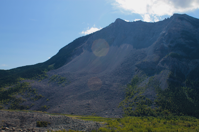
(Above) In this profile view, you can get an idea how thick and tall the avalanche was. Try to see the full-size trees high on the mountain for scale.
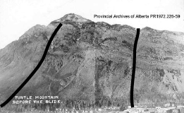
(Above) The town of Frank before the avalanche. Notice all the rock debris on the mountain front from frequent rock falls. That was a warning sign. (history.alberta.ca)
(Above) Another great story is that of Big Charlie, the mine horse. He survived for a month in the mine by chewing on mine timbers and drinking contaminated water. After rescue, he tragically died from an overdose of oats and brandy. (history.alberta.ca)
(Above) A view of the avalanche shortly after it occurred, and before the highway, railroad, and river cuts were dug through it. It is huge! (history.alberta.ca)
(Above) The avalanche initially blocked the Old Man River, flooding parts of old Frank and making rescue more dangerous. A new channel was soon cut for the river. The town has since moved farther north, out of the path of rocks that continue to fall from high on the mountain. The mountain is being monitored by dozens of instruments to track movement and hopefully provide warning of another avalanche.
(Above) The visitor center sits at the northern edge of the avalanche, and provides spectacular views. (history.alberta.ca)
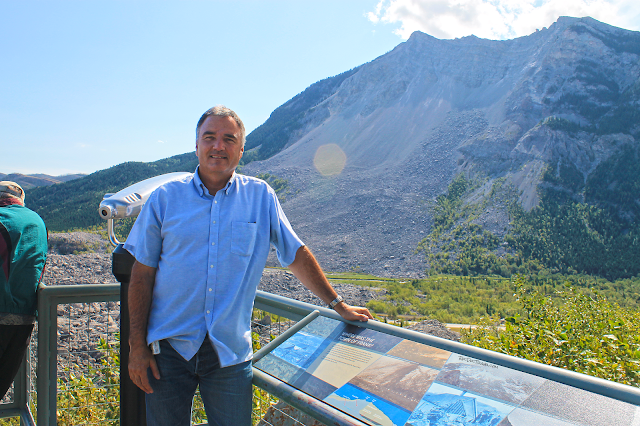
(Above) The Visitor Center provides good interpretive signs.
Other Resources:
- 30-second overview of the slide, produced by the Visitor Center: YouTube
- Frank Slide Visitor Center Learn the whole story of the town and its unfortunate people.
- Hazards Monitoring by Alberta See what the provincial government is doing to monitor the unstable mountain.
- Gigapan Zoomable Pictures Click on the image to bring up its zoomable page. Then zoom in to see the instruments on the skyline, the enormous boulders, the river, and get a sense of the slide's enormous scale.
- My favorite compilation of survivor stories: sympatico.ca
